
Watching an isolated storm chance for this evening; storms could be strong if they do develop.


Hot and humid conditions dominate southeastern Wisconsin this afternoon with temperatures soaring into the middle to upper 90s. Officially 100 degrees this afternoon in Milwaukee! The last time that happened was back in July 2012!

Storms have fired across central Wisconsin. Biggest threat are quick bursts of damaging winds.
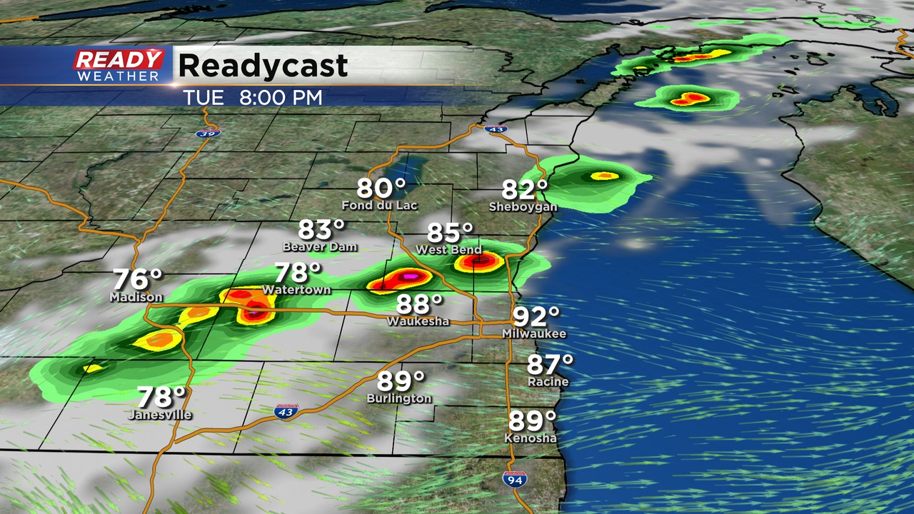
A front will arrive by the early evening that could spark a few isolated showers and storms. This will not be widespread and most areas won't be impacted. If storms develop they will move through between 7 pm until 10 pm.
The problem is the amount of energy that's available in the atmosphere. Storms that fire could produce hail and gusty winds. Marginally strong to severe storms are possible. Heavy downpours would also be likely with the high humidity.
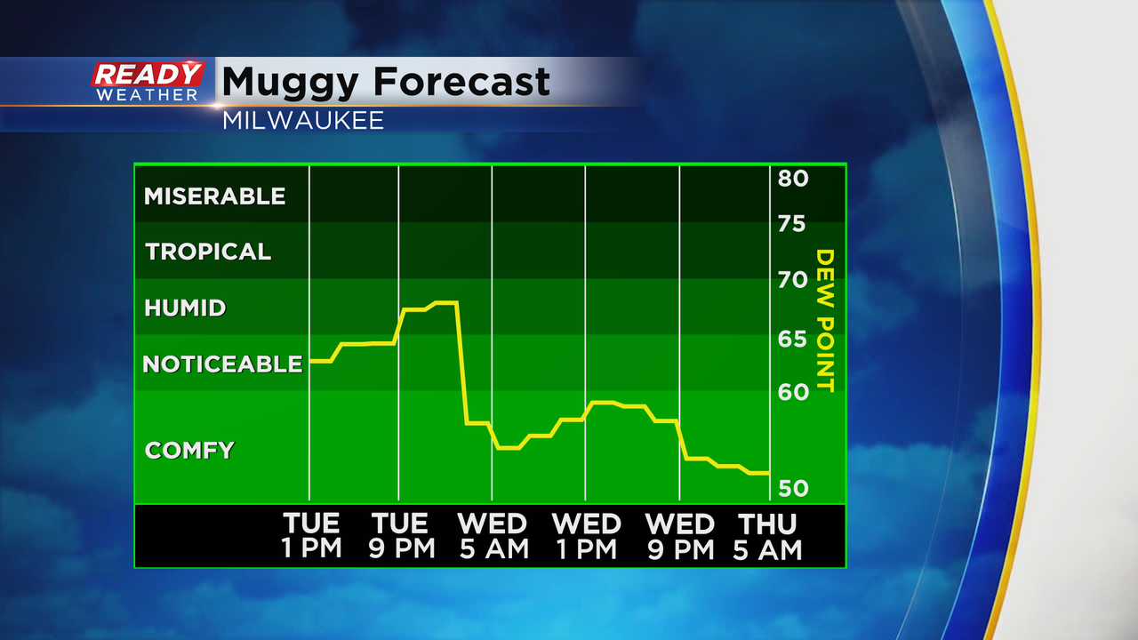
That humidity will go away after the front comes through for Wednesday!