NE wind keeps temps cool today, rain on the way for parts of the weekend
A wild swing in temperatures were seen the last two days with highs in the 70s and 80s on Wednesday; then a northeast wind dropped the temperatures 11 degrees in one hour yesterday morning, and a significant drop in daytime highs from day-to-day from Wednesday to yesterday.
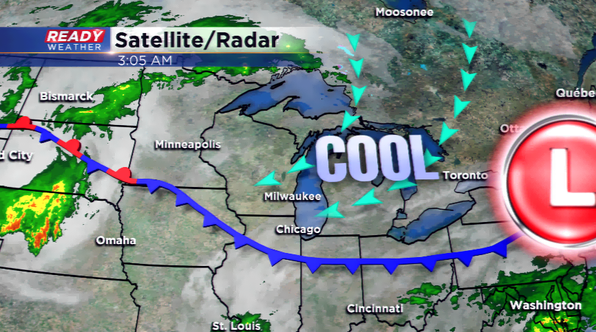
With high pressure to our north and east the lovely lake wind will keep temperatures much cooler along the lakeshore again today. Highs will struggle to make it out of the 50s, but 60s are likely, especially inland.
The weather maker tonight is an upper-level disturbance that will lift from the south to the north and give way to showers late tonight and Saturday morning. Most of the activity is done early, which will allow for drying conditions to take over the rest of Saturday. Sunday will be a struggle all day long with an easterly component for a wind and showers will be possible around an area of low pressure.
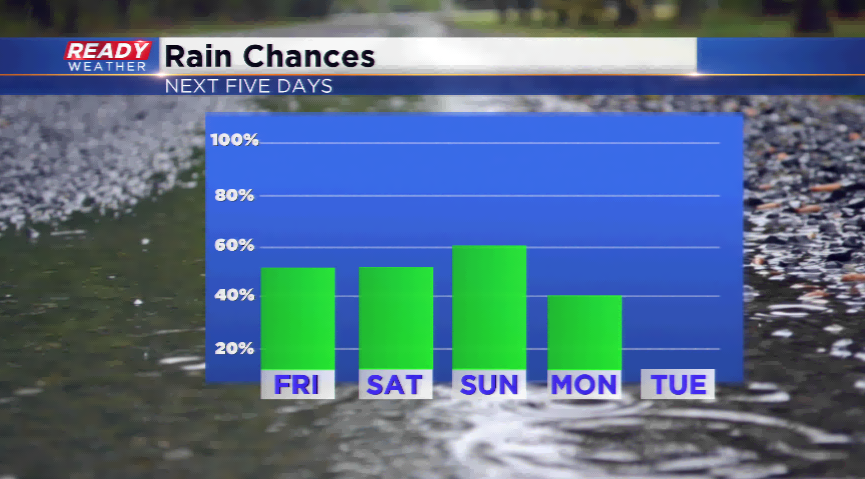
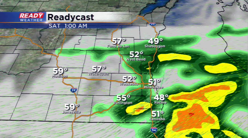
With the next two rain systems looking weaker than the last several for us, and the last three days being dry, this will continue to bring a slow drop off in the flooded locations in southeastern Wisconsin. Flood Warnings continue for areas along the Fox and Rock Rivers, but there have been significant signs of improvement near the Root River. We will watch for any changes in this pattern.