Potential for messy weekend ahead

-
3:02

Visit Milwaukee preview: Dec. 27-29
-
5:53

CBS 58’s Theater Thursday: ’A Complete Unknown’ and ’Nosferatu’
-
1:22

Vigil honors tow truck driver killed in suspected I-94 hit-and-run
-
1:34

Forbes and Volker lead Marquette as scoring duo
-
2:26

Firefighters hoist Santa, superheroes to wave to patients inside...
-
1:49

’I’m so thankful for it’: Salvation Army provides Wisconin’s...
-
3:26

Post holiday rain and mild weather will dominate the forecast
-
2:22

3 Milwaukee firefighters are siblings, spending Christmas Eve...
-
3:03

’Miracle on 64th Street’ neighborhood holiday display collecting...
-
2:01

2 killed in shooting near 38th and Nash; 1 arrested in connection...
-
1:29

Free Christmas Eve meals provided to those who need them by Capuchin...
-
1:00

Shoppers hit the stores for last-minute Christmas Eve gifts

The weather forecast appears quiet for the rest of the work week with rising temperatures. I mean, we can only go up from one of the coldest starts to March in a while, right? Temps go from the 20s today back up to near 40 by Saturday.
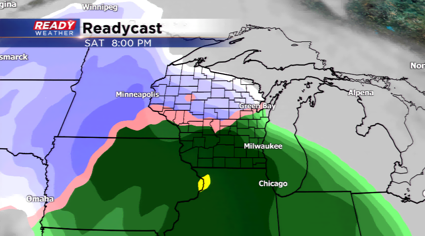
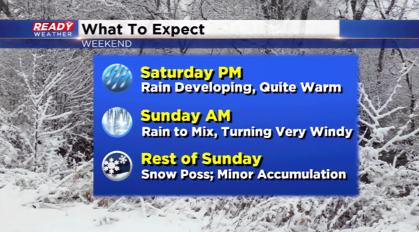
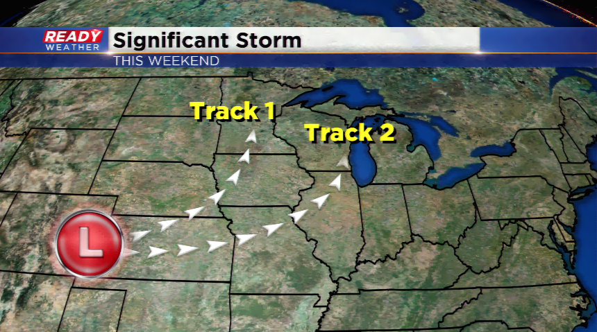
Since we are on the subject of Saturday, that’s when we will start to see the influences of very messy weather. A significant storm system moves in for the weekend. The track of the storm will be very important for the placement of warmer weather, snow, and a dry section of the system. Regardless of the position from different model runs, the storm looks to run in the warm sector for us, which means mainly rain. It could be heavy at times Saturday evening into Sunday.
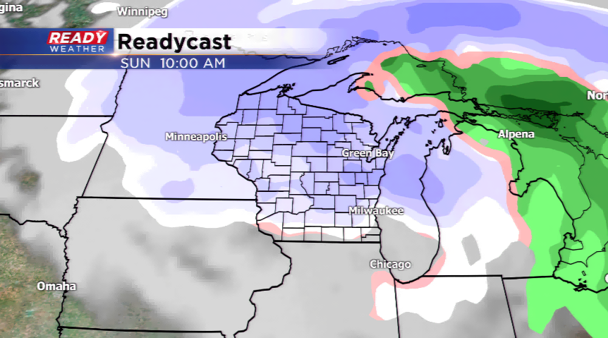
When we head into Sunday, the storm will transition from rain to snow with a punch of cold air. Any moisture leftover will chance to winter weather. Sleet, snow, and freezing will take place causing very slippery conditions. It’s something we’ll keep a close eye on for you! Stay tuned!