Cold front will bring rain showers, snow showers today

-
2:07

Funeral service held for Rubi Vergara, 14-year-old killed in...
-
5:55

What to do with the budget surplus?
-
3:07

’Give them a hug - focus on the heroes’: How to talk to your...
-
3:00

Chilly Winter Solstice, but temps warm heading into Christmas...
-
2:31

Injured pelican found in Wisconsin, Wildlife In Need Center asks...
-
2:04

Madison school shooting survivors share how they are healing...
-
1:31

Wisconsinites take advantage of first big snowfall of the season
-
2:04

Milwaukee faith and community leaders call for new gun violence...
-
1:04

Over 500 students receive gifts at St. Anthony School in Milwaukee
-
0:52

Hunger Task Force distributes 1,500 holiday hams to local partners...
-
0:53

Gifts of Love program brings books to children in need
-
2:50

Official says Wisconsin shooter was new student at Christian...

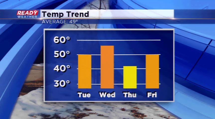
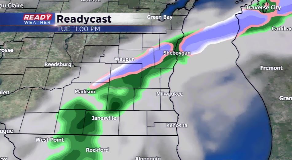
A weak disturbance along with a cold front will produce light showers today into the early afternoon. The most the region will pick up will be about 0.10” of rainfall. Light snow showers or flurries could mix in our northern counties this morning. There could be some clearing taking place behind the front by later parts of this afternoon and evening. This will set the stage for nice weather for Wednesday. Highs look to skyrocket well into the 50s tomorrow.
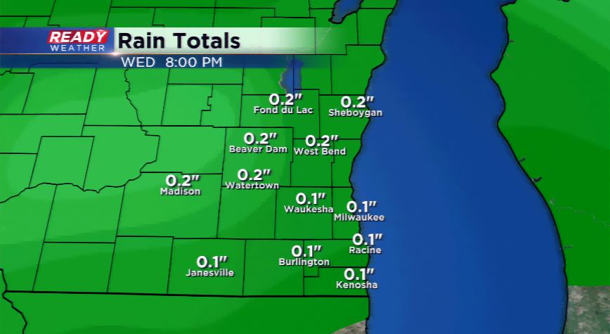
Yet again another wave comes in for Wednesday night and Thursday will produce light rain or snow showers. Temperatures will cool significantly by Thursday into the upper 30s and lower 40s. Expect the winds to pick up as well on Thursday into Thursday night. The temperatures again climb above average for the weekend with the potential of more 60s coming around for Saturday and Sunday. It looks to be a great weekend ahead.