


Parts of southeast Wisconsin got a soaking rain on Sunday, mainly with two strong storms. One along the WI/IL border in the early afternoon and another in the evening across Waukesha and Milwaukee Counties. Those storms dropped over 1" of rain in spots.
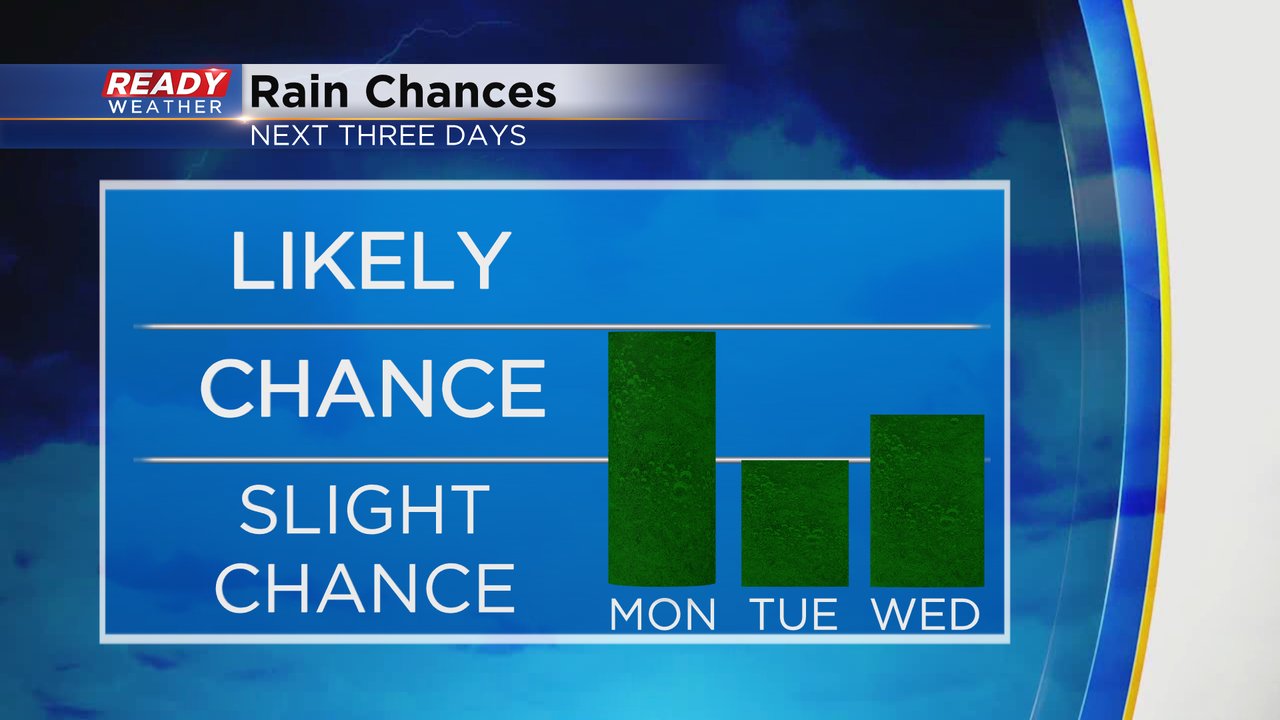
Some areas in southeast Wisconsin woke up to showers Monday morning and a few more showers and storms will be possible throughout the rest of the day in the afternoon and evening. No severe weather is expected.

While there is the chance that parts of southeast Wisconsin could stay dry on Monday there is a pretty good chance most of the area sees at least some rain, but plenty of dry time for most. Tuesday's rain chance is less likely with only a few isolated showers or storms in the afternoon and evening. Wednesday also has a chance for showers and storms but some of that depends on the exact track of the remnants of Beryl.
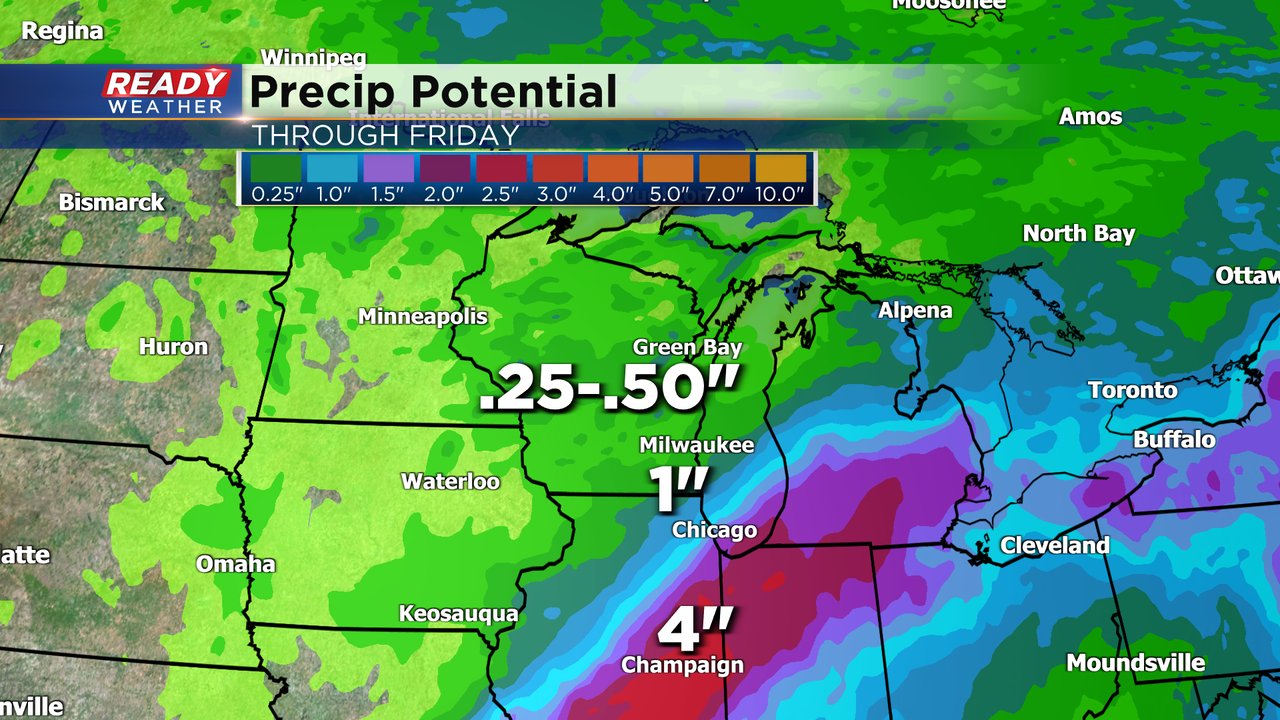
Hurricane Beryl made landfall as a Category 1 storm along the coast of Texas early Monday morning. The storm likely becomes a tropical storm Monday as it moves into Arkansas and then a Tropical Depression. The latest track takes the remnants of the storm into Illinois and Indiana.

Communities that see the track of Beryl could get heavy rain with 2-4" of rain possible in parts of Illinois and Indiana. If some rain showers get into parts of Racine and Kenosha Counties we could see around an inch of rain there, but most of southeast Wisconsin only gets 0.25-0.50" of rain over next few days with higher totals in storms.
Download the CBS 58 Ready Weather app to track the interactive radar with all these rain chances.