Expect one of the most active weather weeks we've seen in some time

-
3:02

Visit Milwaukee preview: Dec. 27-29
-
5:53

CBS 58’s Theater Thursday: ’A Complete Unknown’ and ’Nosferatu’
-
1:22

Vigil honors tow truck driver killed in suspected I-94 hit-and-run
-
1:34

Forbes and Volker lead Marquette as scoring duo
-
2:26

Firefighters hoist Santa, superheroes to wave to patients inside...
-
1:49

’I’m so thankful for it’: Salvation Army provides Wisconin’s...
-
3:26

Post holiday rain and mild weather will dominate the forecast
-
2:22

3 Milwaukee firefighters are siblings, spending Christmas Eve...
-
3:03

’Miracle on 64th Street’ neighborhood holiday display collecting...
-
2:01

2 killed in shooting near 38th and Nash; 1 arrested in connection...
-
1:29

Free Christmas Eve meals provided to those who need them by Capuchin...
-
1:00

Shoppers hit the stores for last-minute Christmas Eve gifts

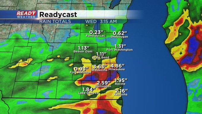
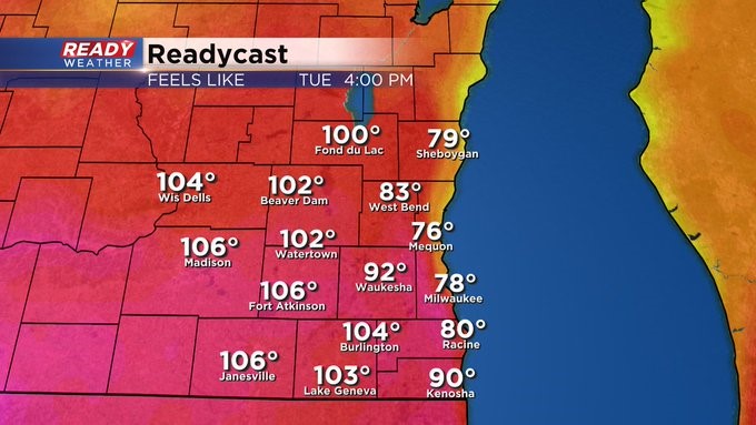
MILWAUKEE (CBS 58)--After coming off flooding rains and damaging winds, unfortunately, you can expect more of the same through Thursday. Dealing with several areas of low pressure moving in from the southwest this week. It's not until a strong front clears the area on Friday we'll get a big break from all the storms, high humidity and temps. Highs on Monday near 80. Into the 90s for Tuesday through Thursday. But with the humidity, it'll feel like 100 degrees plus for many of us, especially away from the lake.
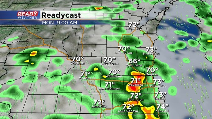
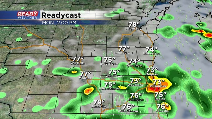
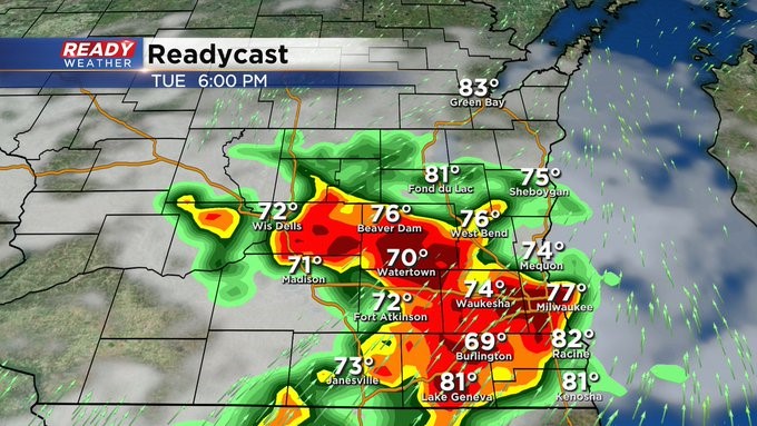
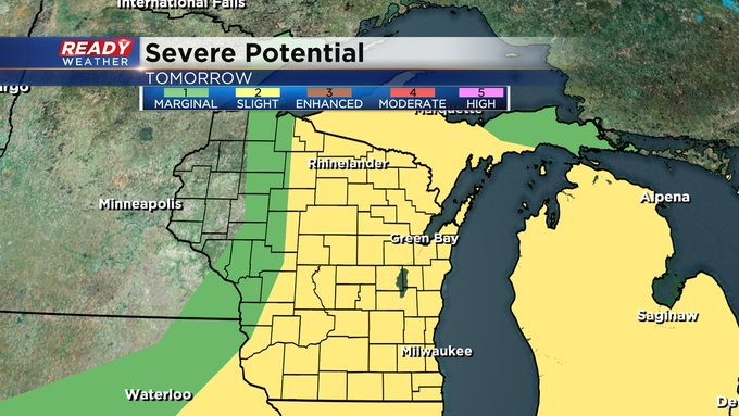
There's a marginal risk of severe weather today, and it increases to a slight risk on Tuesday. We'll have scattered storms all day on Monday. Most of the storms Tuesday will happen in the evening. Then we still keep the storms going into Thursday afternoon.
How much rain did you get over the weekend? Some of us received more than a half a foot of rainfall. Let us know what you received. Also, if you have any storm pictures, please send to [email protected]. Hopefully by now, you're downloaded the free CBS58 weather app. It's great to have when severe weather strikes. You get alerts, and you can see what's on the radar in real time. You can also send photos this way as well.