Winter Storm Watch issued for parts of SE Wisconsin beginning Sunday
Updated 2:45 p.m. November 23, 2018
UPDATE: A Winter Storm Watch has now been issued for parts of SE Wisconsin beginning Sunday.
A winter storm watch has been issued for parts of SE Wisconsin for Sunday! There remains a lot of uncertainty to where the heavy snow will setup. pic.twitter.com/2xpDuk1bjG
— Drew Burgoyne (@CBS58Drew) November 23, 2018
br>
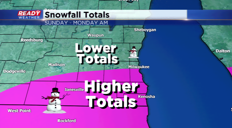
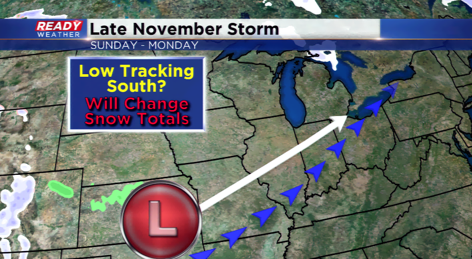
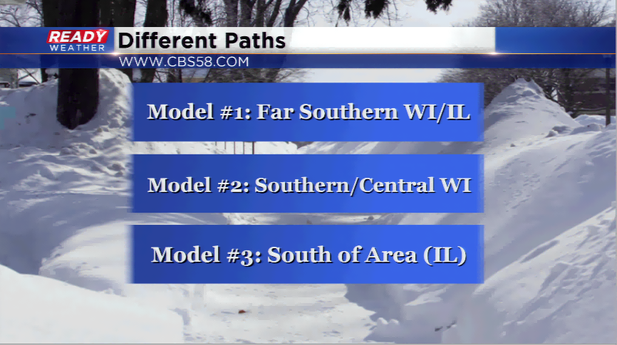
Confidence is plummeting with this next major weather maker heading its way by Sunday in terms of the forecast. The computer models have been all over the place with the placement of the storm system. Why is the low track important? The low gives forecasters an insight on where the heaviest snow will take place, typically 100-150 miles northwest of the center of the low. If we can figure out exactly where that low will go, it makes all the different in the forecast.
Every single model that is available to us is different at the moment. In fact, several models have shifted farther south. There have been parallels with this system, especially looking at past storms. Storms will trend a bit farther as the forecasts moves along, which could mean putting the snow into southeastern Wisconsin. For now, I have placed the heaviest snowfall potential in far southeastern Wisconsin, northern Illinois, and parts of Iowa. There looks to be the best dynamics for heaviest snowfall. Until the low moves onshore from the Gulf of Alaska, and the models come to an agreement, we cannot put out a snow forecast.
Timing appears to be as early as Sunday morning, with the most activity in the afternoon and evening on Sunday, then ending by Monday morning. Anticipate travel difficulties as the end of the weekend progresses. Stay tuned for more updates!