High and Dry

NOW: High and Dry

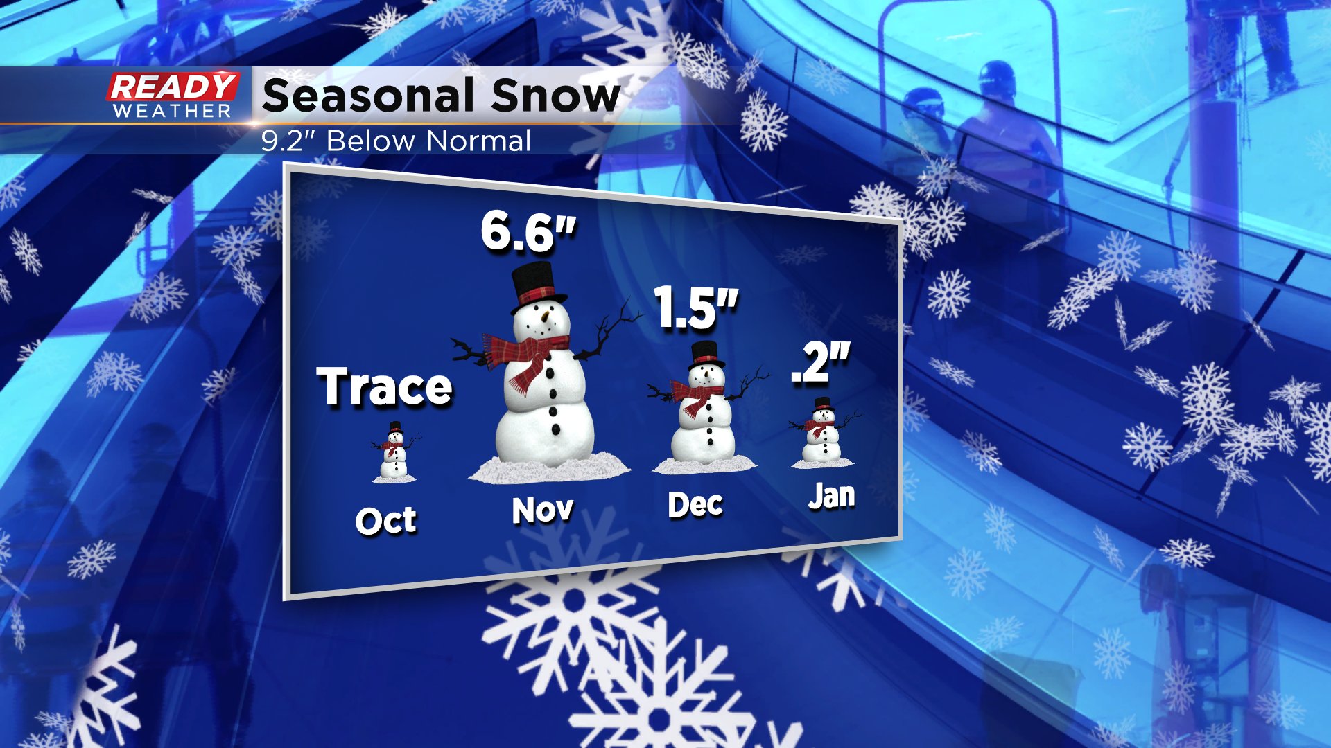
Looking for snow? We are too! It's been a bit of a lackluster winter so far with not much snow to track. Take a look at what we've seen so far:

  At first, it seemed like we would be in for a hefty winter with November turning sharply colder and snowy by its second week. Normal November snowfall is just 2.4 inches. You can see we nearly tripled that amount. Then we went on a twenty-three day dry stretch in December only surrounded by minor events. I suppose less snow means it's easier to get out and enjoy winter foliage, like what you see here. This image was taken from the northwest side of the city. Frosty, perhaps. Snowy, no. 


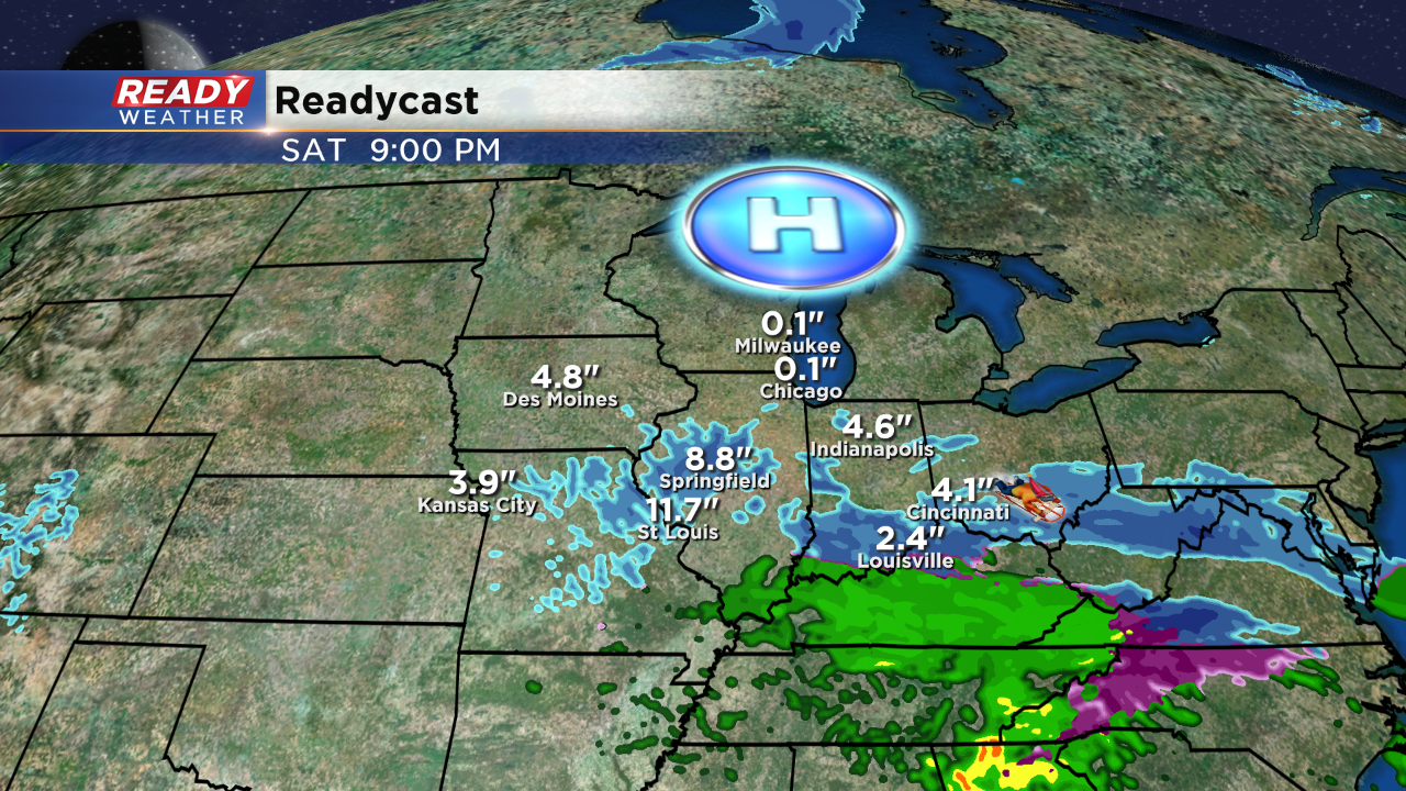
But what about that weekend snow on the way? Oh, it's on the way! The storm will dump over 10" of snow in spots, just not here in Wisconsin. As we look at surface features and patterns, one weather player seems to be dominating our forecasts as of late. It's called High Pressure.

 This weekend high pressure parked just to our north will provide a dome of protection from that storm skirting by just to our south. High pressure systems generally keep us dry and often times bring bright and mild weather. These pressure systems can also drop down from Canada and bring dry but cold air. Lately it seems that when we do see a storm brewing a week out on our models, as the timeframe gets closer high pressure sneaks in and keeps it away. It's a pattern that could linger the next two weeks with little snow accumulation in sight.

I'm meteorologist Rebecca Schuld


Share this article: