High fire danger early this week
Posted: Apr 30, 2018 3:40 AM CDT
With very limited precipitation the last two weeks, Wisconsin DNR has issued burning bans parts of the Badger State.
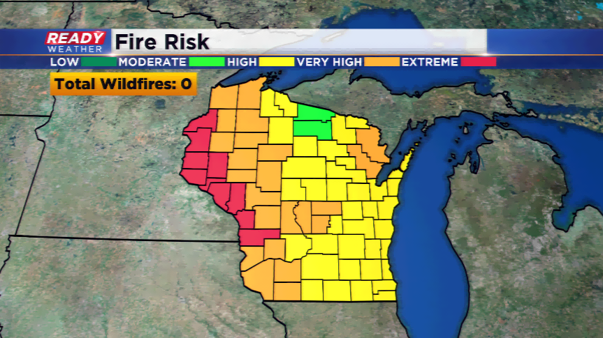
The fire danger map will be updated at 11am on Monday, and is daily.
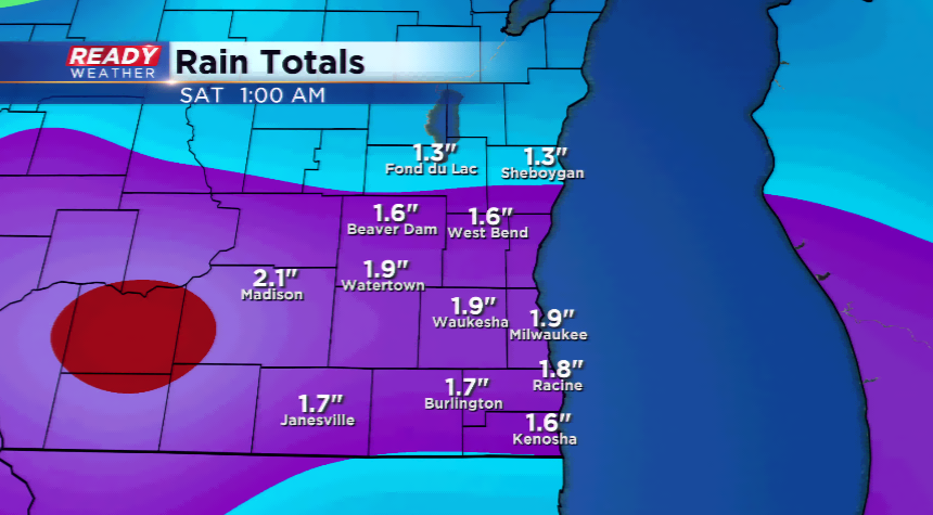
Some good news is with the warm temperatures and increasing moisture, precipitation will return. There will be several waves of rainfall from Tuesday night into Thursday. The computer models are indicating 1”-2” of rainfall possible. This should eliminate fire dangers by the end of the week.