Humidity and rain chances return to start the work week


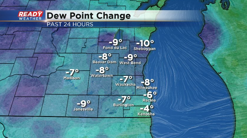
It's been an enjoyable afternoon across southeast Wisconsin with a nice break from the showers and humidity!
Despite not having a solid third round of showers and storms last night, most of southeast Wisconsin has still picked up around 2-2.5" of rain over the last week and a half.
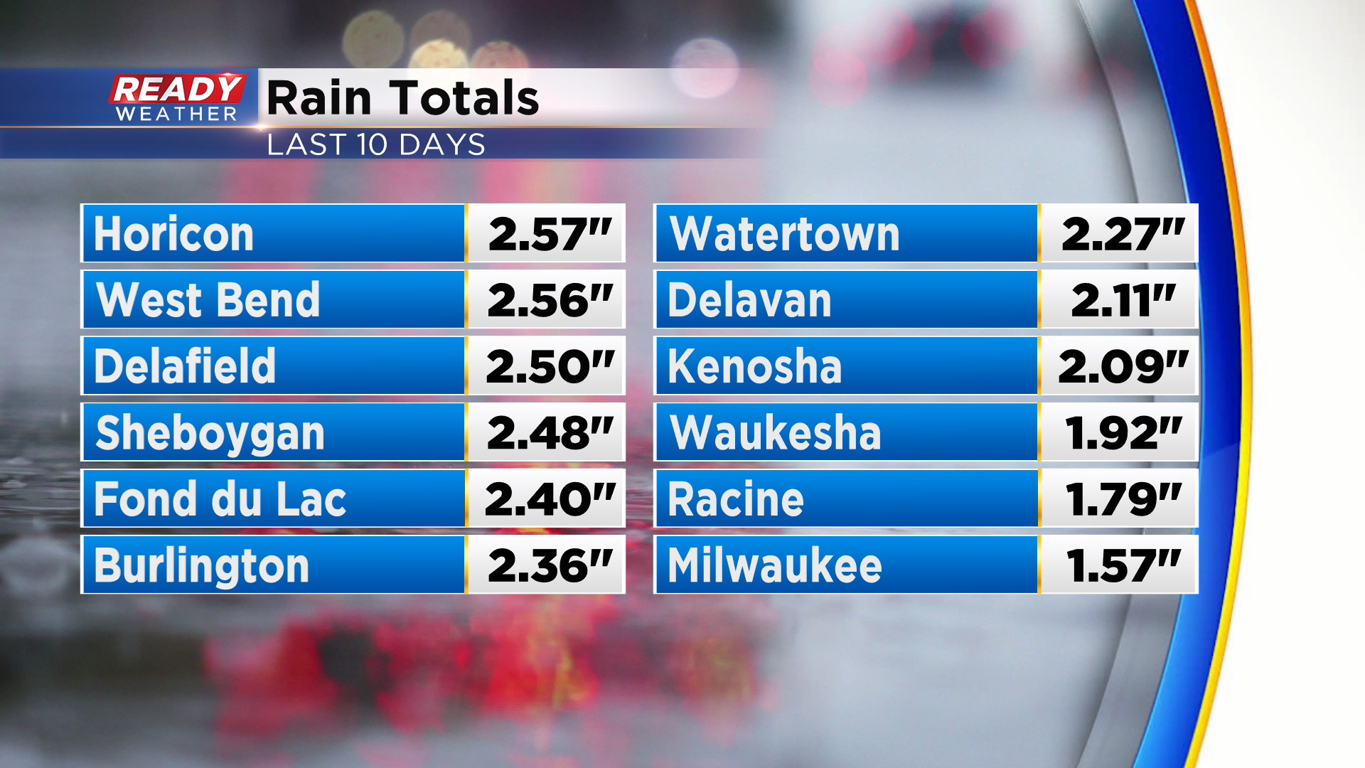
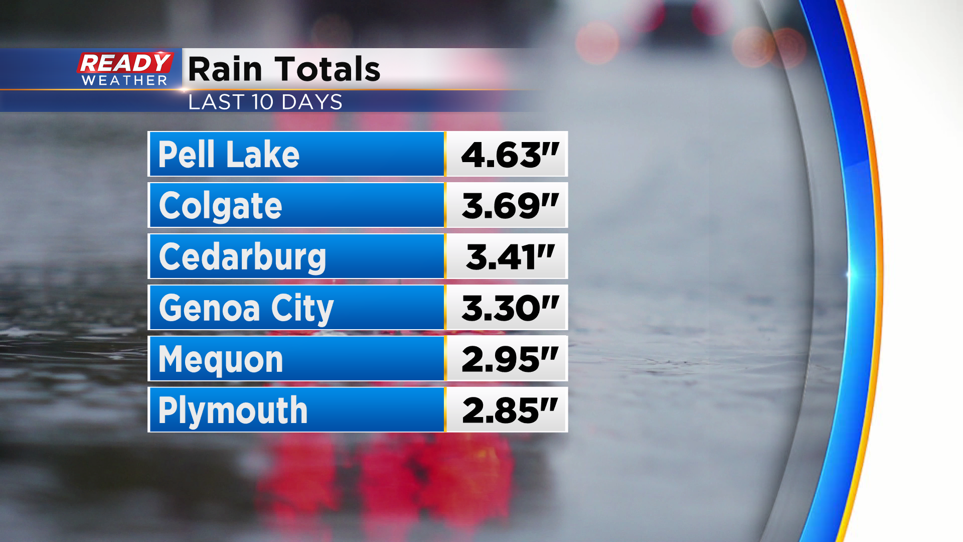
A few lucky spots have had over 3"!
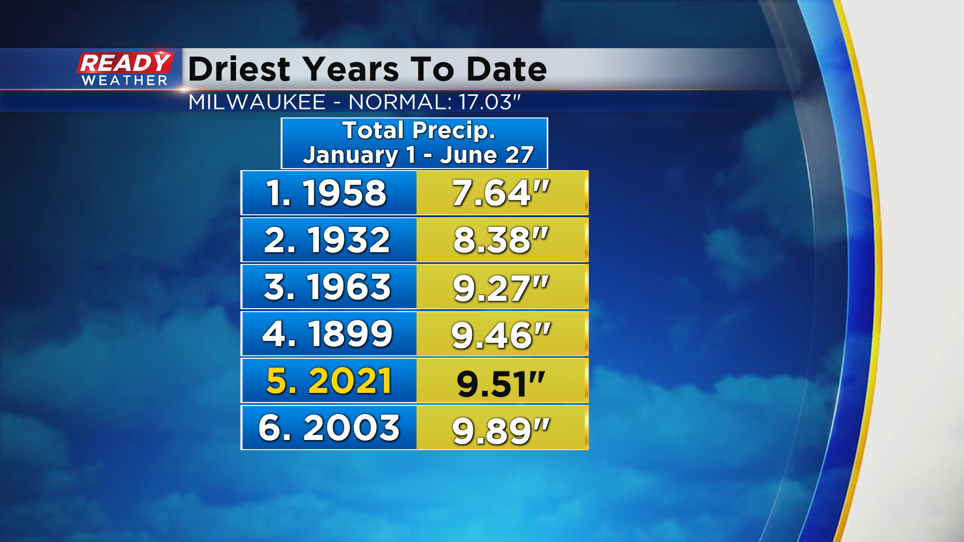
Despite the inch and a half of rain over the last 10 days, Milwaukee is still running 7.51" below normal on the year. To date, this is the 5th driest year on record.
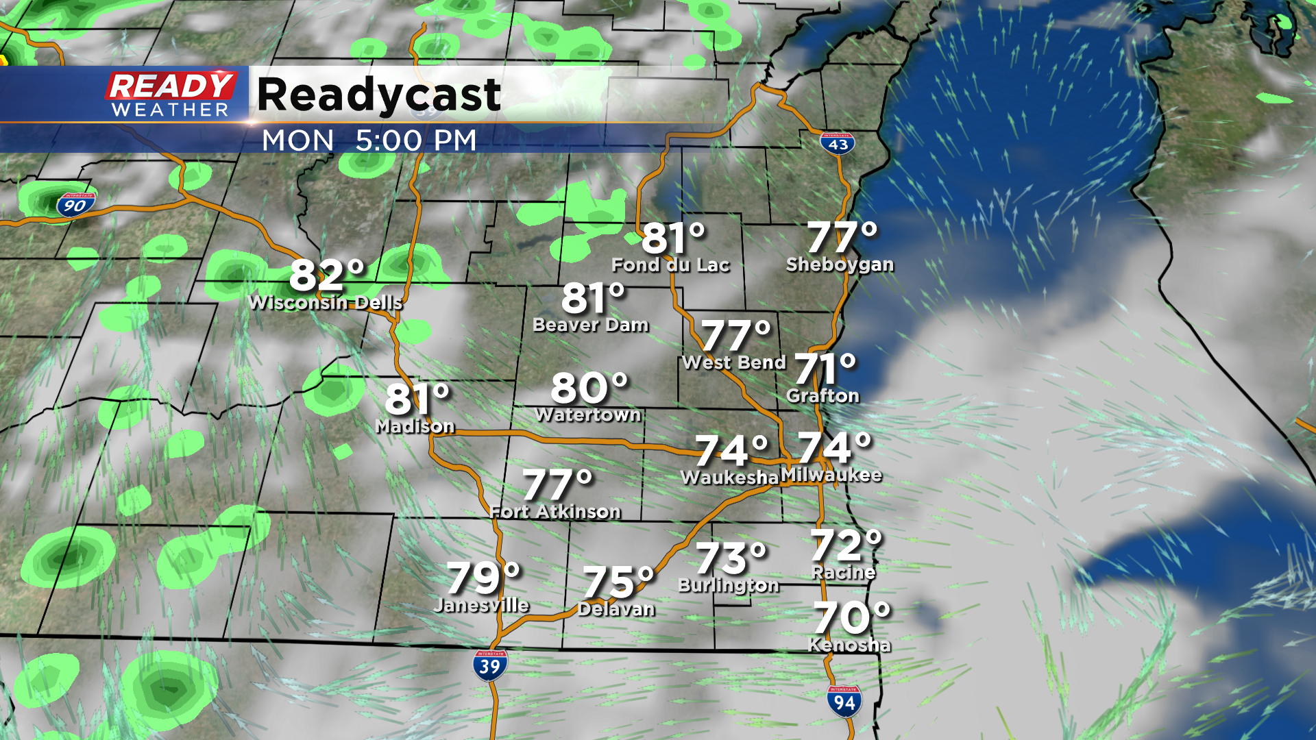
After a nice break from the rain this afternoon and evening, a few more waves of low pressure will rotate through the area to start the work week, bringing more chances for showers and isolated storms.

A few isolated showers may sneak into the area around sunrise, but a better chance for scattered rain and isolated storms will come mid morning into early afternoon.
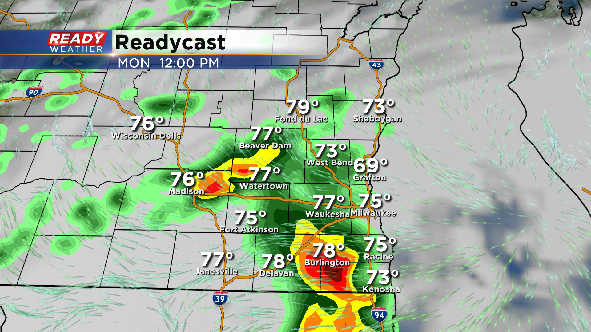
Once this wave moves through, we should dry out for the late afternoon and evening.
Another more potent wave will track through on Tuesday, bringing higher chances for showers and storms, especially in the afternoon
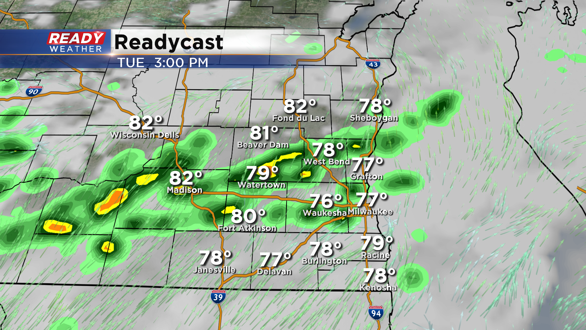
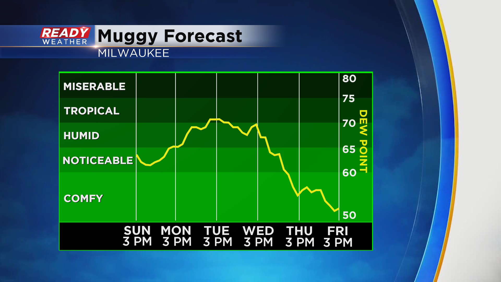
Along with increasing rain chances will come increasing humidity. Dew points will rise back to tropical levels by Tuesday, but a stronger cold front on Thursday will finally knock the humidity out of here to end the week.
Download the CBS 58 Ready Weather App to see the full 7 day forecast.