Evening Update: Rain Ending
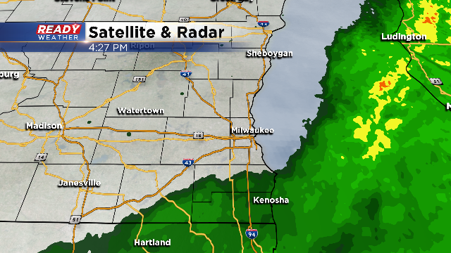
The rain is coming to an end. By 6 pm expect the measurable rain to be out of the area; however, some lingering drizzle will be possible.
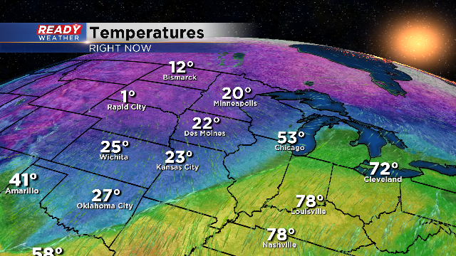
The bigger story tonight will be the drop in temperature for tomorrow morning. We will expect a refreeze on the roads all across the area. Plan on some extra time for your morning commute.
2 PM Update:
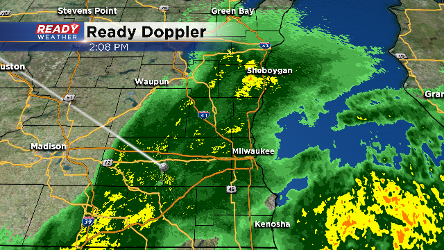
The rain will continue through the late afternoon. The computer models move out the rain by 7 pm. Another 0.25" of rain is expected across the area, which will create more localized flooding issues.
We will turn our attention to tonight when the temperature drops below 32. Refreezing roads will be an issue for tomorrow morning.
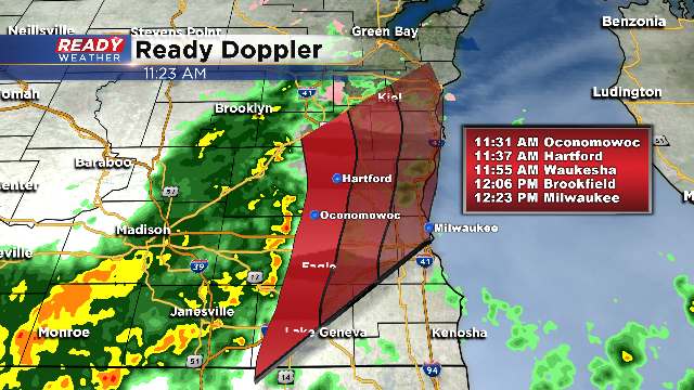
11:30am: We're starting to see rising river levels in isolated parts of the area. Another round of rain is also on the way! Take a look at Ready Doppler, a solid wave of rain is quickly moving north-northeast around 60 mph.
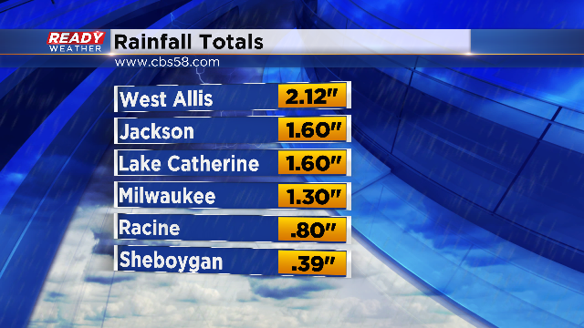
There's been a few embedded bolts of lightning as well. This next round will continue to exacerbate the flooding concerns for places in Franklin at the Root River, Raymond at the Root River along with the Fox River near New Munster. Expect water levels to peak Thursday afternoon. Some spots may then stay around flood stage until next Monday.Here's a look at some of the rainfall totals so far:
We also had minor icing reports in places like Waupun, Ripon and Fond du lac. Look for additional rain totals of a quarter to half inch through today. There's still a chance for a light wintry mix this evening so use extra caution on the roads.9AM Update: The freezing rain and ice has come to an end as temperatures are starting to climb above freezing for all of southern and central Wisconsin. There will be another round of rain once the scattered showers taper off this morning. This comes to an end by this evening once the front pokes all the way through.
630AM Update - Freezing drizzle and rain continues to fall in Dodge, Fond du Lac, and parts of Sheboygan County. Rainfall totals in the Milwaukee metro are as high as 1.5" with ponding of the road and standing water. Give yourself extra time this morning. Another round of rain will drive in this afternoon with a quick lull mid-to-late morning today. The cold front moves through later this evening to scour the moisture out completely!
The threat continues for ice and freezing rain in our northern areas this morning. The target area will likely be northern Dodge and Fond du Lac Counties through 9 am. With the risk of ice, please stay off the roads in those locations and prepare for branches, limbs, and power lines to potentially becoming iced, which could bring minor damage. Ice accumulation could be between 0.10”-0.15”. A Winter Weather Advisory runs until 3pm today for Sheboygan, FDL, and Dodge Counties.
With all of the moisture streaming in, a Dense Fog Advisory runs this morning until 6am. Expect visibility problems for most of SE Wisconsin until sunrise.
The rest of the viewing area will see rain on and off the rest of the day. A few more rounds could bring an additional inch of rain, with claps of thunder as well. Most of the Milwaukee metro received over an inch of rainfall since yesterday afternoon leading to minor flooding. There is a Areal Flood Warning for sections of Milwaukee, Waukesha, Jefferson, Walworth, and Racine until 945am this morning. With the threat of more rain, there’s a Flood Watch for those same areas as well Kenosha until 6pm this evening.
A cold front will scour the moisture out, but the cold air moving in at a rapid pace could lead to a “flash freeze”. This could lead some standing water to freeze and cause very slippery conditions overnight and Wednesday morning.

