January goes into the record books mild and wet as we get ready for a longer February


An up and down January is over! Welcome to February! January featured a mild start then a cold blast and a warm end. Even with the bitter cold during the second week of the month, January still goes down as the 20th warmest on record with an average temperature nearly 3* above average of 27.8. The warmest day was just a few days ago at 44* and the coldest was right in the middle of the month when the lows were below-zero.

When it came to snowfall we had a good amount of it in January. The entire month saw 16.6" of snowfall which is almost 2" above average and more than we got last year. It goes down as the 38th snowiest January on record.

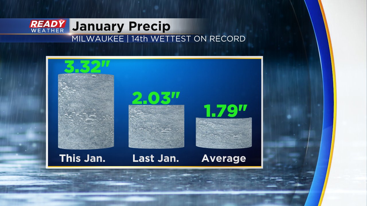
We also had some good rainfall and a lot of the snows we saw were very wet so our total precipitation for January was also well above average. We picked up 3.32" of precipitation which is double the average and more than last year. It goes down as the 14th wettest January on record.
Now we look ahead to February. On average, the month warms up nicely with highs nearing 40* by February 29th. Yes, 29 days! This is a leap year so February gets the extra day. February is, on average, our driest month of the year but still manages to pickup up around a foot of snowfall. In fact since this is a leap year the average precipitation and snowfall for the month go up a bit compared to a "normal" February. Precipitation goes up 0.07" and snowfall goes up 0.3" compared to what's shown below.

Download the CBS 58 Ready Weather app to track the temperatures and precipitation chances for the new month which look warm and dry right now.