Multiple rain chances this week, but also plenty of dry time


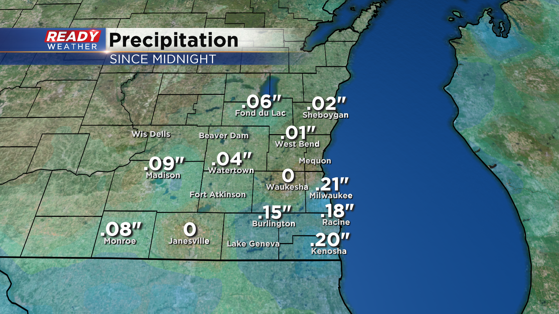
An area of rain pushed through the region this morning with a cold front, and a few of us saw some wet snowflakes mix in with the rain for the first time this fall. Around .20" of rain fell around and south of Milwaukee, but the showers were much lighter farther north.
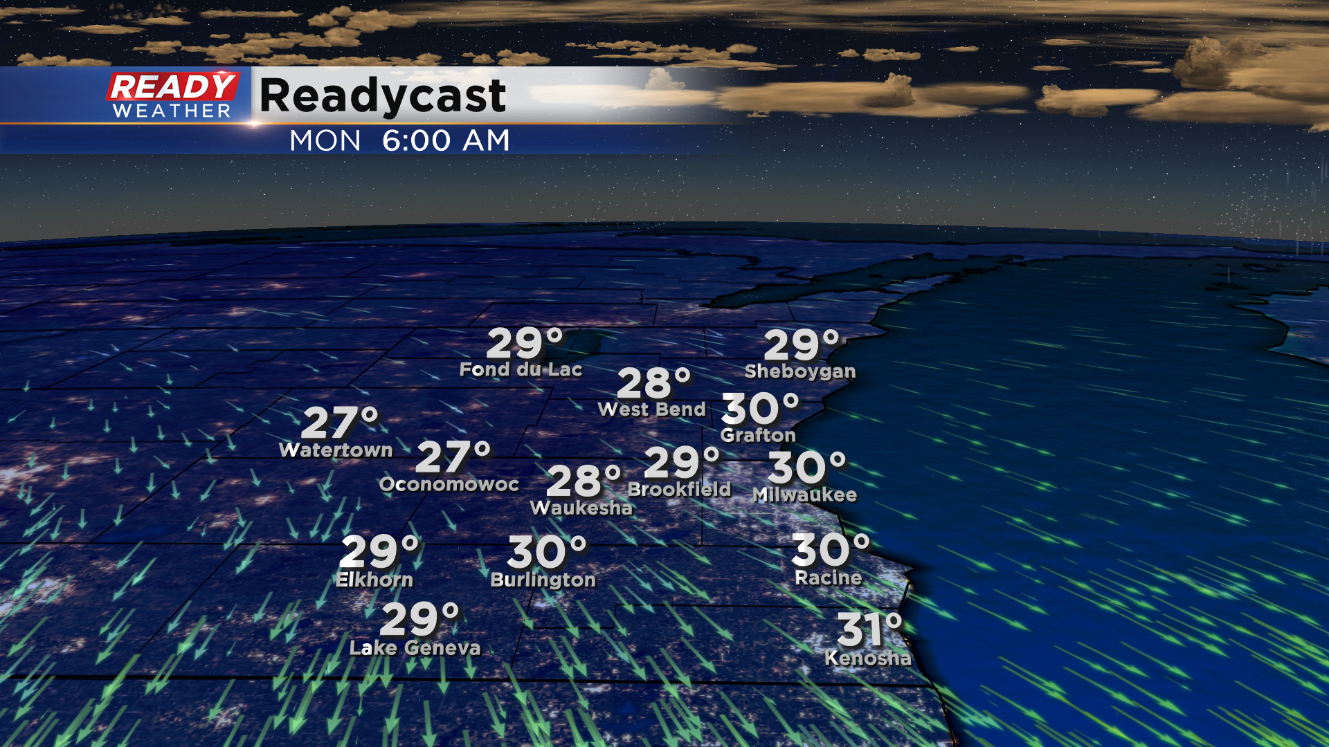
Clouds have gradually been clearing from west to east this afternoon and will continue to clear this evening. With mostly clear skies and calm winds, temps will be dropping into the mid 20s inland and to around 30° lakeside overnight with a widespread freeze expected.
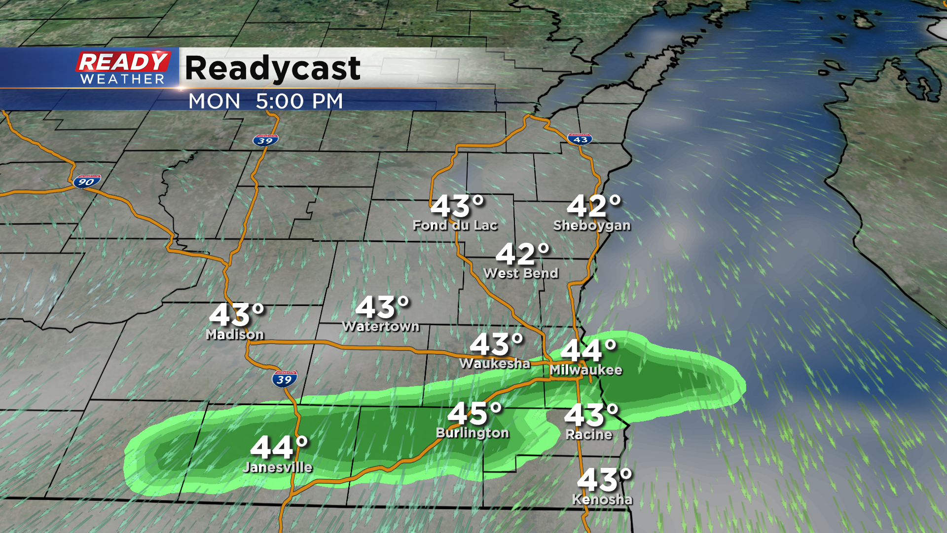
Clouds increase on Monday with 30% chance of showers south of I-94 mid afternoon into the early evening. Like today, a few wet snowflakes may mix in, but won't have any impact.
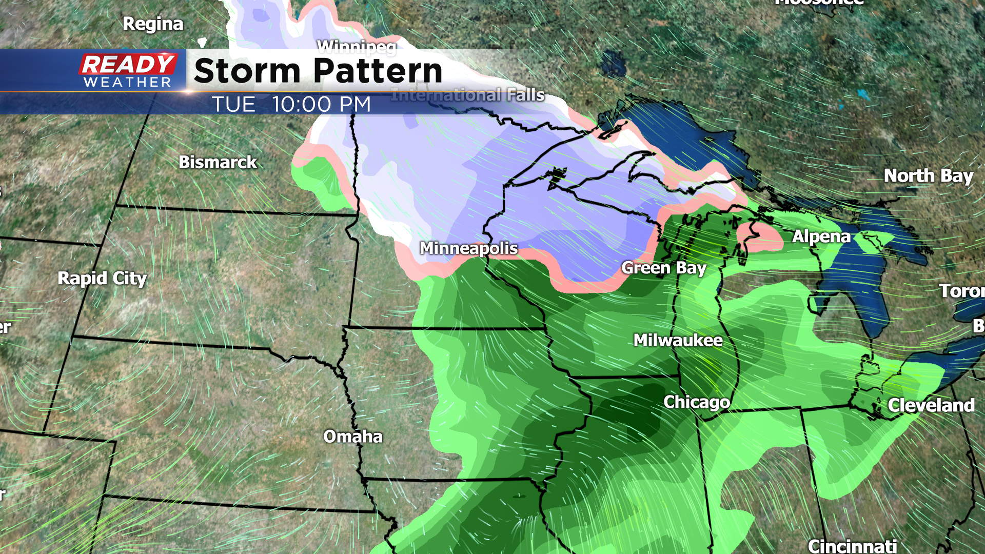
A better chance for showers moves into the area late afternoon to early evening Tuesday as a low pressure system tracks by to our north. This system could bring a few inches of slushy snow to the northern half of the state, but temperatures will be too warm for any snow in southeast Wisconsin.
After a dry day Wednesday, showers and a few isolated storms return Wednesday night as a stronger system lifts a warm front through the state. This system will eventually drag a cold front through the area sometime late Thursday night or Friday morning bringing more rain into the area.
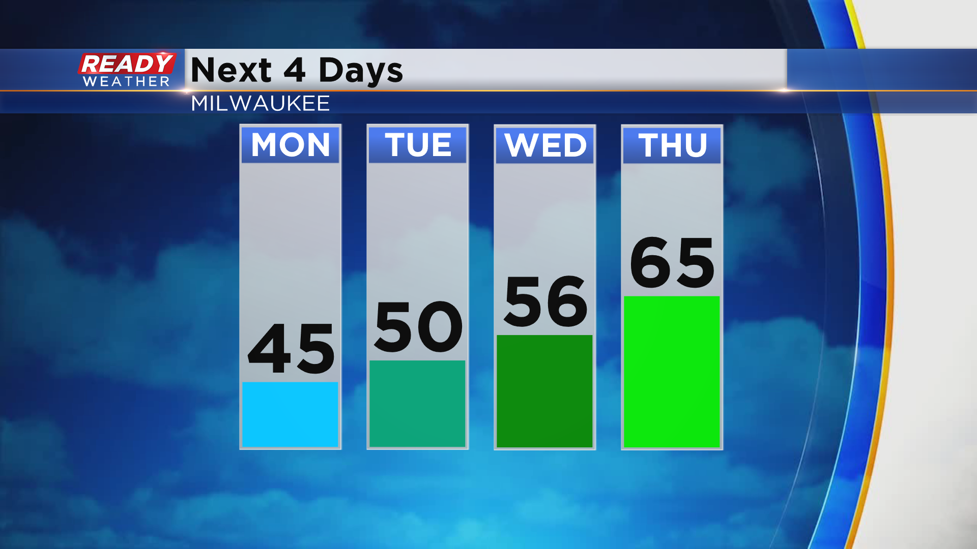
Temperatures will be on the chilly side to start the week with highs in the mid 40s to around 50, but will rise into the mid 60s on Thursday after the warm front moves through.
The active weather pattern will continue into the start of next week as well, with more chances for a rain/wet snow mix. Rather chilly temps will settle in behind that system as well. Download the CBS 58 Ready Weather App to track the showers and see how chilly temps will get.