New Winter Weather Advisory for Wednesday
Th winter weather ramps back up for Wednesday as another clipper system moves in from the northwest out of Canada. This clipper is more potent with a better chance for accumulating snow than our last event. The main reason is an onshore flow that will allow warmer lake temperatures to enhance snowfall.
The winter weather advisory starts at 4 am across our northern counties and starts at 6 am for the Milwaukee metro area. The advisory doesn't include our southern counties along the Illinois border. The advisory ends at 9 pm.
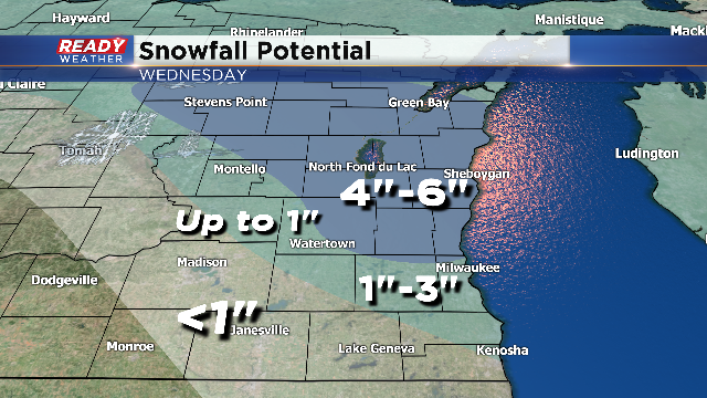
The snow will really pick up during the late morning and afternoon, especially north of Milwaukee. Sheboygan and Fond du Lac counties will have the best chance for a swath of 4" to 6" of snow. If the low track is a little further west, the heavier totals could move further south. There remains a lot of uncertainty on where the track will be.
The Milwaukee metro will likely see 2" to 3" of snow out of this event. The totals drop off quickly the further south you go. Washington and Ozaukee counties are included in the 4" to 6" totals.
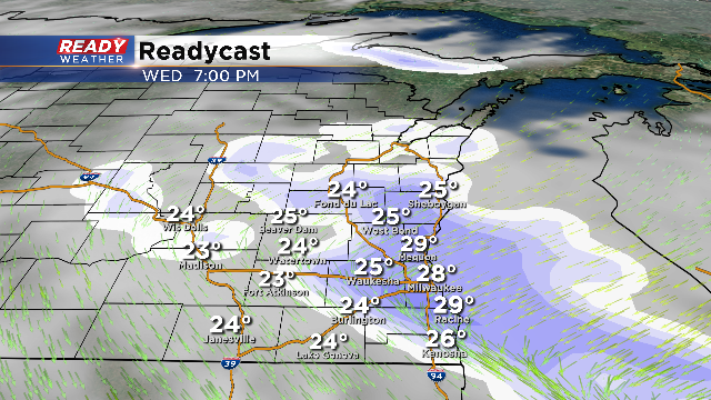
Lingering snow showers will persist throughout the evening. Accumulation will continue during the evening commute. Slick roads and travel issues are expected with the timing of this event, so please use caution.