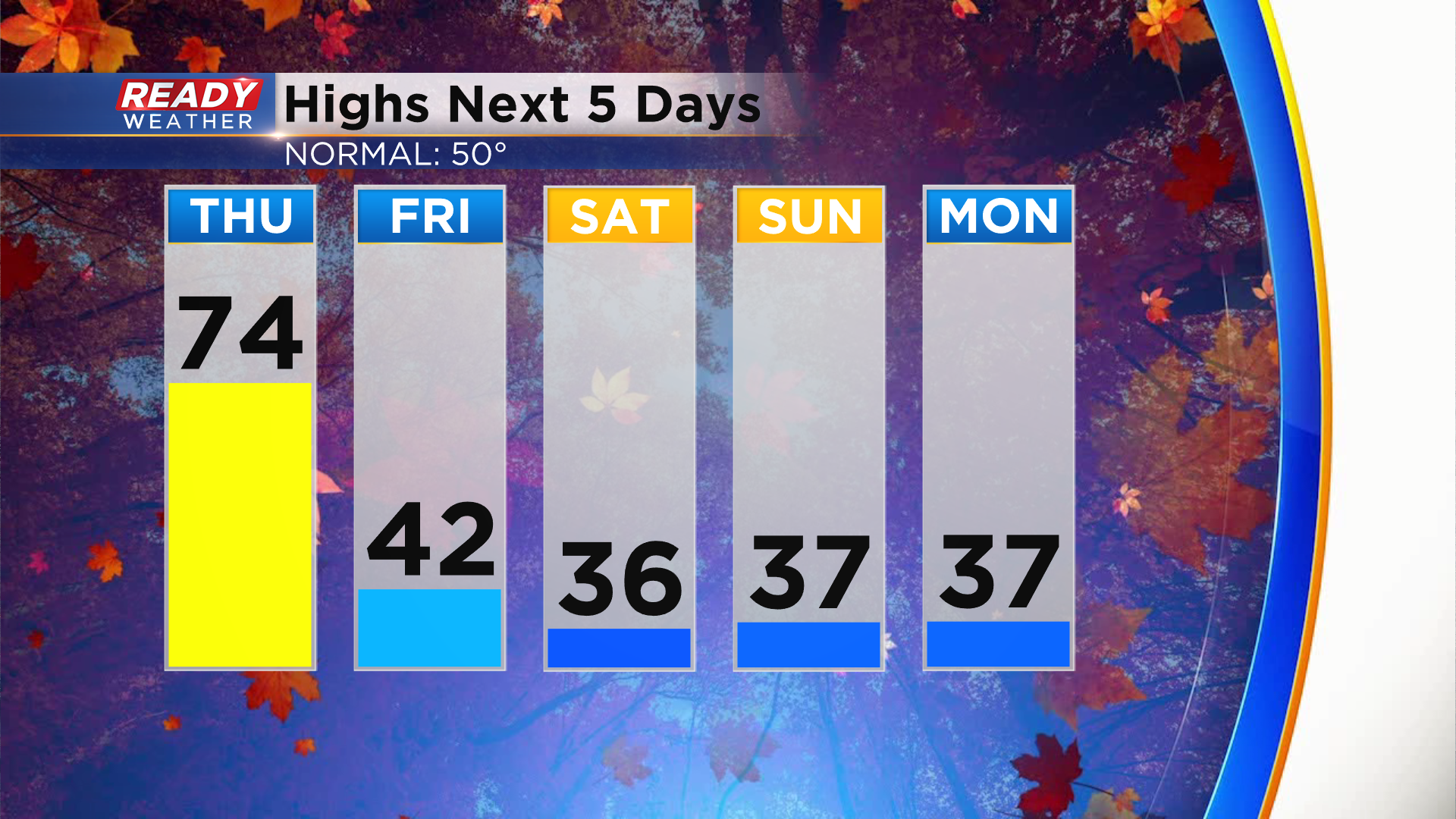
One more day of warmth until colder air settles in for a while
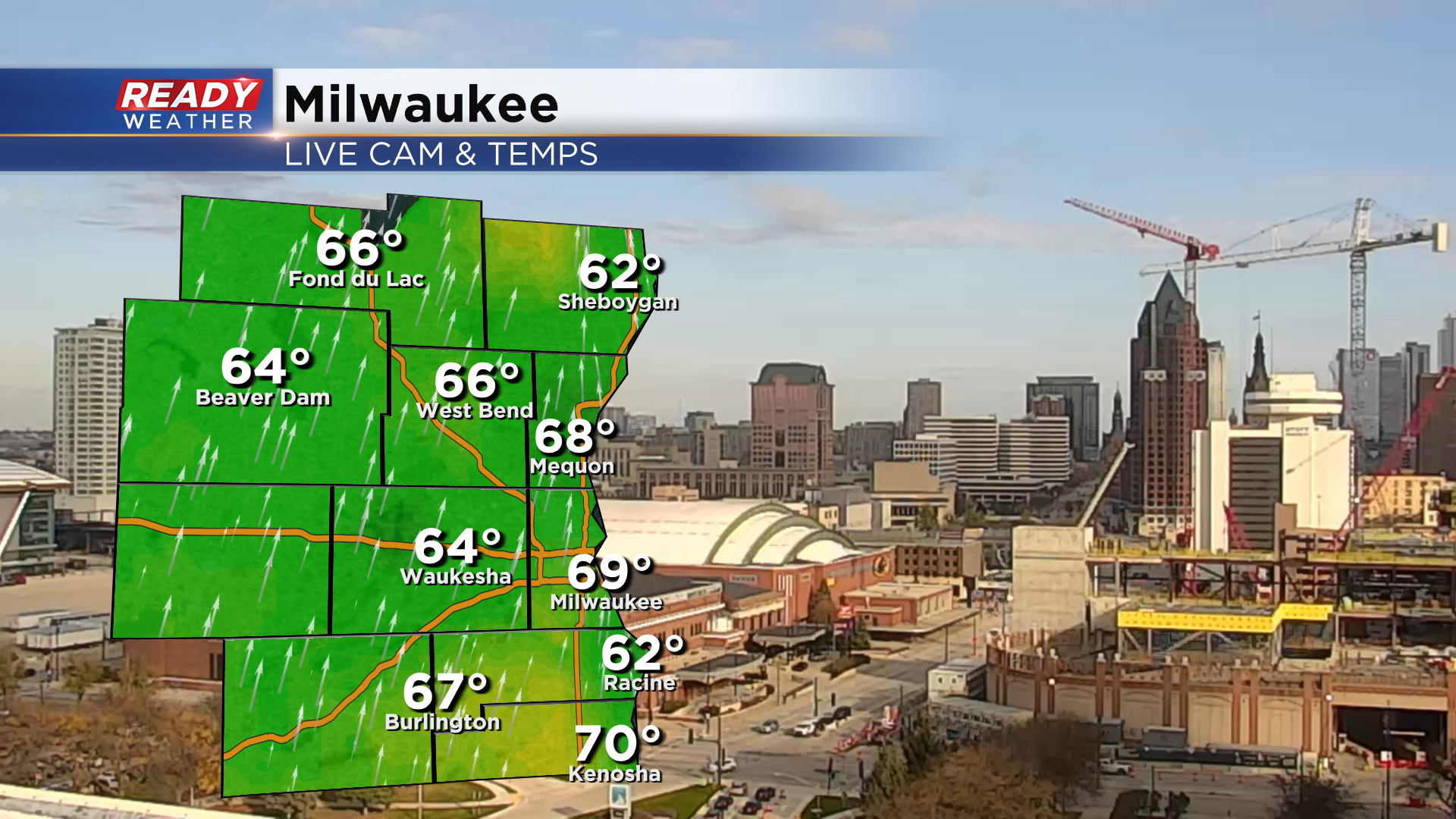
It's been a fantastic Wednesday weather-wise across southeast Wisconsin with sunny to partly cloudy skies and temps well into the 60s. Some spots are even making a run at 70°!
Temps will warm into the low to mid 70s with ease on Thursday thanks to a strong southerly wind gusting between 20-30 mph. That will be it for the warmth as a strong cold front moves through Thursday night into Friday morning. The cold air behind the front will keep highs in the 30s to around 40° for the foreseeable future.
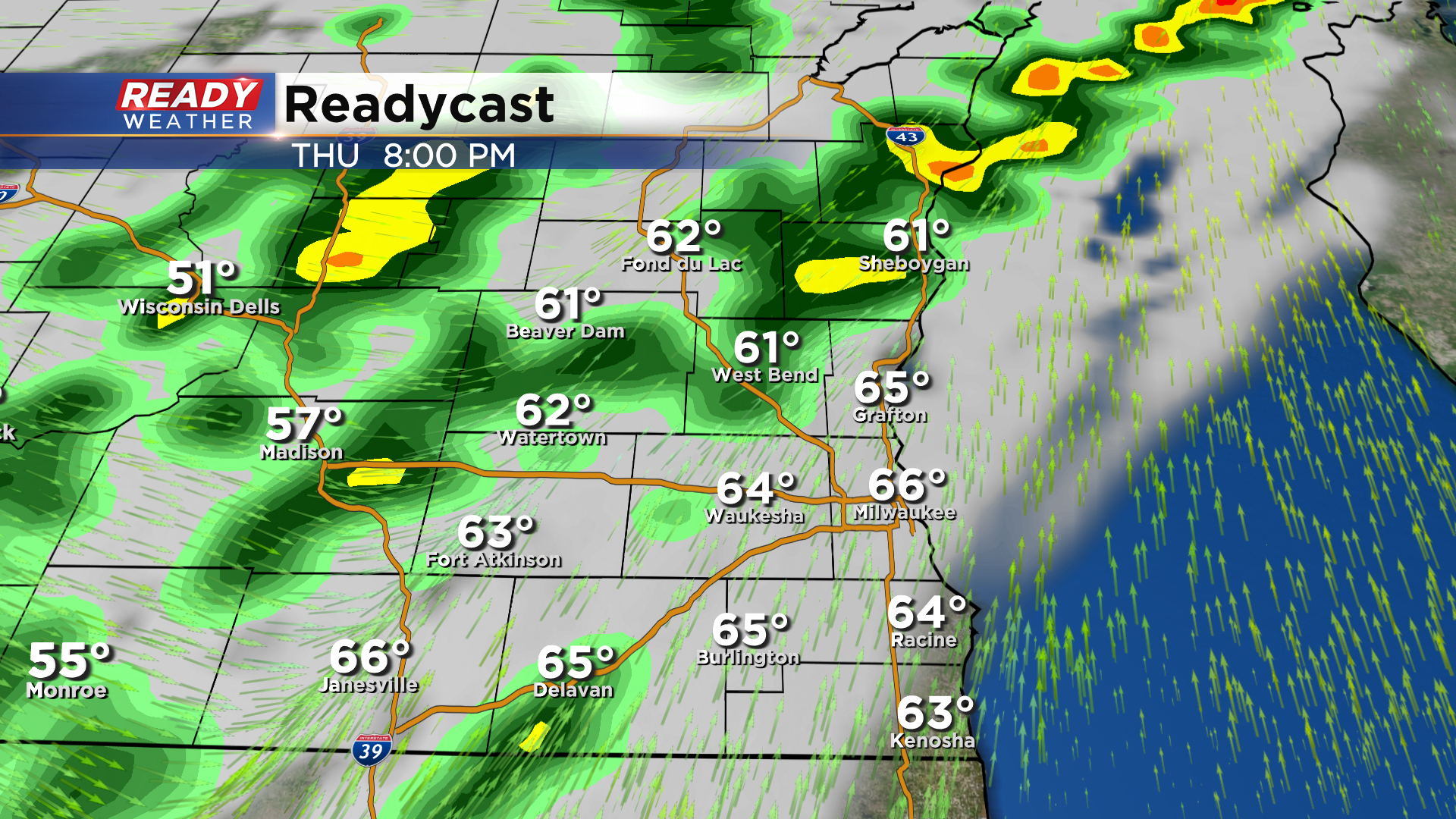
After a sunny to partly cloudy and breezy day, scattered showers and isolated storms will roll in with the front after sunset Thursday and continue into Thursday night.
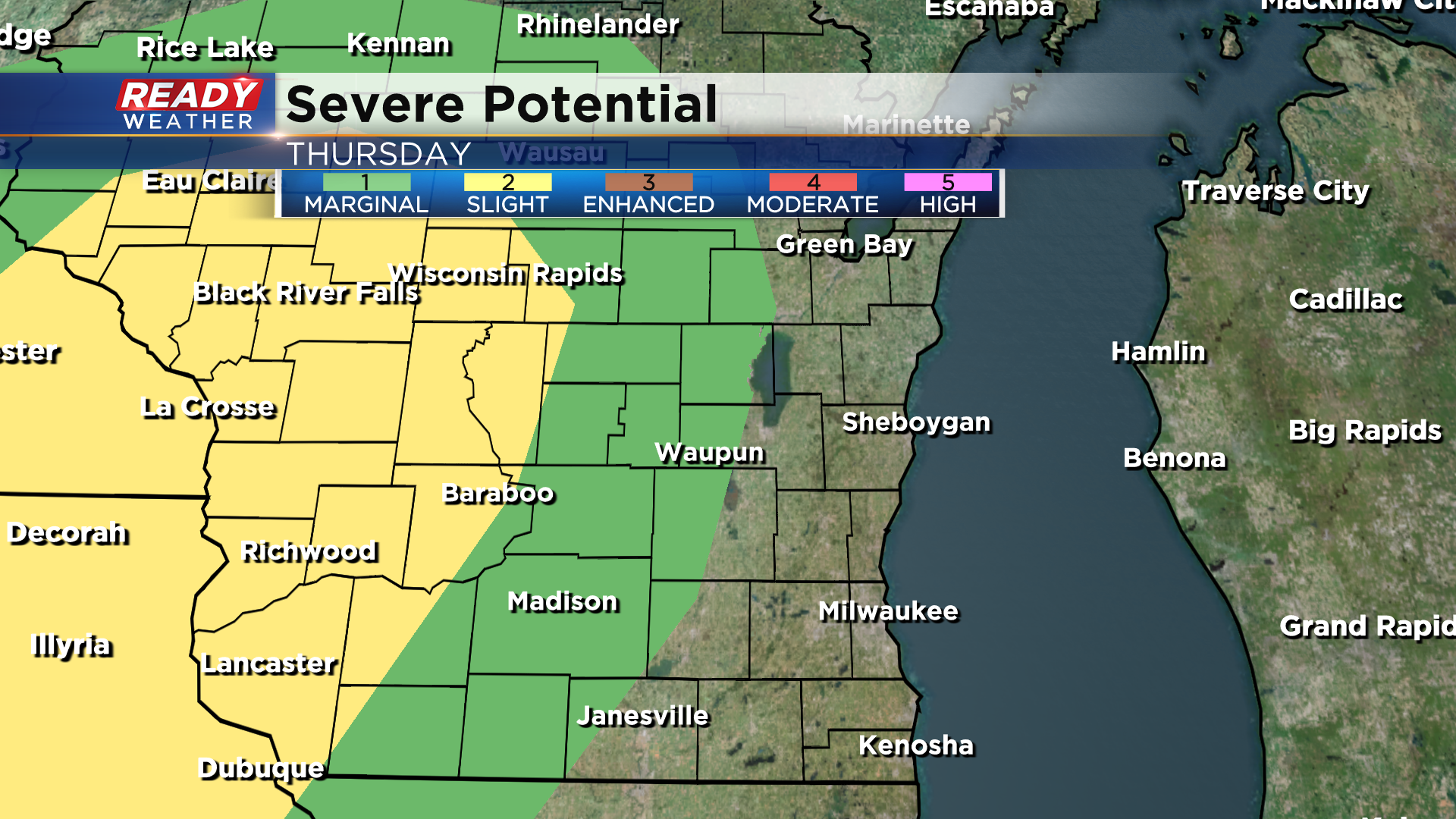
A few storms could be on the strong to severe side well west of the Milwaukee metro where a Marginal Risk (Level 1 of 5) is in place. The higher chance for severe storms will be in western and west central Wisconsin where an isolated tornado can't be ruled out.
The strong storm threat will taper off by 6pm with a majority of the showers and storms arriving in SE WI in the evening. This will be a slow moving front, so showers may not reach the lakefront until late evening into the night. Any precipitation will largely wrap up around sunrise Friday morning. Download the CBS 58 Ready Weather App to see how long the chilly temps stick around.
