Periods of rain, melting snow could lead to minor flooding


After a bad run of winter weather the last two months, the tide has changed in southeastern Wisconsin as we transition slowly from winter to spring. The spring warmth will be felt the next two days as we will see the mildest air of the year so far. Highs will run near 50 today, then potentially jumping into the low 60s for the day Thursday. This will be the first chance at 60 since we hit into the lower 60s the day before Halloween last year.
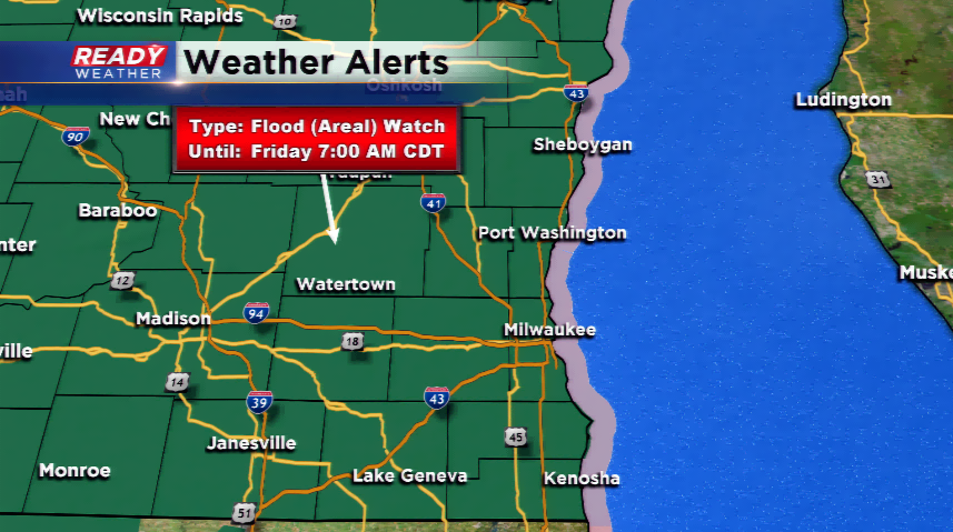
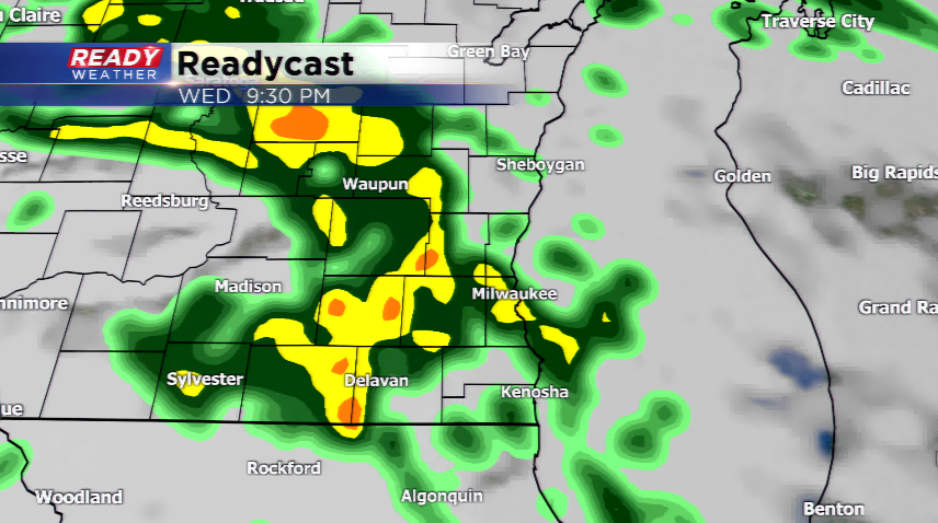
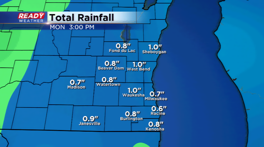
Our eyes will be on the flooding potential with the mild air melting the snow, but also the rain threat. Rain waves will be in and out the next 48 hours around a large area of low pressure. Rainfall totals will hit around one inch for the region. Rain, melting snow, and the frozen ground will lead to minor flooding for area streams, creeks, and rivers; keep a close eye on your basement and yard, as well. The NWS has issued a Flood Watch for the viewing area until 7 am on Friday. Wind will be a concern around this tightly-wound storm as gusts will exceed 40 mph.
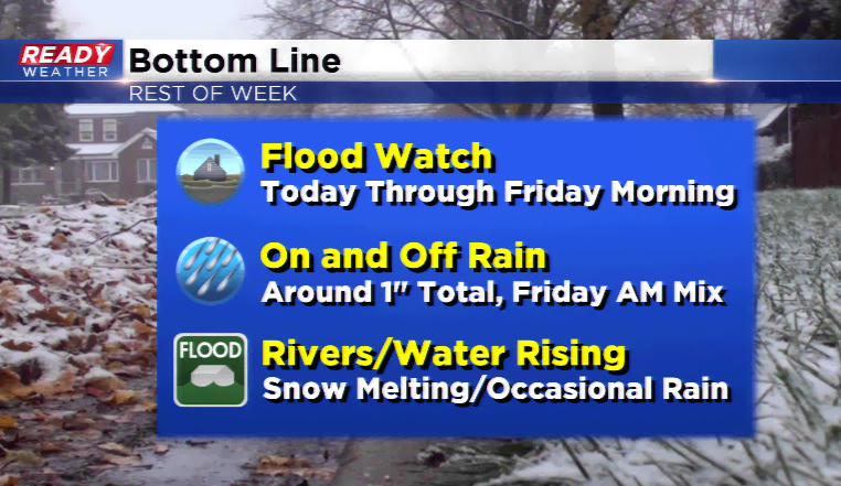
The storm will slowly track to the west by Friday morning. As the cold air funnels behind the cold front, the potential is there for a light mix or flurries behind the storm system. Snow accumulation is not expected. Our weekend looks quiet with seasonal temps following.