September rain rises in the records as flooding comes to an end

-
2:45

’It’s gross and disappointing’: Brady St. chaos includes...
-
2:26

How the Racine County Sheriff’s Office is using AI to catch...
-
2:32

MPS board discusses why 13 schools are being considered for closures...
-
2:40

Milwaukee’s Puerto Rican community stung by racist comments...
-
3:11

Push to limit noncitizen voting on Wisconsin ballots
-
2:53

MPD squad cars involved in multiple crashes in 1 night
-
1:39

’We take care of each other’: Organization provides bikes...
-
1:06

Baldwin, Hovde make final push on campaign trail as Senate race...
-
1:03

New gun violence prevention program coming to Milwaukee County
-
1:03

Early voting update in Milwaukee
-
1:26

Go on an adventure into Wonderland at new Shorewood bookstore
-
3:44

UW Health Chief Quality Officer joins CBS 58 to discuss health...

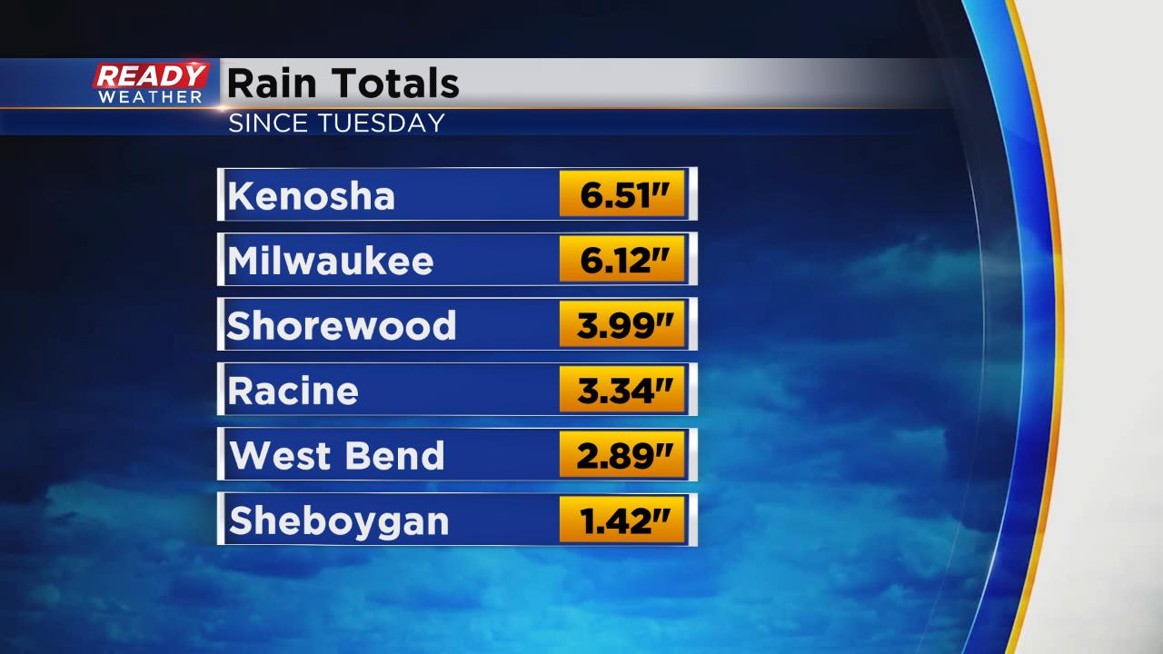
For the fourth straight day we had heavy rain in southeast Wisconsin Thursday night into Friday morning. The heavy rain led to flash flood warnings in some spots that expired early Friday. Rain totals from Thursday night surpassed 4" in some spots but the majority of the area were in the 1-3" range.

If you add that heavy rain onto the heavy rain from Tuesday, Wednesday and Thursday some official reporting stations such as Milwaukee's airport have seen over 6" of rain.
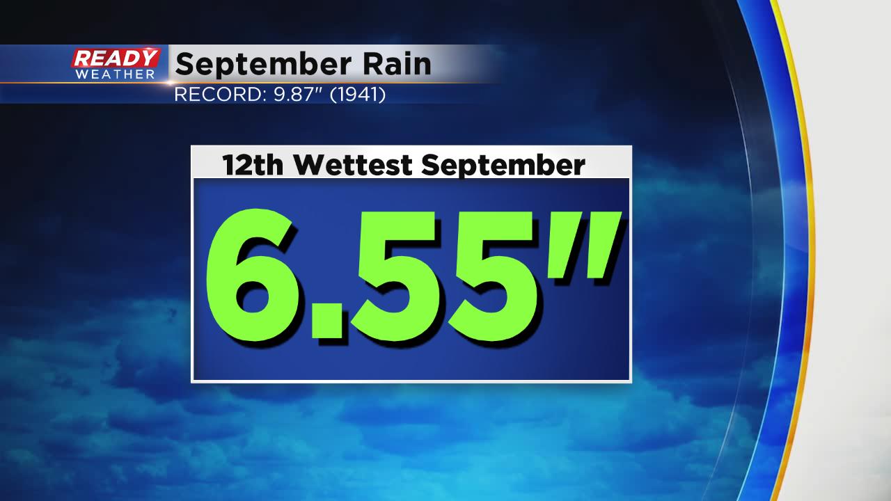
Since the start of September Milwaukee has picked up 6.55" of rain which is a lot. If September ended now it would go down as the 12th wettest September on record and we still have two weeks to go. If we pick up just another inch it would be the 5th wettest September on record. For reference, the wettest September was in 1941 when nearly 10" of rain fell. Last September was also very wet. We saw 6.83" of rain in September 2018 which went down as the 10th wettest September on record.
Now that the rain has finally stopped, sunshine returns by late Friday morning and definitely this afternoon. Our next chance for rain arrives Saturday night into Sunday morning but should be light with less than a quarter inch in most spots.
Download the CBS 58 Ready Weather app to see when more rain could happen in the 10-day forecast.