Severe storms and heavy rain possible Sunday
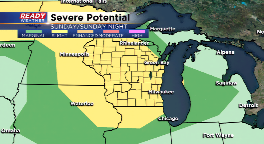
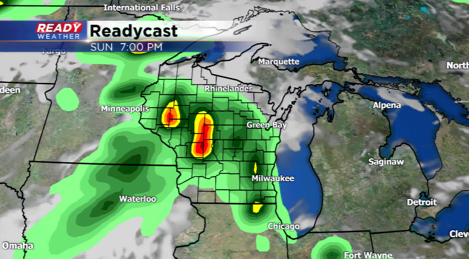
An active weather pattern takes shape starting tomorrow with several rounds of showers and storms. The ingredients will be present for big time thunderstorms into early next week. Temperatures will jump well into the 80s with dew points back close to 70, if not above. With the instability in place, a line of thunderstorms will develop out west and rage into southeastern Wisconsin by the afternoon and evening. The Storm Prediction Center has a *slight* risk of severe weather, the second category out of five on the list. The big threats will be large hail, damaging winds, and very heavy rainfall. The line of storms should move out by early Monday morning.
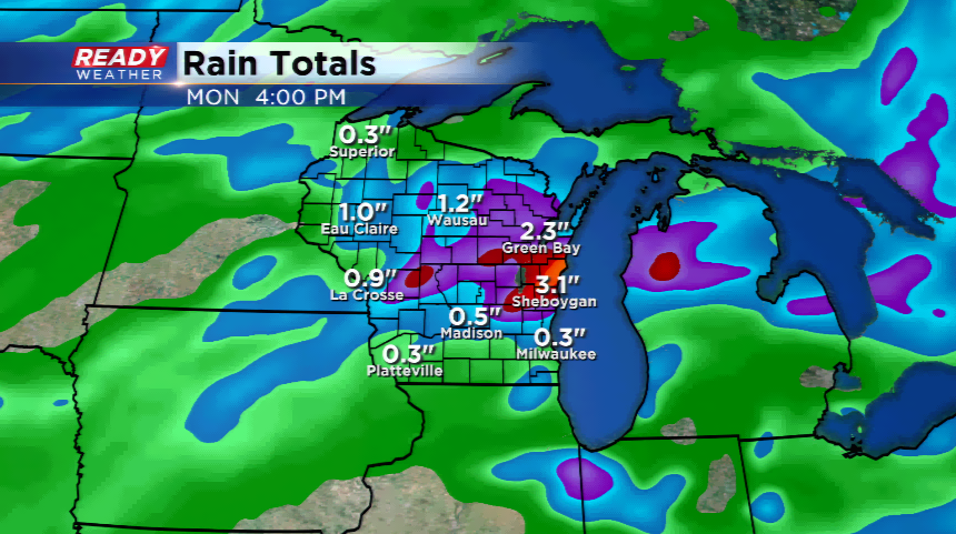
The ingredients remain present for strong to severe storms heading into Monday, especially late. With temps hovering in the upper 80s and low 90s on Monday, storms will re-fire overnight Monday into early Tuesday. The severe storms might be a little more limited since they’re happening during the night hours; however, with the low level jet pumping in ample moisture, rain will become the issue. Totals could get high in some locations.

Finally, a cold front will drive into the region by Tuesday and Tuesday. This should bring one final round of storms, some being strong. The cold front will bring a taste of early fall with much lower dew points and highs only getting into the mid 70s.