Snow to make a return
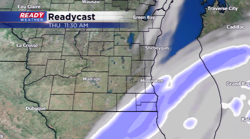
Three systems will give the viewing area an opportunity for fresh snowfall. The first is a much larger low pressure system that will drop several inches of snowfall south and east of southeastern Wisconsin. Model data is forcing the northern edge of the storm into the region giving way to a possible dusting or snow showers today.
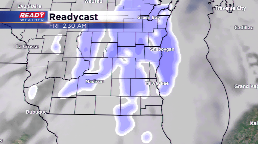
The second and third systems are Alberta Clippers which will be fast-moving disturbances slinging in light snowfall. The first of these two will move in tonight. Another dusting to 0.5” will be possible by daybreak tomorrow morning. There’s even the question if there’s a chance for freezing drizzle out of this. It will have to be watched closely with the morning commute in full swing.
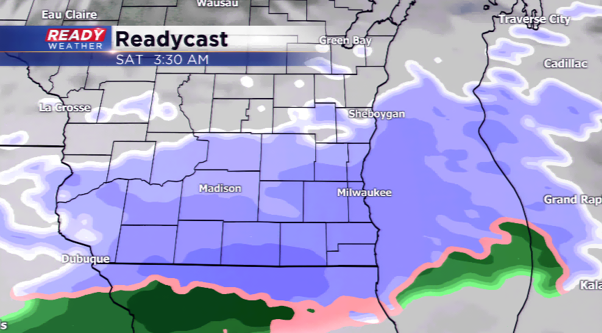
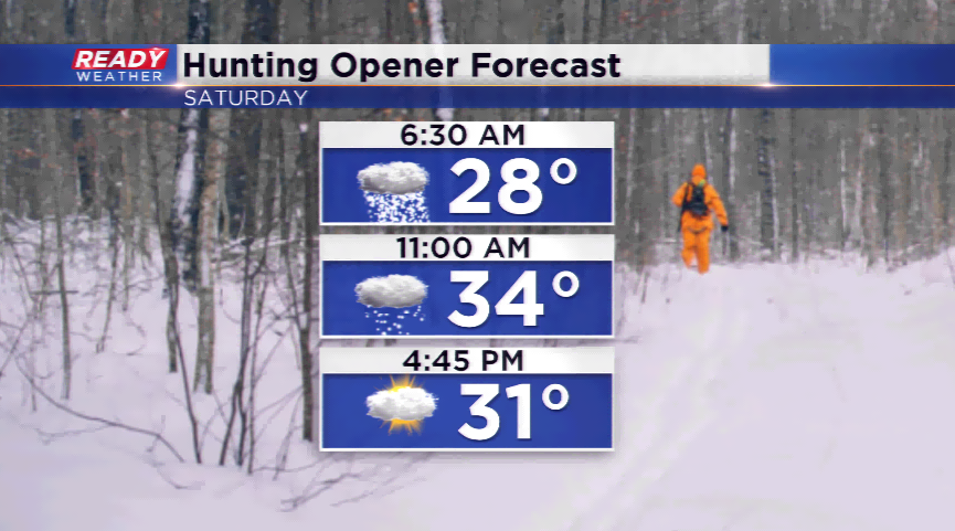
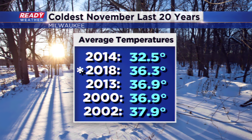
Expect the last system to be the most disruptive for southeastern Wisconsin. This glides in by Friday night and Saturday morning. The numbers are showing a few inches possibly, but the track and the exact accumulation amount are still up in the air. Once this moves out, it looks to be a quiet weekend. The cold has been the other story this month with the November numbers ranking it the second coldest in the last 20 years.