The summer-like heat and humidity returns

-
4:52

Previewing May’s event calendar in the Historic Third Ward
-
2:50

Mount Mary’s annual CREO Fashion Show this Friday has a different...
-
4:00

Wisconsin BBB warns about moving scams
-
2:29

Staying warm this week with a few rounds of storms possible Tuesday
-
1:16

2 dead after hit-and-run on Milwaukee’s south side
-
2:11

’Innocent people are dying:’ Loved ones hold balloon release...
-
0:56

Community gathers at fundraiser for Ocular Melanoma, a rare eye...
-
1:06

Dozens gather at The Cooperage to celebrate Cinco de Mayo
-
3:27

Third Wisconsin Lutheran High School sibling achieves perfect...
-
1:19

Colonel Heg Memorial Park
-
4:31

’It’s a transformation’: Tattoo artist uses psychology...
-
6:16

’An amazing opportunity for these students’: A Hometowns...

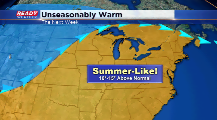
Today will be the last day in the next week it won’t feel like the dog days of summer. That’s right. Check your calendar, it won’t feel like the end of September.
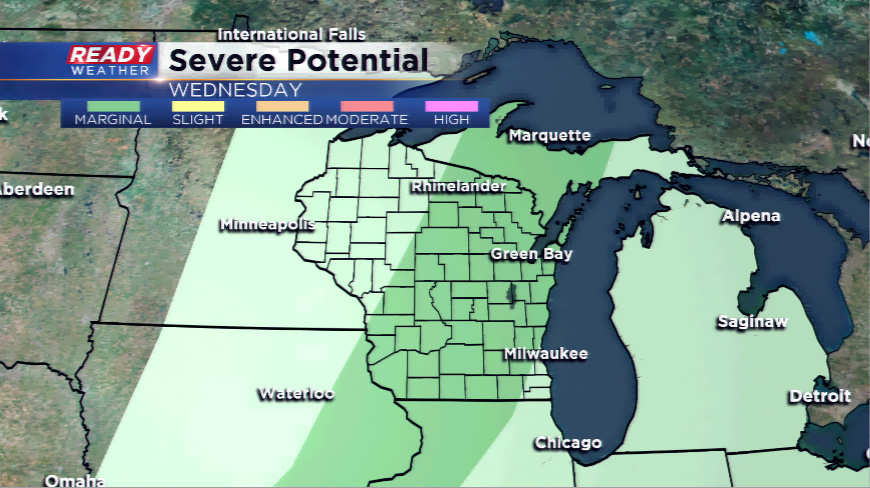
A strong upper-level ridge will grab hold of the Great Lakes and Badger State allowing a string of 80s to develop the next several days. The culprit will be a warm front; the warm front will track north and provide hit or miss chances of rain Tuesday morning. Most of the activity stays south of the border. Another chance along a weak cold front will blossom showers and storms. There is a chance with the right dynamics in place a few of these turn strong.
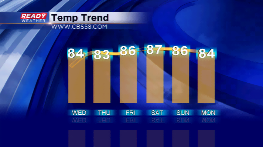
The longest streak of 80s so far this summer has been six consecutive days. The streak starts tomorrow and could last into next Monday. The ridge begins to break down by next Tuesday. A cooler, drier air ma