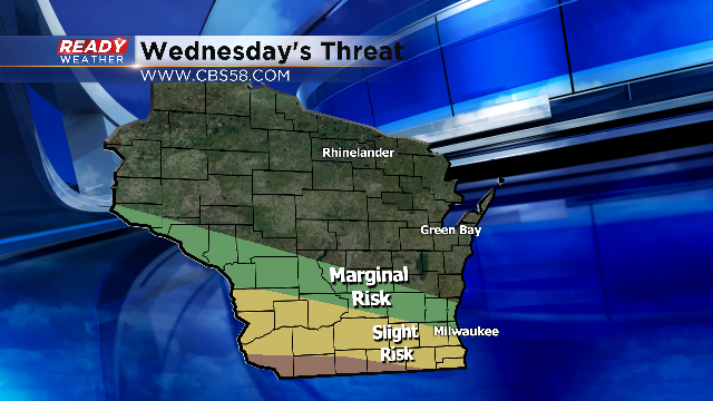
Wednesday's Severe Weather Threat

The severe weather season will continue to heat back up this week! We are closely watching Wednesday for a round of strong to severe thunderstorms across southeastern Wisconsin. Right now the SPC has the southern part of our viewing area under a slight risk for severe weather; however, just over the border there's an enhanced risk across northern Illinois.
The severe weather threat, specifically the tornado threat, is contingent upon where the warm front will setup Wednesday morning. Right now the forecast models appear to position the warm front close to Milwaukee. The greatest severe weather ingredients will sit just south of the boundary. Any storm that can get rooted south of the boundary by Wednesday evening could become severe and possibly tornadic.
The position of the warm front is the toughest part to forecast. If rain and storms continue through Wednesday morning, the cooler outflow could reinforce the warm front south, so the exact position won't be known until Wednesday.

The trigger for the showers and storms will occur between 18K and 30K feet. A fast moving shortwave over 100 knots will streak across the Midwest on Wednesday. Those strong winds aloft will help to intensify a surface low pressure area to our west. As the low deepens, it will pump warm and very unstable air across the area. Wind shear will also intensify by Wednesday evening!

Right now it appears that two rounds of severe weather will be possible. Late Tuesday night into Wednesday morning could feature storms with winds and hail. If the atmosphere can recover late Wednesday afternoon and evening, another eruption of storms with all modes of severe weather will be possible.
We will continue to update the severe weather threat over the next 36 hours. Please check back to the blog for the latest.

