8 PM Update: Severe Storms Still Firing
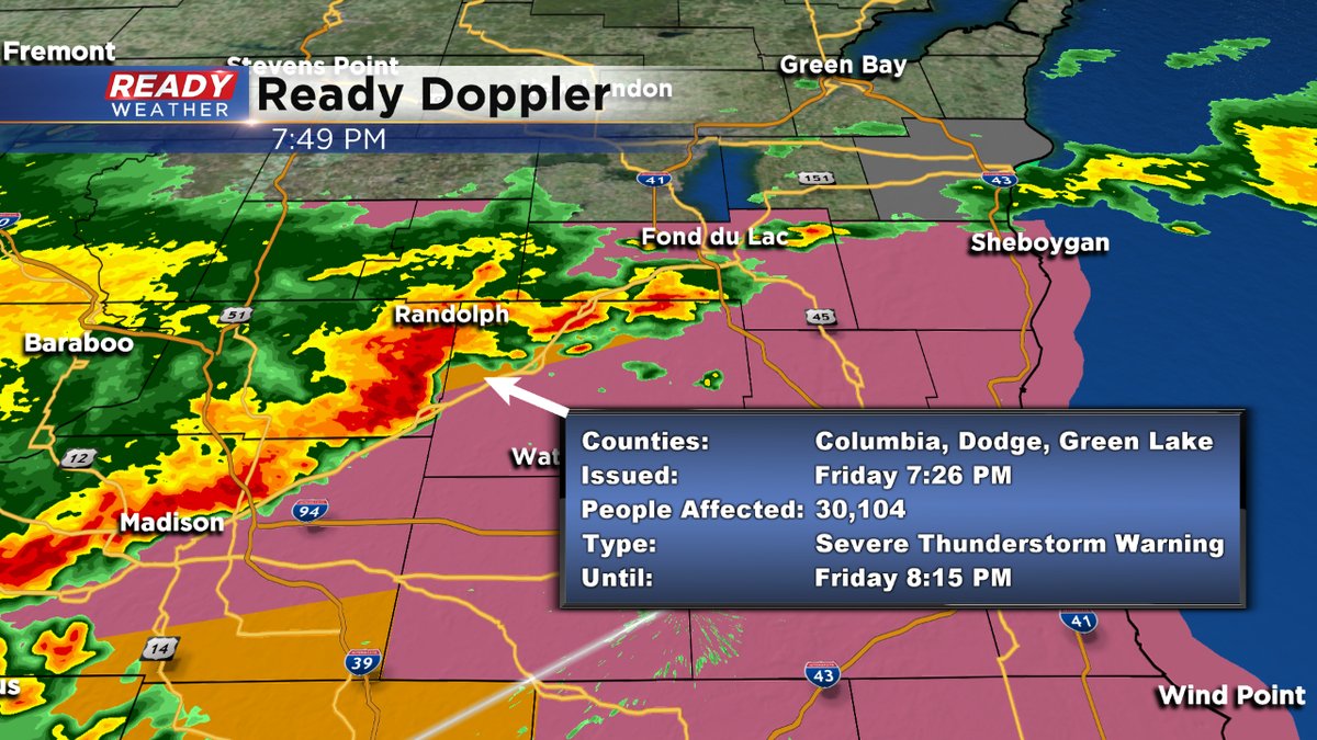
Here's the latest on current warnings. This particular warning for Dodge county also has the potential for some rotation so we are watching this carefully. The warning goes until 8:15pm
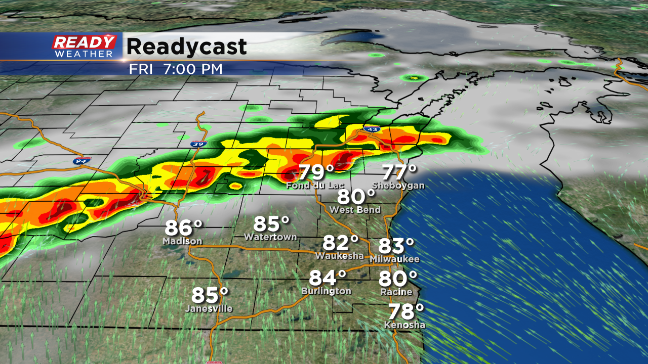
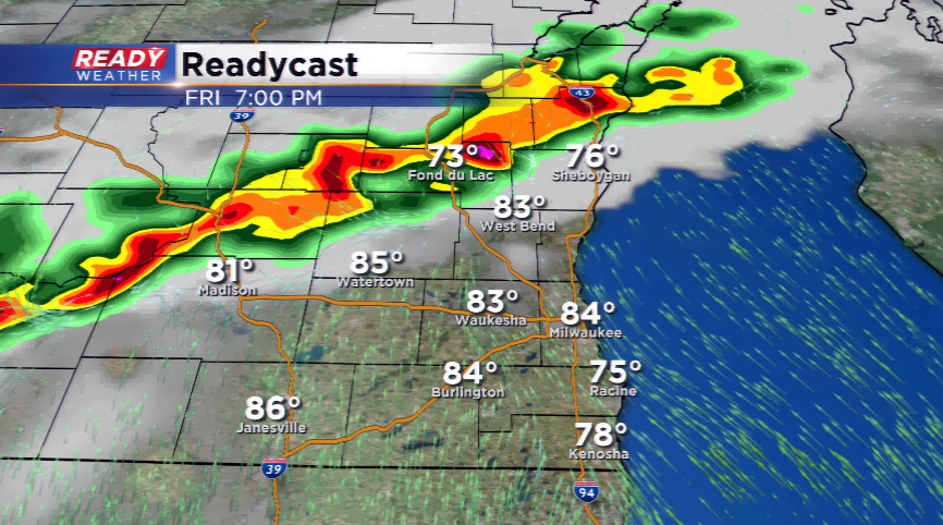
7:00 PM
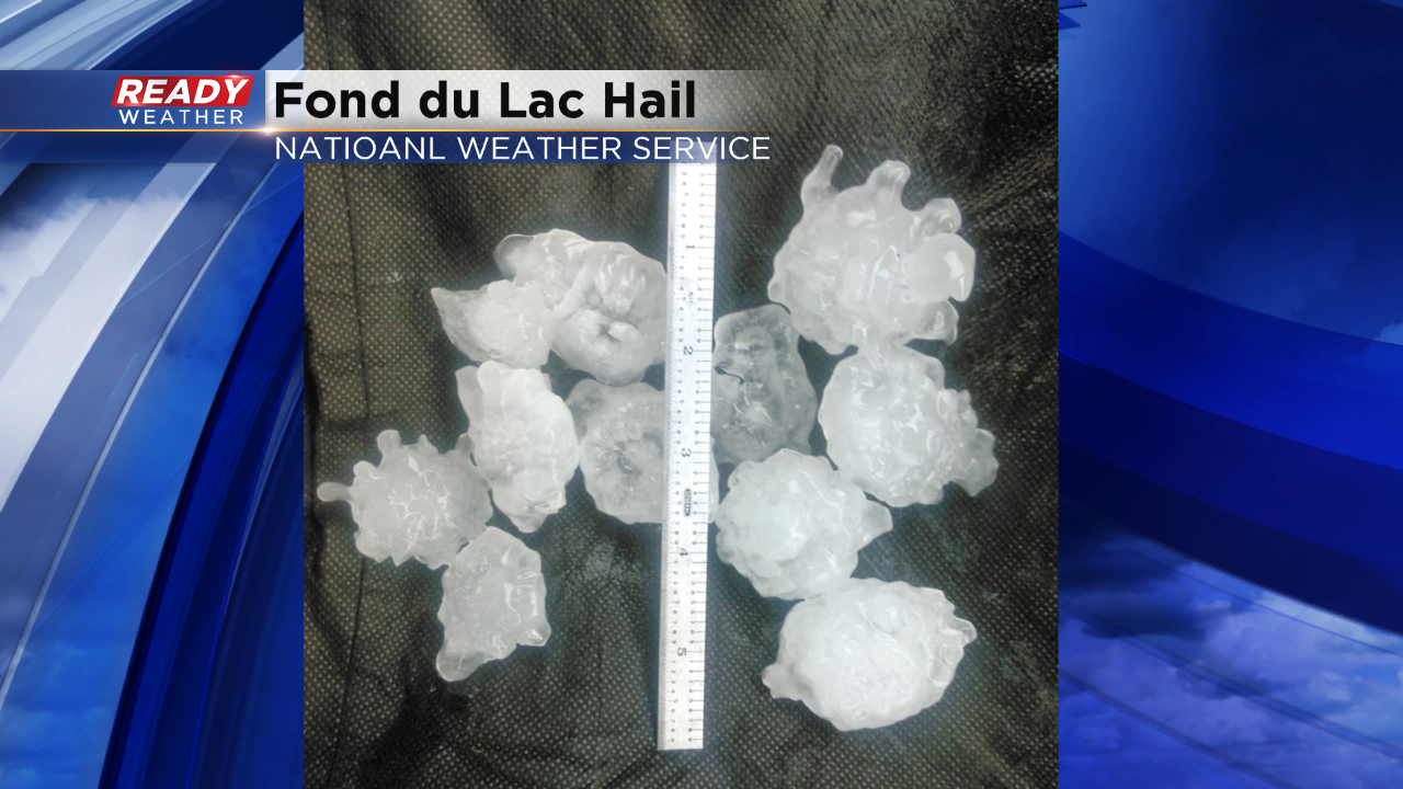
Take a look at the hail that was captured around 5:30 in Fond du Lac county! This was egg size hail around 2"!
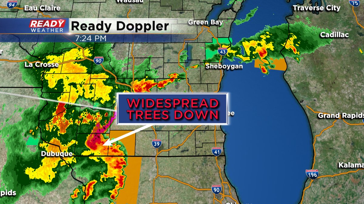
Additional storms are firing across western Wisconsin, and even more rotating northeast out of northern Illinois. We still expect storms to hold off across the metro until after 9 pm.
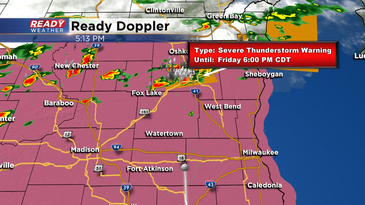
Ongoing storms will continue throughout Dodge, Fond du Lac, and Sheboygan counties this evening.
____________________________________________________________________________________________________________
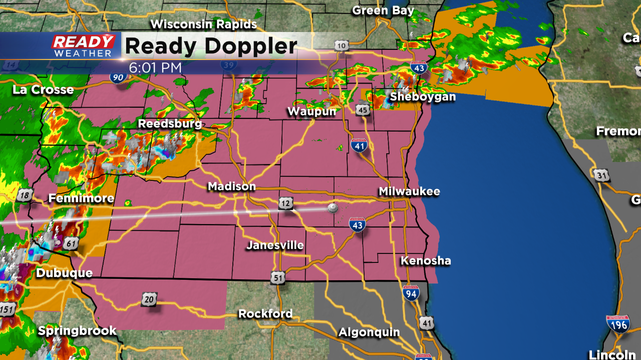
6:00 PM
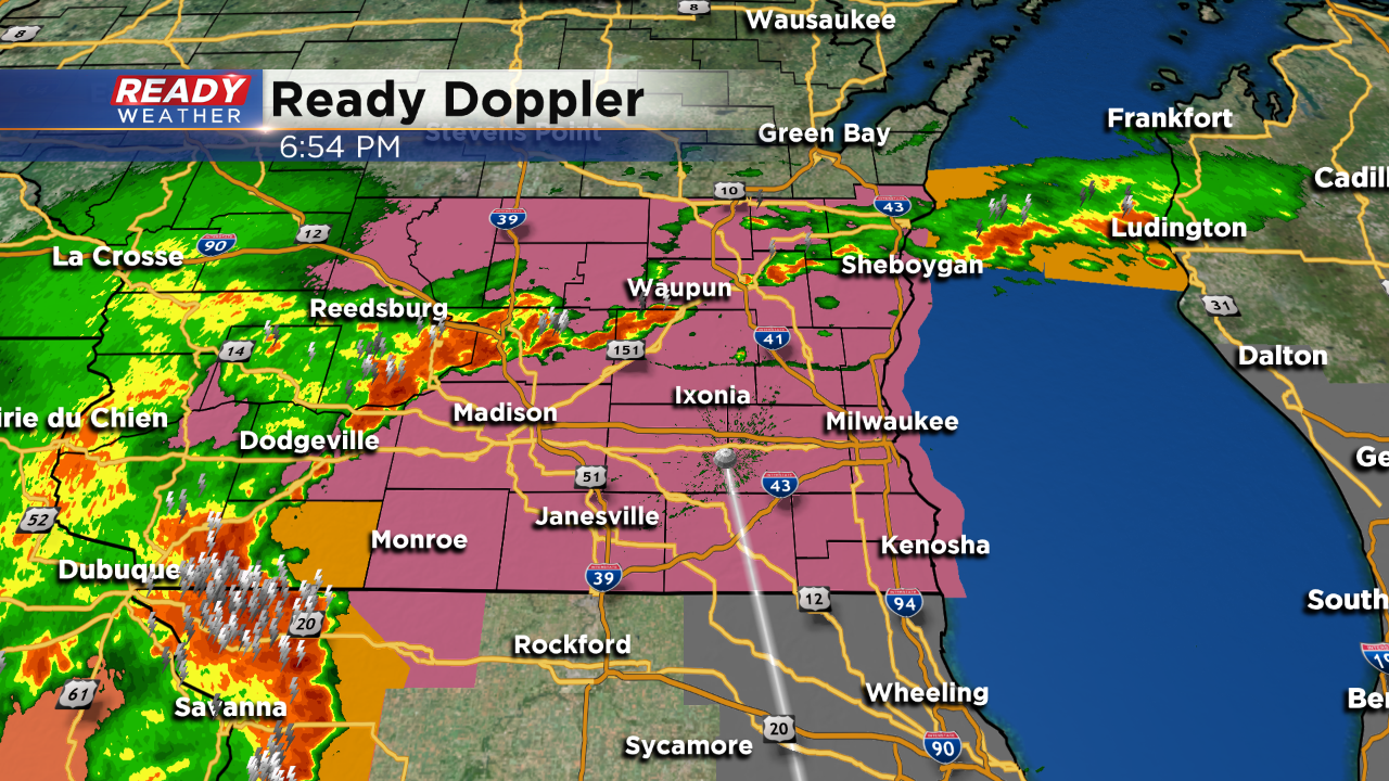
We are watching two areas tonight. The first is along a boundary across Fond du lac and Sheboygan counties. Storms in that area have continued to fire with quarter hail and wind gusts over 50 mph. Those storms will persist over the next couple of hours.
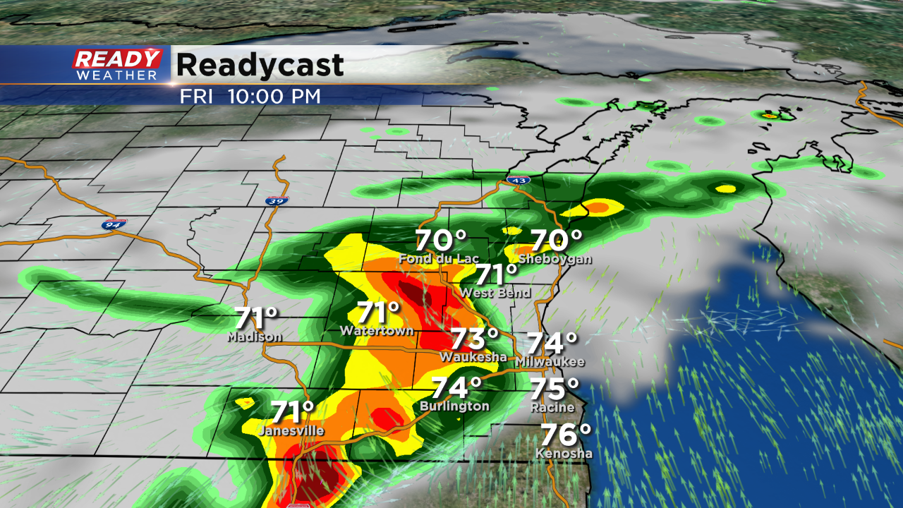
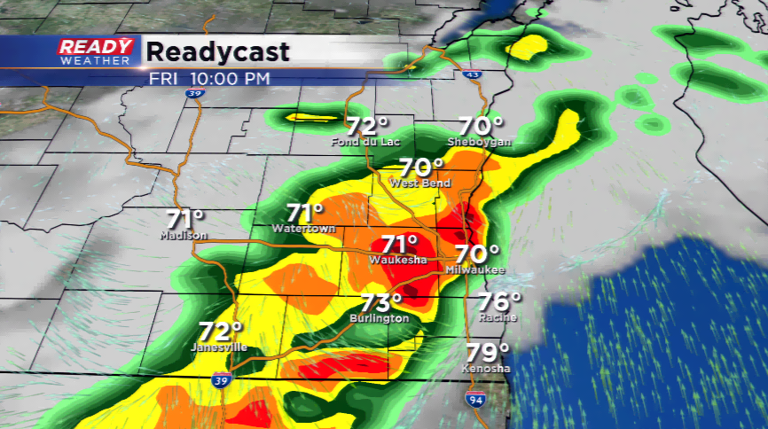
The second area is filling in across western Wisconsin. This line of storms will move east into the Milwaukee metro area between 8 pm and Midnight. The entire area remains under a severe thunderstorm watch until 11 pm.
__________________________________________________________________________________________________________
Conditions are turning severe in a hurry late this afternoon. At 4pm the Severe Thunderstorm Watch was issued.
4:00 PM
A severe thunderstorm watch has been issued for the entire area until 11:00 pm. Strong to severe storms capable of large hail and damaging winds are expected to develop over the next several hours.
The storms will really pick up in coverage between 7 pm and Midnight.
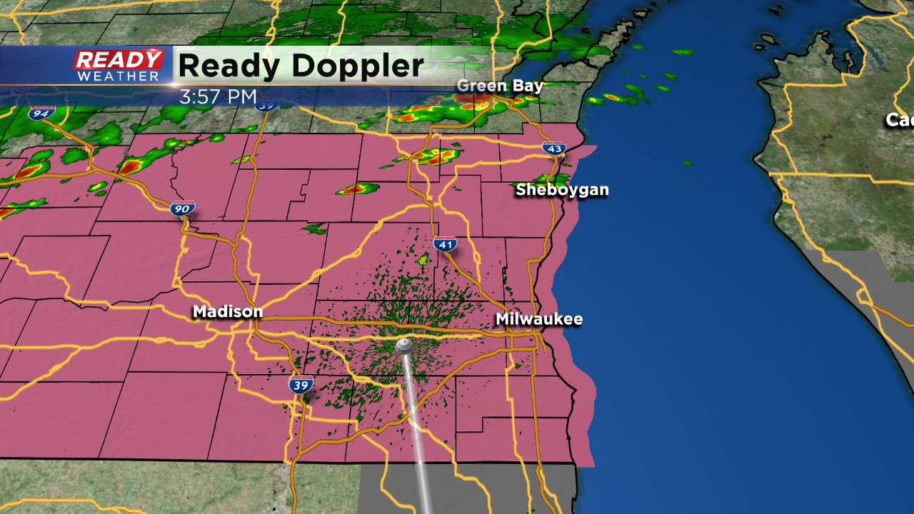
3:00 PM
The overall convective risk hasn't changed much from this morning. The SPC has highlighted our northwest areas as the best chance for strong to severe storms this evening. Damaging winds and large hail are possible across the entire area.
2:00 PM Temperatures have spiked into the upper 80s and lower 90s this afternoon. The heat index is more like the middle 90s! Isolated storms could develop across our northern counties late this afternoon and early evening.
No severe watches have been issued at this time. Strong to possibly severe storms are expected to develop late this evening between 7 pm and Midnight. The biggest push for widespread storms looks to be after dark. Storms that do fire could contain hail and gusty winds, along with locally heavy rainfall.
Isolated rain and storms will likely continue overnight into Saturday morning.
______________________________________________________________________________________________________________
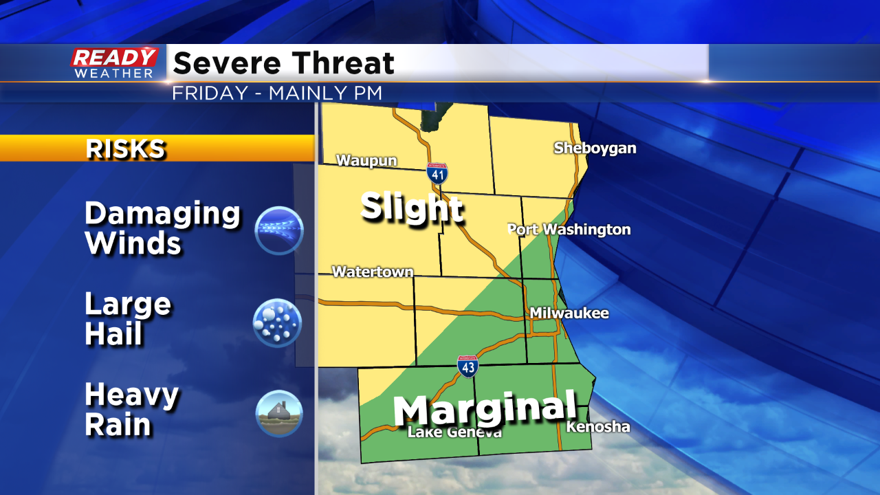
A one-two punch of weather conditions are expected today in southeastern Wisconsin and the Badger State. First off, the heat will continue with muggy air and temperatures nearing 90 degrees. If we hit 90, it would be the ninth time of the season, matching the typical amount of 90 degree plus highs we see in a year. Yes, it has been a warm season thus far.
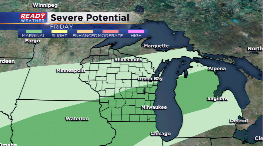
As the sun glimmers in the hazy skies, the instability will eventually built enough to blossom bigger thunderstorms, especially by later today and tonight. These storms will develop along a cold front; the front will slide in by 7 pm to the north, and possibly 10 pm in the metro. Storms that fire could be strong to severe with high winds, hail, and heavy downpours. Due to the risk of these types of storms, the Storm Prediction Center has placed the whole viewing area under a marginal risk of severe storms, the lowest tier on the list.
Download the CBS58 Ready Weather App for updates on this blog, watches or warnings that take place in real time, and track storms on our easy-to-navigate radar system.