Active weather pattern to bring multiple chances for showers and storms this week


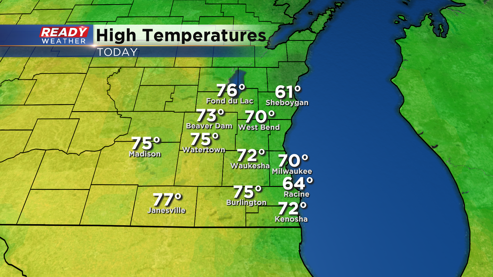
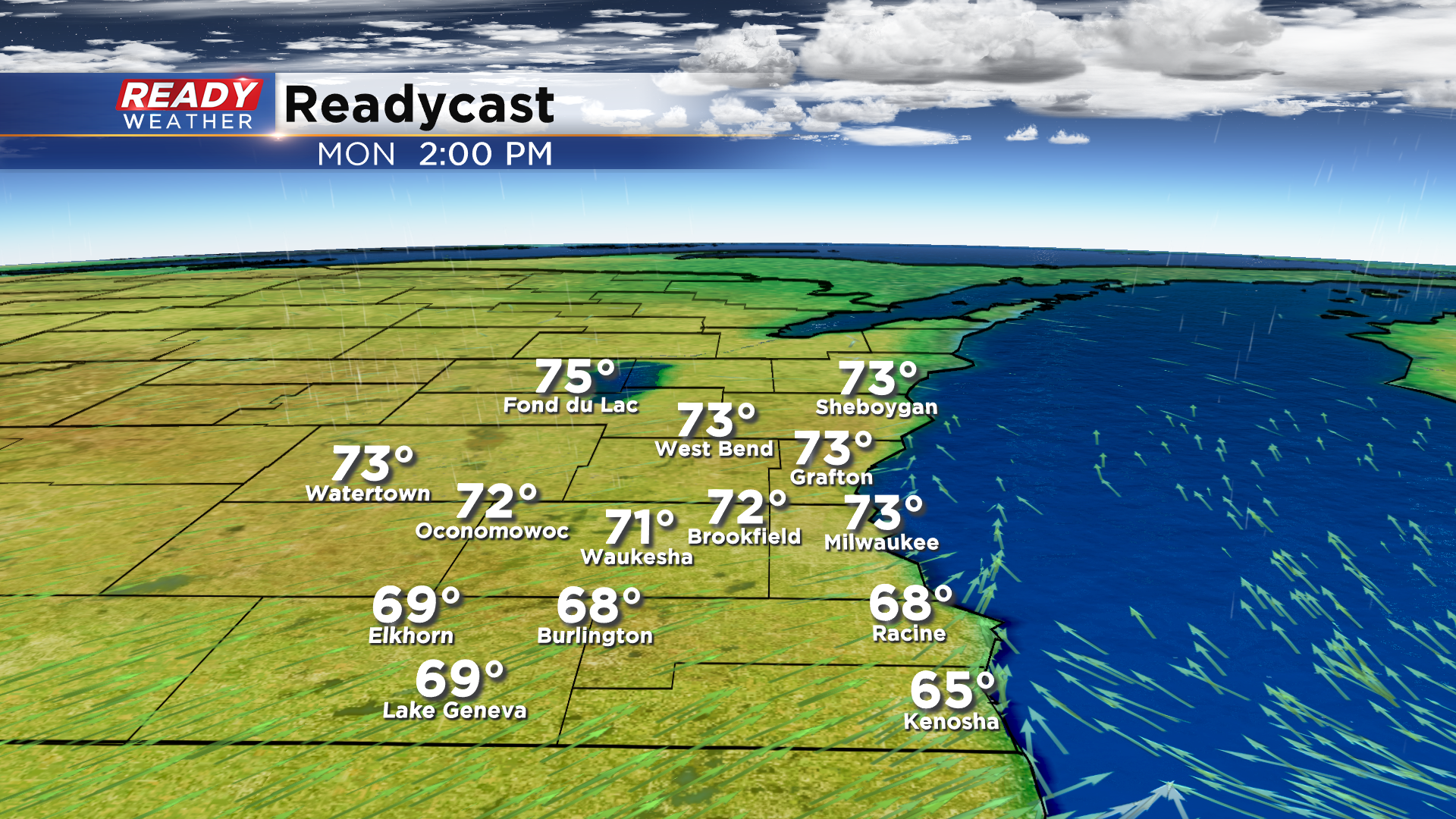
The April sunshine won the battle again the southeast wind today as temperatures managed to climb into the low 70s in Milwaukee! Mid 70s were found even farther away from the lake with abundant sunshine.
After a rather dry stretch of weather, we're in for a rather active week with at least an isolated chance of showers or storms every day this week. However, no day looks to be a complete washout and there will be plenty of dry time, especially during the first half of the week.
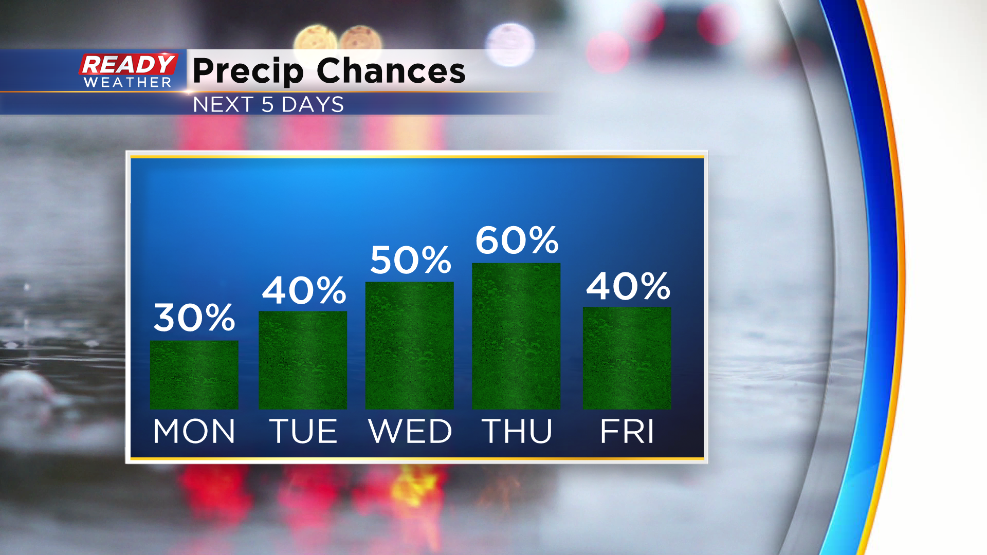
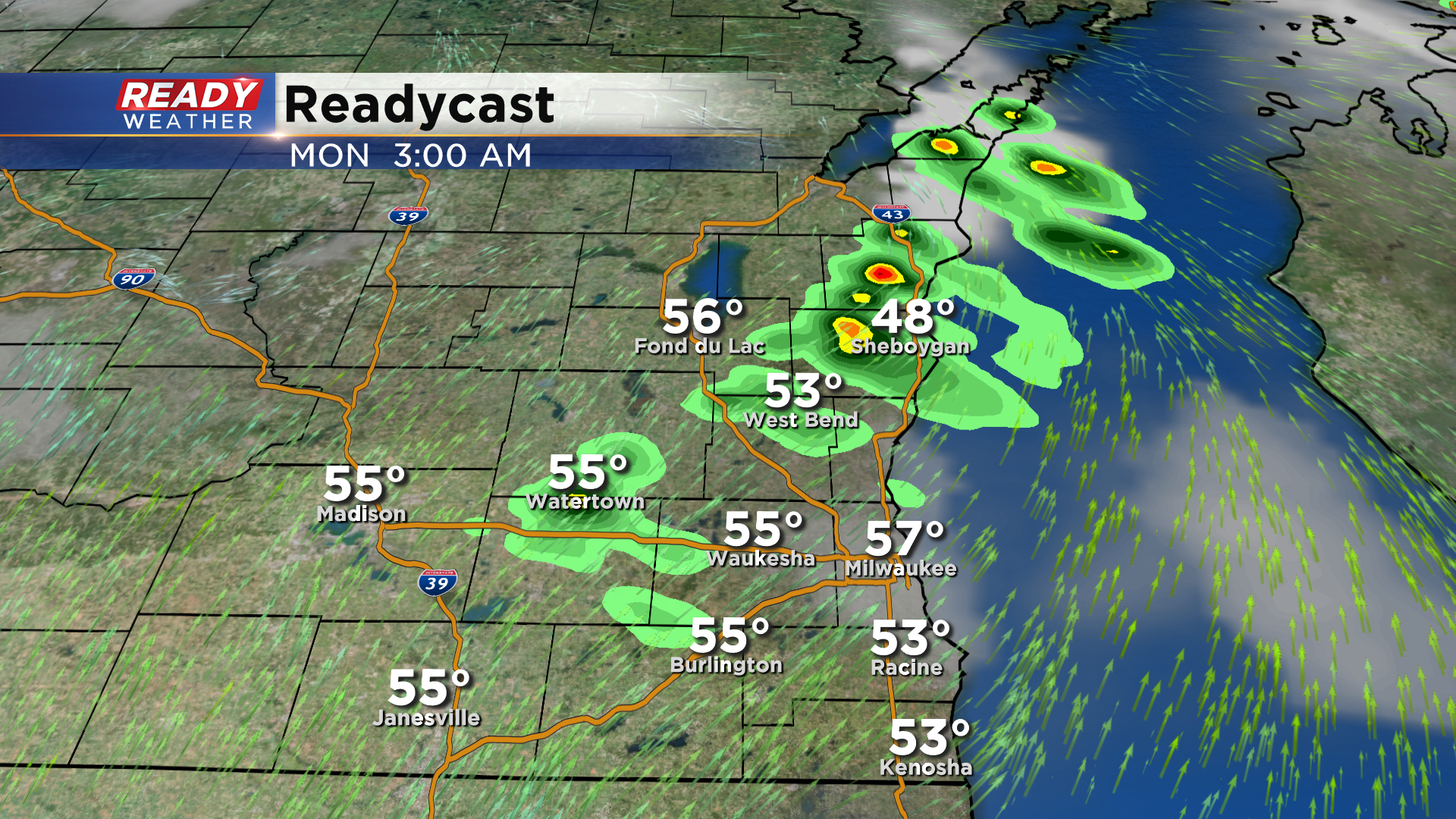
Our first chance of isolated showers and storms comes around and after midnight tonight. If any showers or storms develop, they'll be done by 7 am.
Another weak disturbance may trigger a shower or storm late morning - midday near the WI/IL border, but most of the afternoon should turn dry.
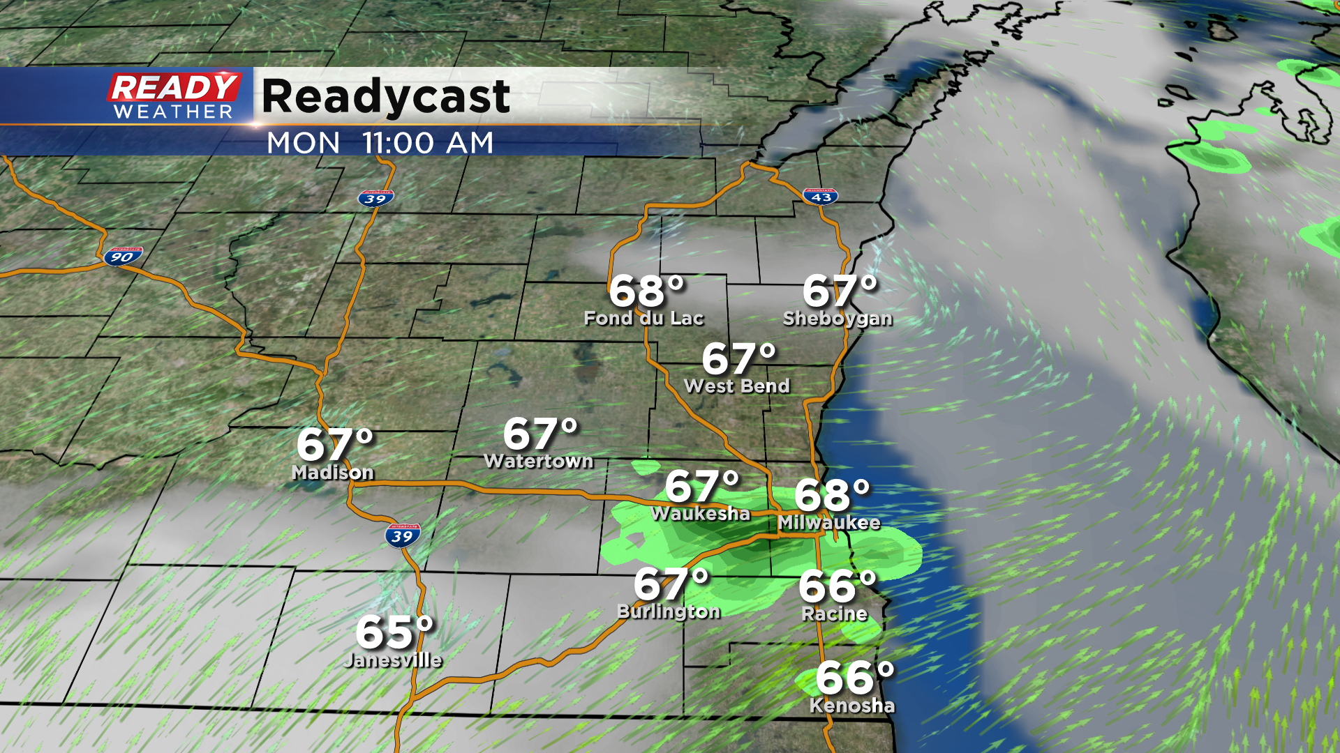
The warm front is expected to sit north of the area on Monday, so any peeks of sun should help temperatures quickly warm into the 70s. Any places that see extended sunshine could easily warm into the mid 70s. Winds will start out southwest, but will turn southeast later in the afternoon, dropping temps back into the 60s lakeside.
A line of storms looks to develop Monday evening in Minnesota and track across the state Monday night, weakening by the time it reaches southeast Wisconsin around daybreak Tuesday morning.
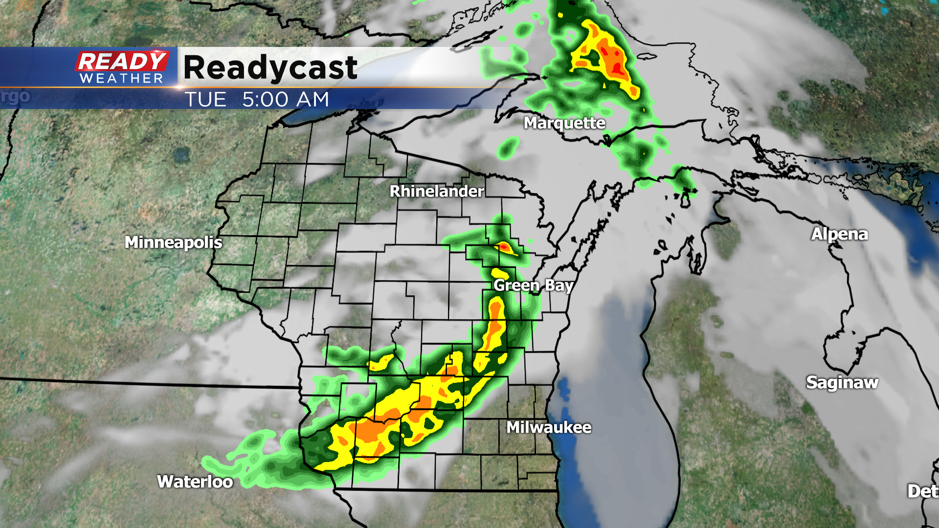
The best chance for any severe storms with this line will be in Minnesota and western Wisconsin, but a few strong gusts of wind will be possible, especially closer to central Wisconsin. Once this line of showers ends on Tuesday, we'll dry out for several hours before a few more isolated showers and storms develop Tuesday night. A slow moving area of low pressure will meander across the Midwest Wednesday - Friday, keep the shower and storm chances in place. The best chance widespread, steadier rain will come Wednesday night into Thursday morning.
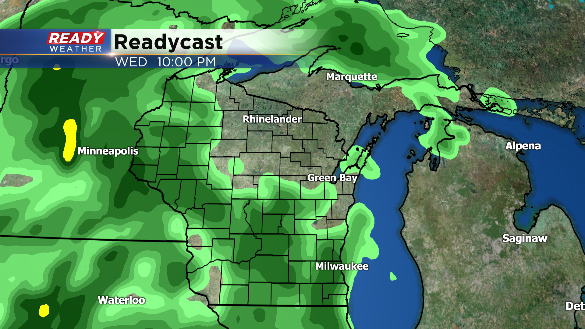
Temperatures will cool back into the 50s during the second half of the week due to this system. Download the CBS 58 Ready Weather App to track the showers and storms.