After Monday's flooding rain more storms are possible Tuesday


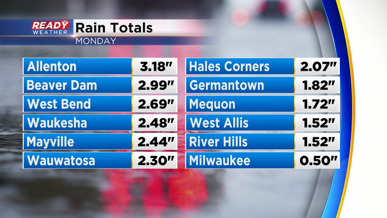
Strong to severe storms rolled through southeast Wisconsin Monday afternoon and evening with very heavy rain and a few reports of thunderstorm wind damage. Rain totals were highest across parts of Dodge and Washington Counties but Milwaukee, Waukesha, Jefferson and Ozaukee Counties saw some street flooding as well.
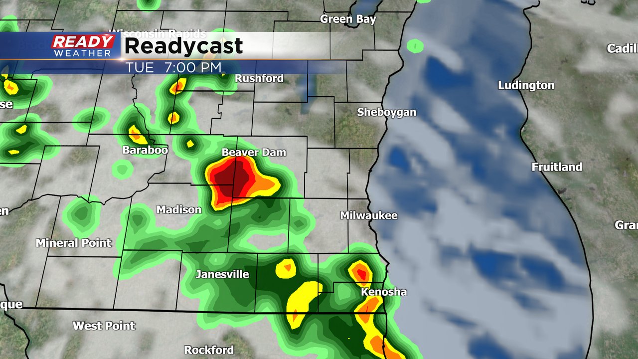
A few of the storms Tuesday evening could be borderline strong to severe. Some of our local western counties are under a Level 1 Marginal Risk for severe weather but there is currently no severe risk for lakeside counties. Gusty wind and small hail would be the main threats with any strong storms.

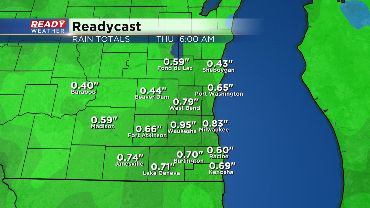
If we get any big rains flooding would be a concern Tuesday especially if it falls in communities that already got dumped on by Monday's rain. Overall, the storms Tuesday and Wednesday should be fairly fast moving with rain totals by Thursday morning ranging from 0.50-1".
Download the CBS 58 Ready Weather app to track another round of rain and storms.