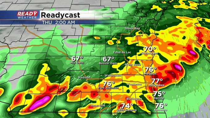
11:15 PM Update: Heavy rain in storms could lead to minor flooding


Updated: 11:20 pm Wednesday, July 14th:
An Areal Flood Advisory has been issued for northern Fond du Lac and Sheboygan counties until 2:15 am. There have been reports of flooding in the City of Fond du Lac and northern parts of the county.
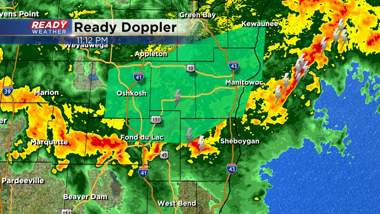
These locations have already picked up 1-2" of rain with heavy rain still falling. Remember to never drive through flooded roadways, especially at night!
------------------------------------------------------------------------------
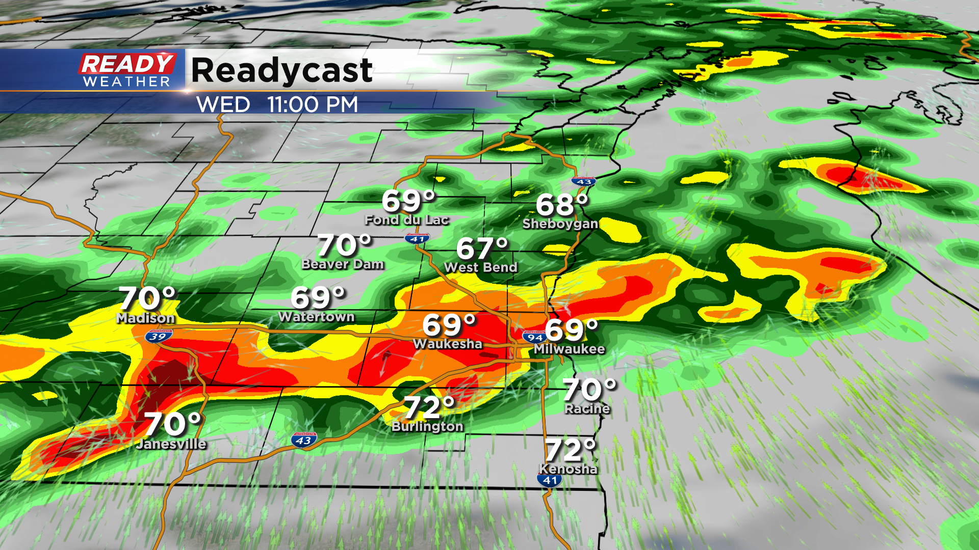
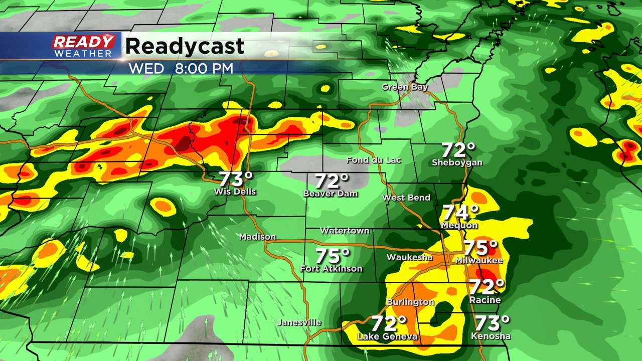
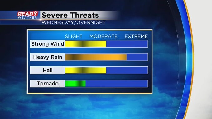
Updated: 10:00 pm Wednesday, July 14th:
A blob of rain formed ahead of the main line of storms in southwest Wisconsin, which has really limited our severe threat.
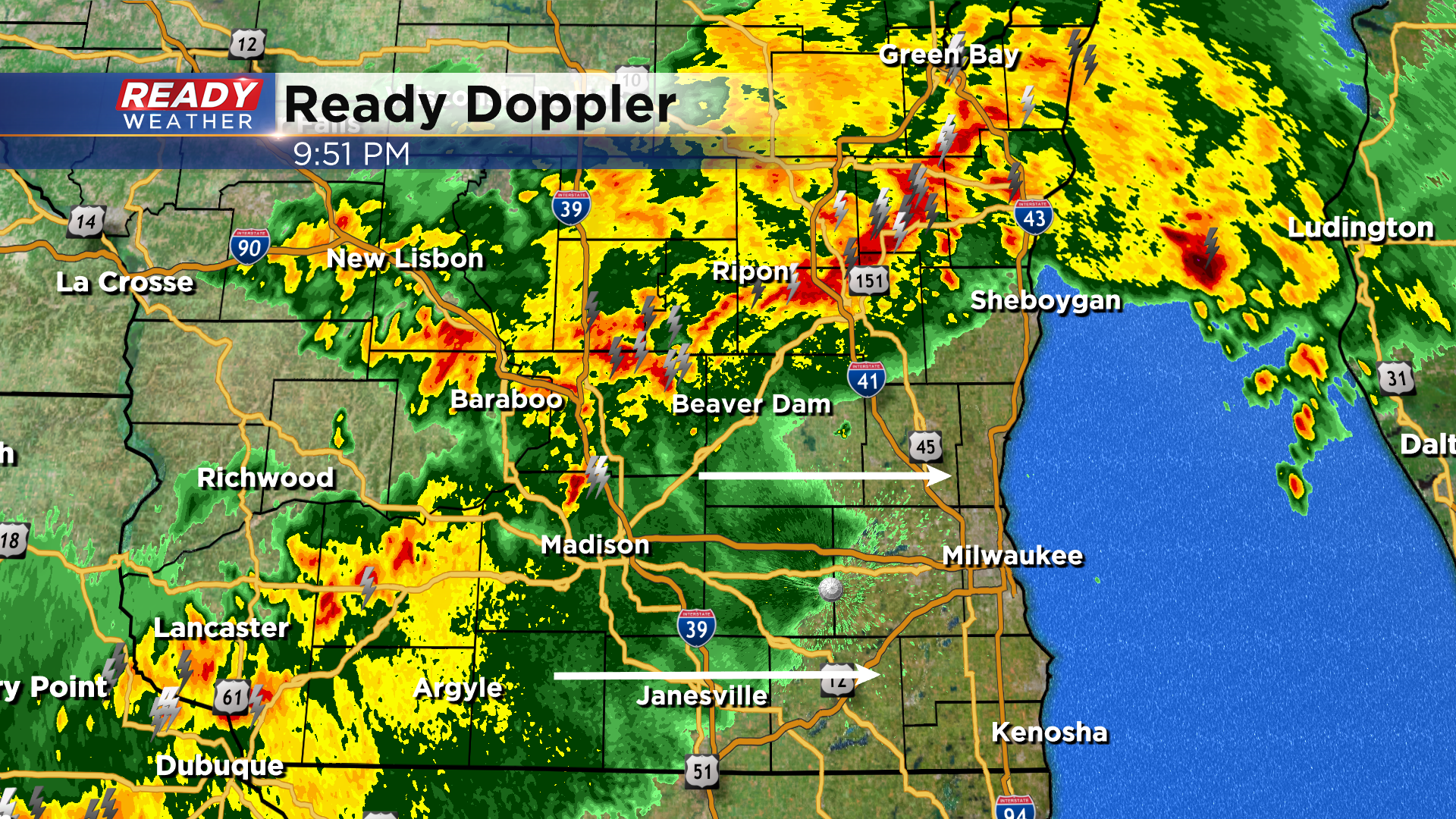
While there have been some embedded spin ups near the Dells, our threat for damaging straight-line winds has diminished greatly. We'll keep an eye out for any quick spin ups, but the main threats going forward tonight are heavy rain and lightning.
-----------------------------------------------------------------------------------------------
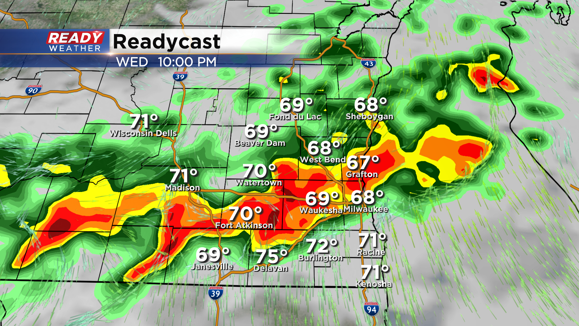
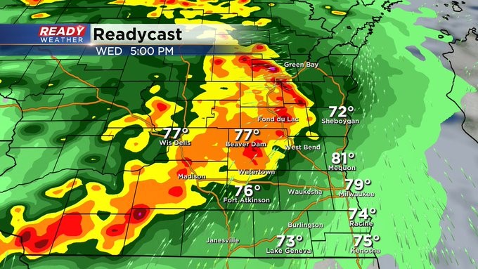
Updated: 8:00 pm Wednesday, July 14th:
A strong thunderstorm is exiting the Sheboygan area while the rest of us have been seeing a break in the action for the last couple of hours. Round two is getting its act together in Iowa and SW WI.
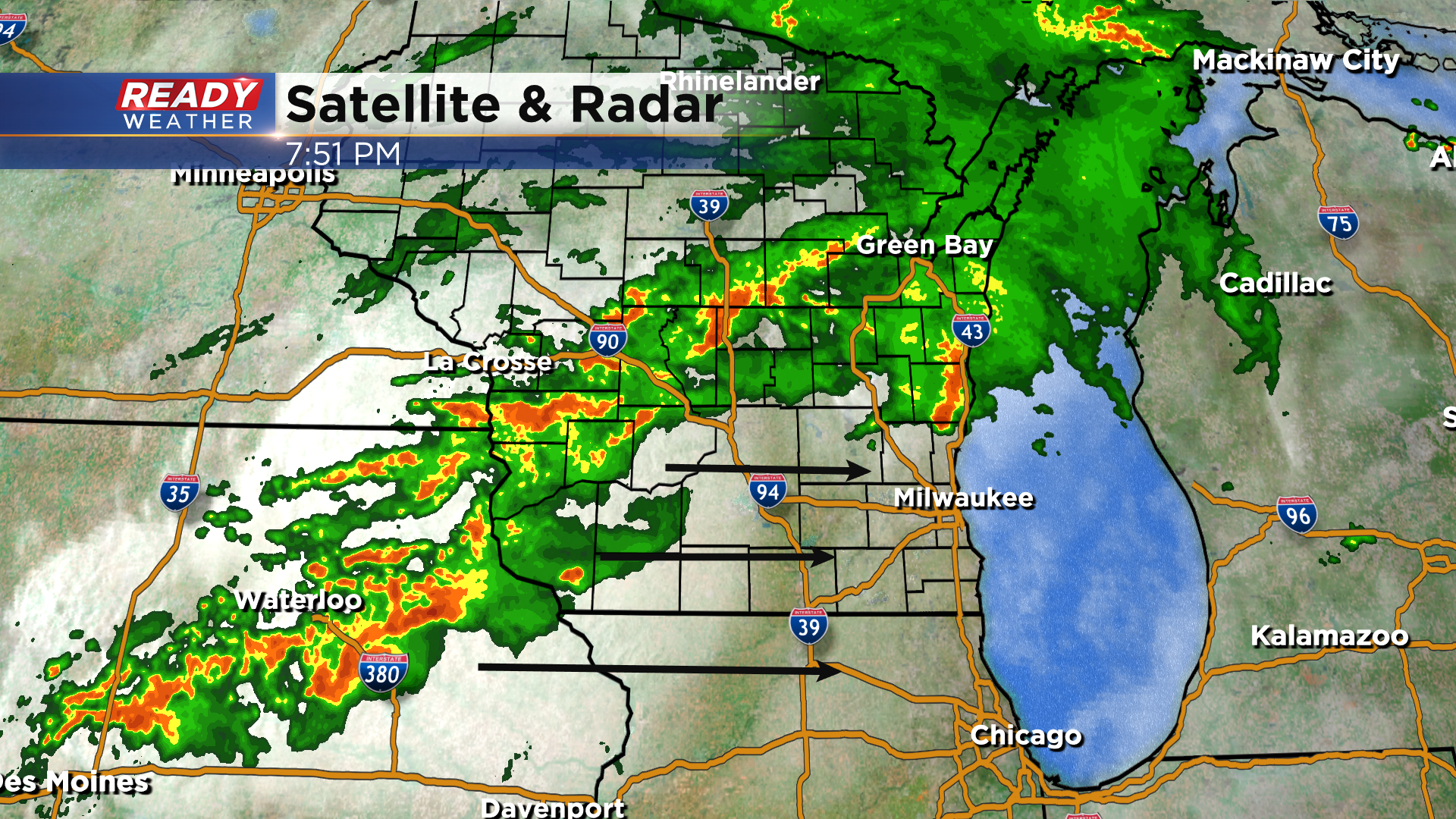
This looks to congeal into a line and track across southern Wisconsin through the rest of the evening into the overnight hours. Strong winds and torrential rainfall will be the primary threats, but we'll be watching for any embedded spin ups. Storms look to reach the Milwaukee area closer to 10:30-11pm.
------------------------------------------------------------------------------
Updated: 6:30 PM Wednesday, July 14th:
The SPC has issued a tornado watch that goes right up to our western counties. Western Wisconsin is starting to recover from early afternoon storms with plenty of instability and sunshine.

Storms out of Iowa will continue to march northeast into a favorable severe environment. These storms are expected to fire between 8 pm and 11 pm. Just because we aren't under a tornado watch doesn't mean severe weather won't happen here.
We will continue to watch it closely this evening!
______________________________________________________________________________________________________________
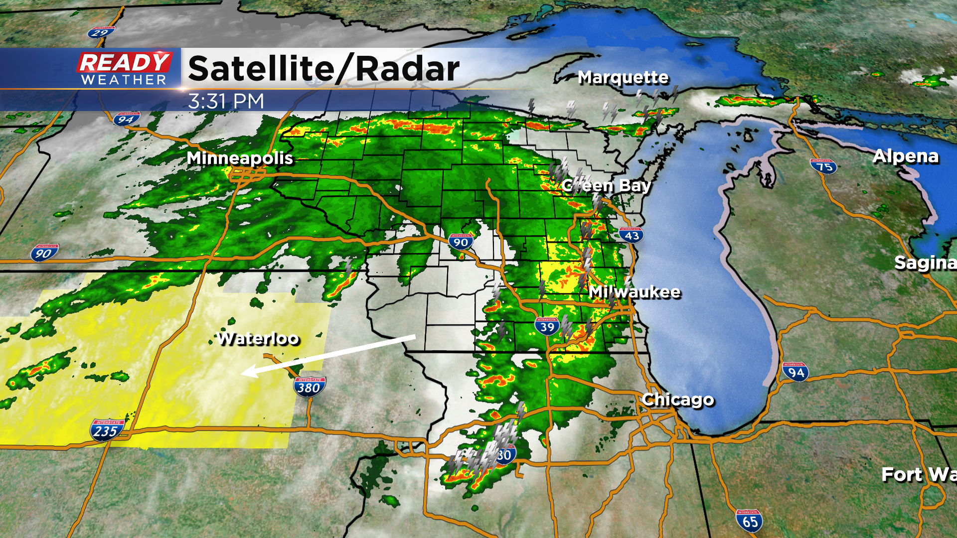
Updated: 4 PM Wednesday, July 14th:
The first round of showers and storms will continue to move through between now and 6 pm. Thankfully, this line has weakened well below severe limits. Some wind gusts between 30 and 40 mph and locally heavy rainfall is expected.
More storms are gong to fire over the next several hours across north-central Iowa. A tornado watch has been issued for that area. Those storms will make a run at our area between 8 pm and 1 am. If the atmosphere can recover, those storms will have the potential to be strong to severe, especially across our western counties.
As for the Deer District, there will likely be a window of dry time before tipoff until 10:00 pm. Showers and storms will be likely after the game.
1" to 3" of rainfall is expected out of this event through Thursday morning.
______________________________________________________________________________________________________________
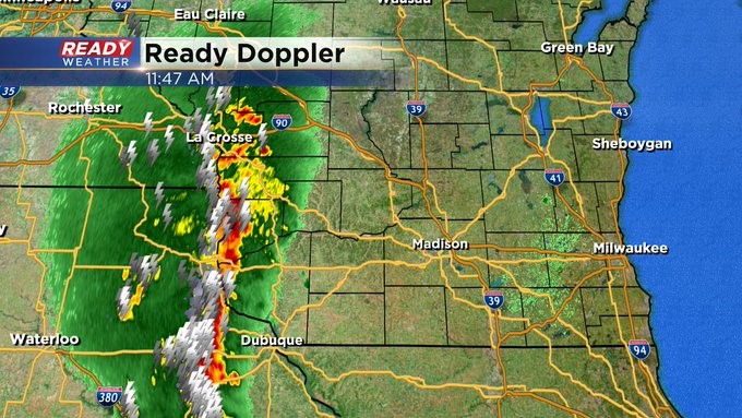
Updated: 2 pm Wednesday, July 14th:
A line of strong to severe storms is approaching southeast Wisconsin, racing east at 45 mph. This line has a history of 40-50 mph wind gusts and is producing torrential rainfall.
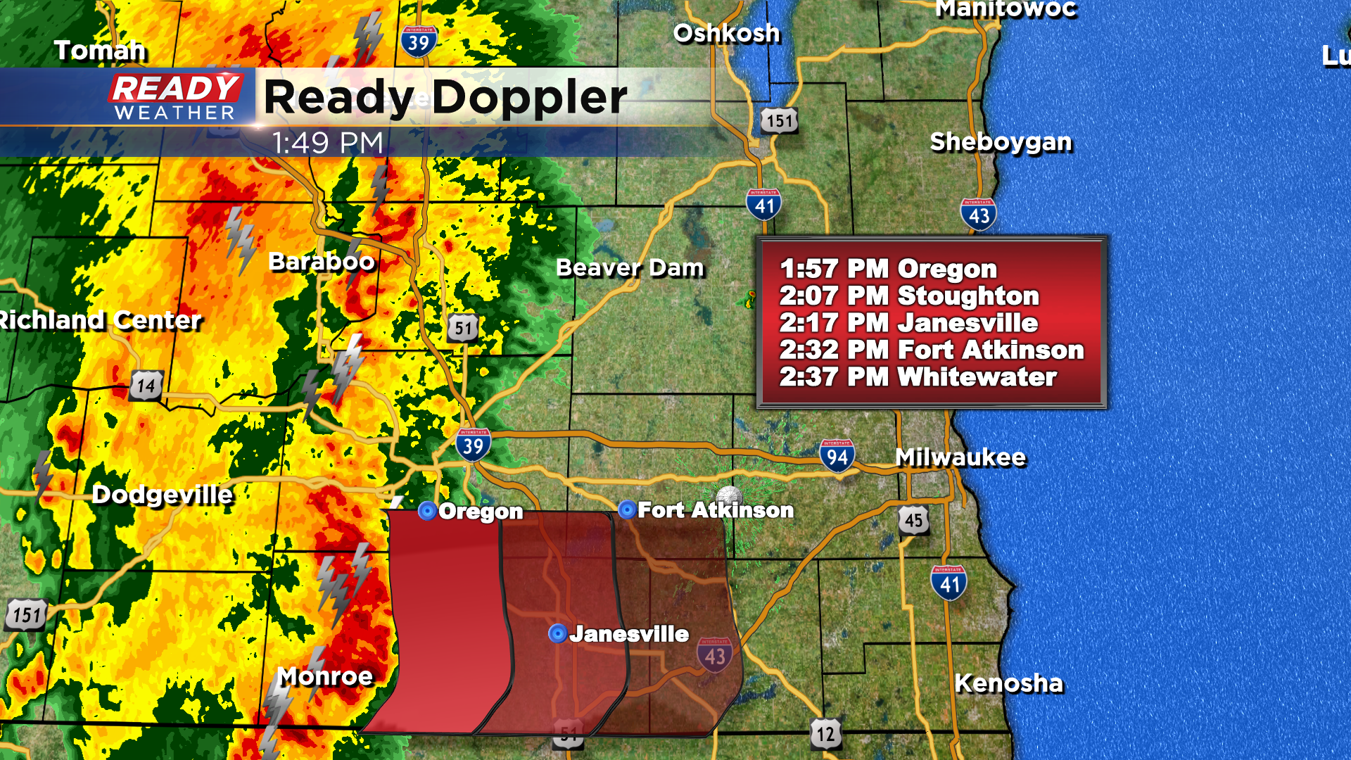
The strongest part of this line should move into Walworth county around 2:30pm-2:45pm, reaching western Racine and Kenosha around 3:15pm. Pea sized hail will also be possible in these storms. Once these storms move through, we'll likely see a break in the action for a few hours this evening.
While the first half of the Bucks game may be dry in the Deer District, storms will likely redevelop and move back in before the game ends.
---------------------------------------------------------------------------------------
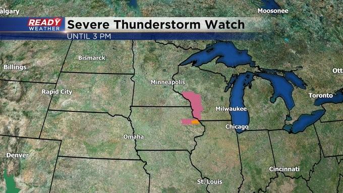
11:45 am Update on Wednesday, July 14
Getting a clearer picture of where the storms are heading. They're lined up along the Mississippi River. This general area is under a Severe Thunderstorm Watch until 3 pm. Expect to see storms fire late in the day. This will be round 1. Many more to follow. Stay tuned to CBS 58 & cbs58.com for further updates. The Ready Weather team is here for you.
______________________________________________________________________________________________________________
8 am Update on Wednesday, July 14
I've updated the forecasted projection of these storms. You can see how all this will evolve. Clusters of showers and storms, some strong to severe, will work in from the west as soon as late in the day. They'll last through much of the overnight. Flooding rains in spots are possible along with damaging wind and the threat of isolated tornadoes. Unfortunately we don't really clear out until the day on Friday. But the weekend is looking great. Stay tuned to CBS 58 and cbs58.com for further updates.
____________________________________________________________________________________________________________
MILWAUKEE (CBS 58)--This is one of those rare days, especially this summer, we've been put in an "enhanced" or level 3 risk for severe weather.
As it stands now, there appears to be two rounds of stronger storms set to move through the area.
The first late in the day into the evening.
And then another push late in the evening into the overnight.
It's really the second round we have to watch very carefully for the prospects of damaging wind and even possible tornadoes.
Rain looks to be very heavy at times as well, perhaps adding up to at least several inches.
This is one of those days you should have at least two sources of getting weather information and alerts, whether it be your phone, CBS58, or the National Weather Service.
Of course the Ready Weather team will keep you updated throughout the day.
So keep it here online or on air.
The threat for storms, by the way, lingers into Thursday as well.
It's not until Friday following the passage of a cold front we really start to improve with the weather conditions.
The weekend, by the way, is looking very nice with highs in the upper 70s to low 80s.