The active winter weather pattern continues into the weekend. Not only will Saturday feature subzero wind chills throughout the day, but there is a decent chance for some snow close to the IL/WI border.
A clipper system will race across the Midwest on Saturday. Most of the accumulation will remain throughout northern Illinois; however, we do expect the chance for some accumulation across our southern counties.
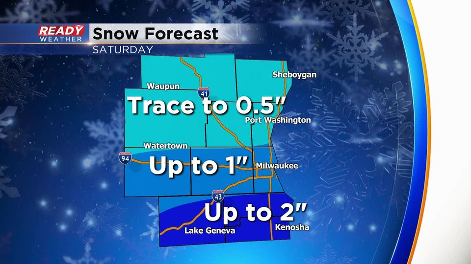
This is not a going to be a heavy wet snow. Most areas will remain well below 2". As you can see, the metro area could measure up to 1" of snow. Areas near the IL/WI border could reach 2" of snow. Many of our northern counties will completely miss out. There should be a very tight gradient.
The snow is forecast by the late afternoon into the evening before clearing out. Temperatures will drop below 0 for Saturday night into Sunday morning.
Areas that see snow will deal with more slick roads with the very cold air.
