Another snow in the books; light wintry mix possible Monday and Tuesday evening


Another round of snow is in the books with most of southeast Wisconsin picking up 2-3" of snow. It was a slushy, wet snow and roads are in fairly good shape Monday morning. Take your time shoveling as the snow will be fairly heavy.

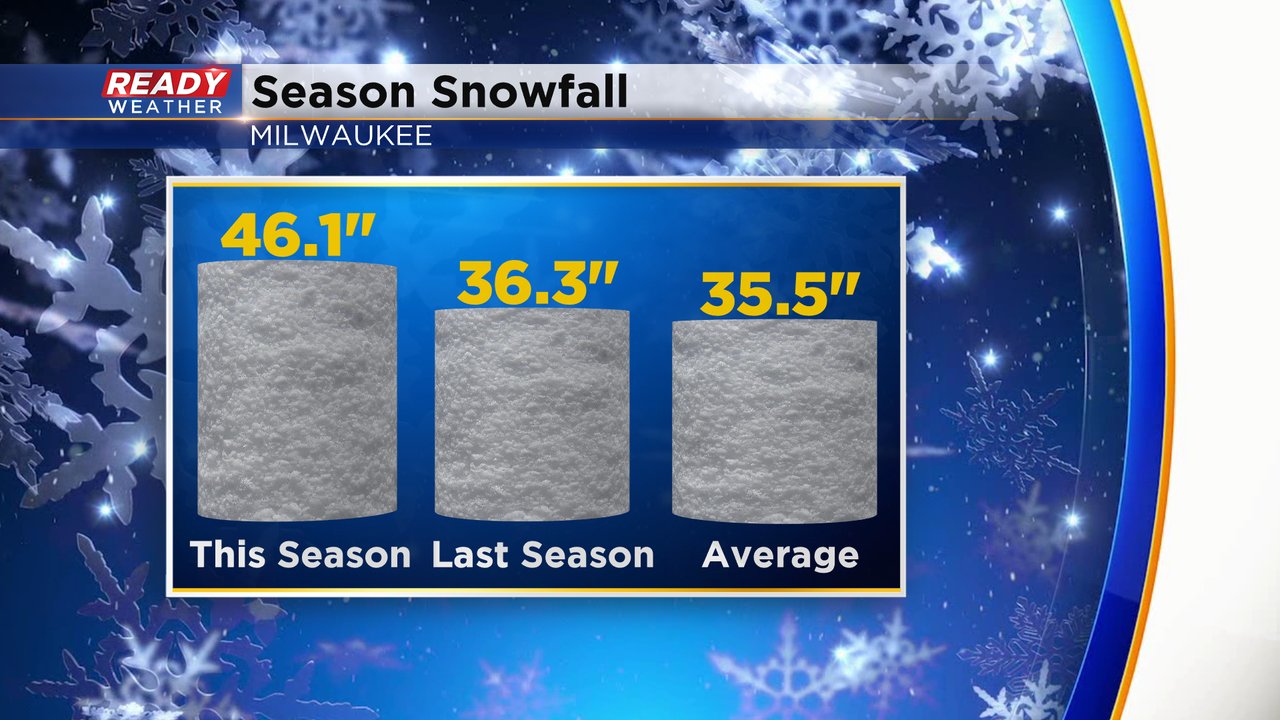
With the 2.2" of snow that Milwaukee officially picked up at the airport we are sitting at just over 46" of snowfall for the season. That is still about 10" above the to date average and last year's snowfall total through today's date. The yearly snowfall average in Milwaukee is 46.9" so one more light snow will push us above average for the entire season.
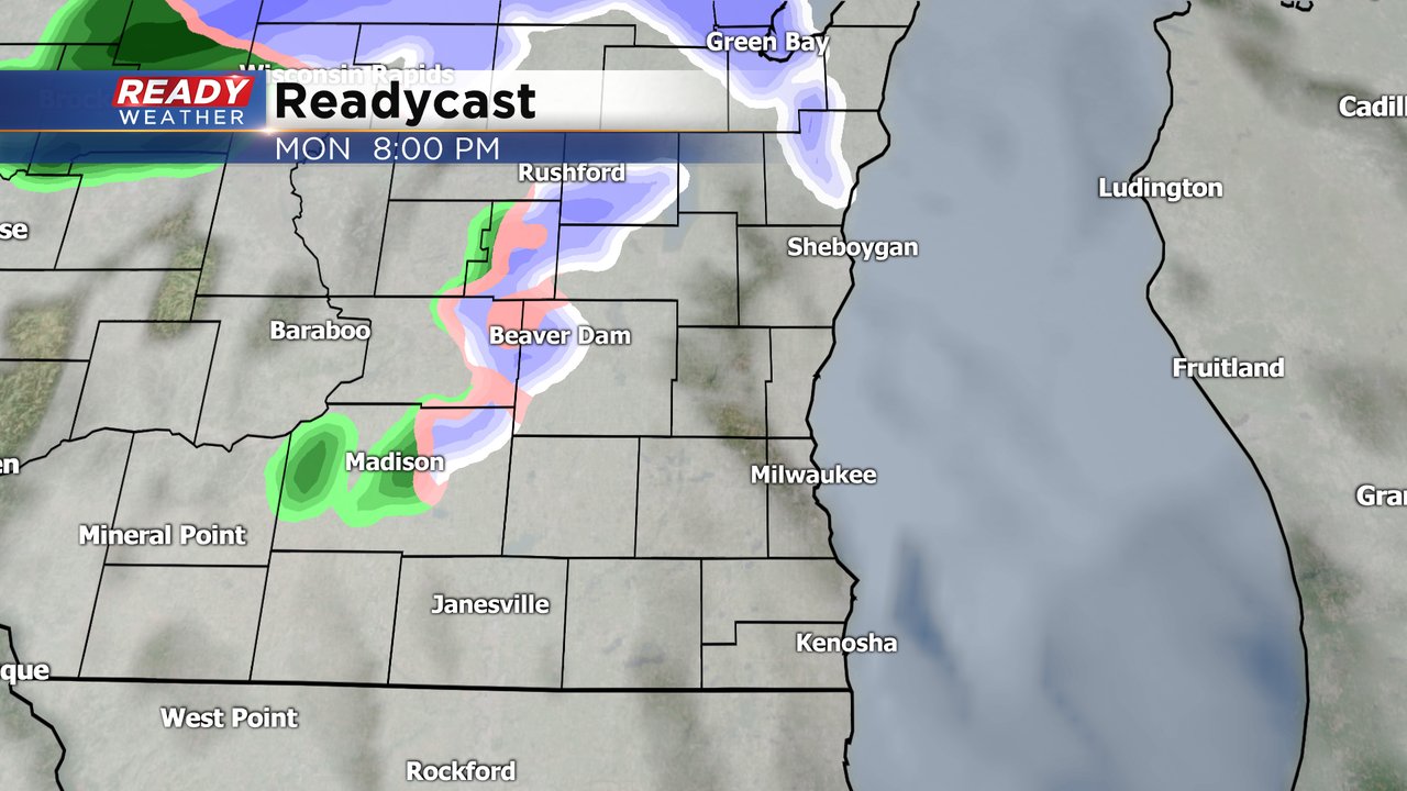
We have a couple of slight chances for some very light precipitation the next 48 hours. Two clippers will quickly move through our area to the north and could bring a little light wintry mix to our northern counties, especially north of I-94. Best timing for any wintry mix looks to be in the evening hours. A dusting to a half inch is not out of the question but snow accumulation does not look too likely.
Download the CBS 58 Ready Weather app to track any light mix Monday and Tuesday evening.