Another soaking rain Friday as fall-like temps arrive

-
4:57

An inside look at the DEA’s North Central Lab
-
2:28

Educators brace for uncertain future as Trump administration...
-
3:07

Former air traffic controller at MKE shares insight into D.C....
-
1:05

FDA-approved blood test detecting colon cancer hopes to increase...
-
1:00

Burlington police ID victim of fatal Menards parking lot crash
-
1:58

Police arrest person of interest after man found dead in Kenosha...
-
2:08

Amber Alert issued for pregnant teen missing out of Beaver Dam
-
2:19

’It’s unbelievable, we would never expect this’: Waukesha...
-
1:51

GOP immigration bill would require Milwaukee to help ICE or lose...
-
2:14

Arrowhead Union High School District could change inclusive language...
-
4:24

UW Health officer discusses heart disease, new FDA-approved painkiller
-
4:06

Previewing upcoming events in Racine County

A few rounds of rain are possible this weekend. We've already seen some light scattered showers Friday morning but a round of heavy rain is expected later Friday from 3 p.m. to midnight. Areas along and south of I-94 have the best chance to see the heaviest rain.
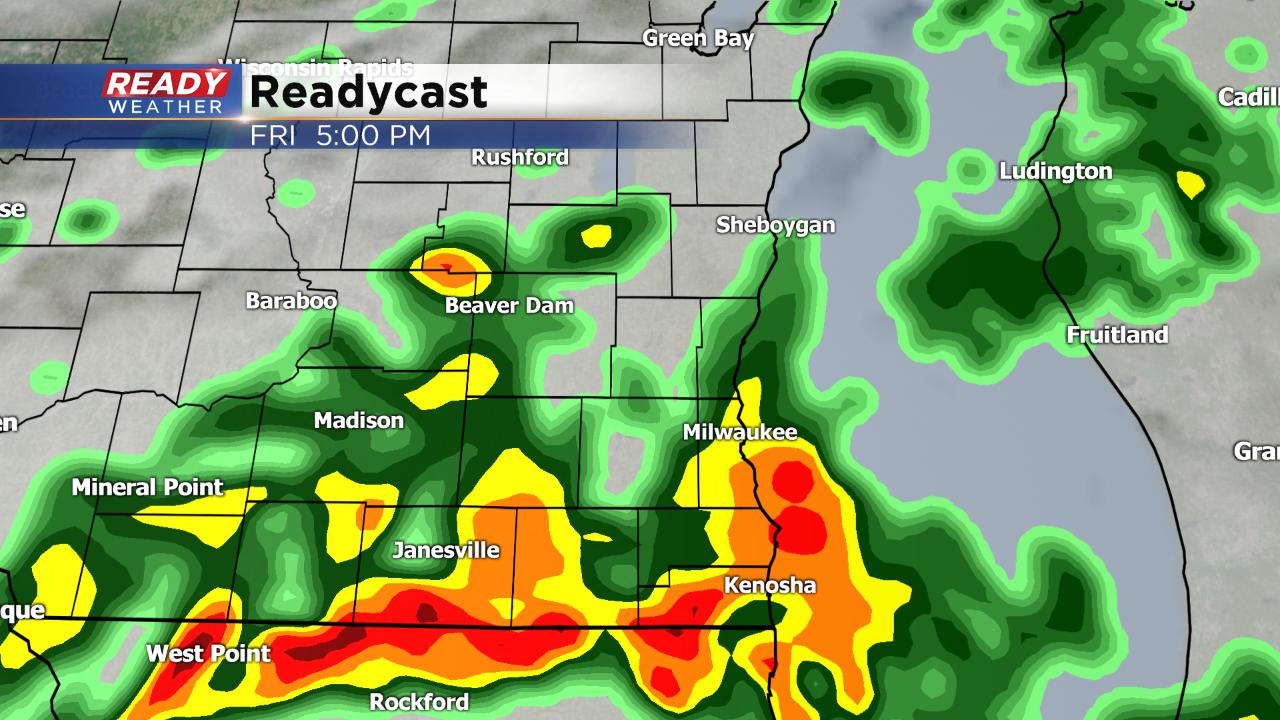
After a mostly dry week, the flooding concern is not super high, but we will be watching rivers as they are expected to rise with any additional rainfall. Up to 1.50" of rain will be possible with highest totals near the Wisconsin/Illinois border. Our northern counties will likely get less than a half inch.

Saturday looks to be a mainly dry day but cooler with highs only in the low 60s for most. Rain chances return on Tuesday, especially in the morning with another soaking rain for some.
September has been a very wet month. Before any of Friday's rain, 5.60" of precipitation has already fallen making it the 17th wettest September on record.
Download the CBS 58 Ready Weather app to track this weekend's rain.