Arctic air moves in tonight and lasts through Christmas


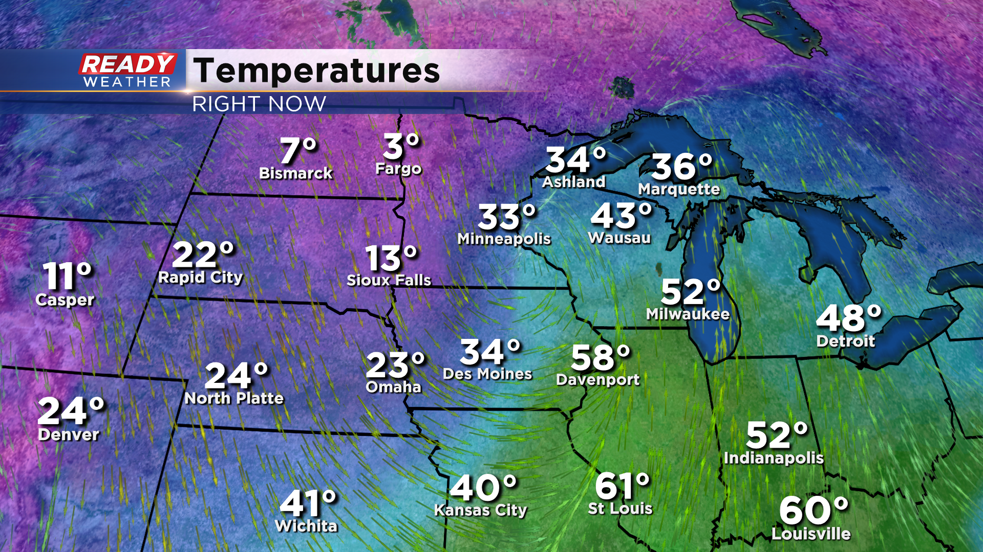
Temperatures are quite mild in the upper 40s to mid 50s across southeast Wisconsin here at midday, but a dose of reality is looming back to the west. We'll remain mild through the afternoon, but the cold will move in just in time for Christmas.
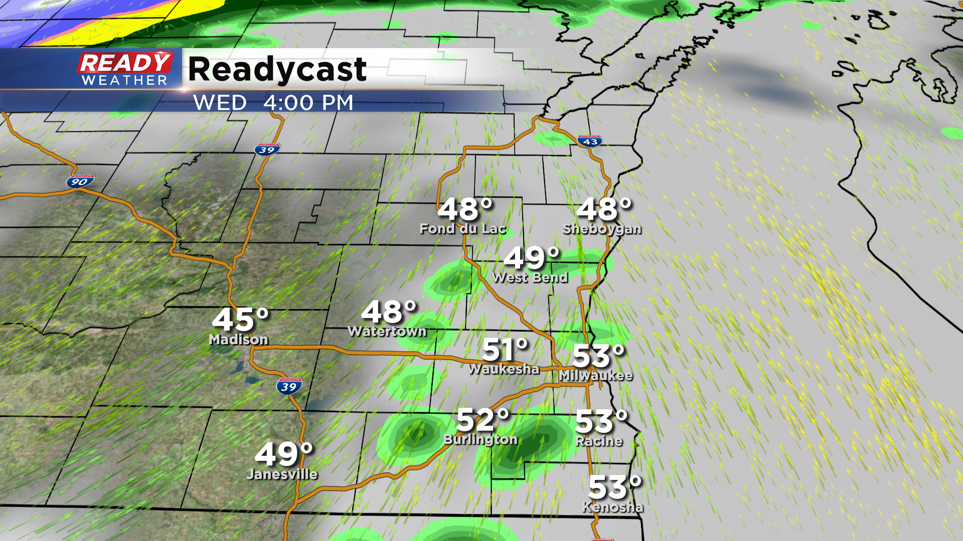
Before the cold arrives, we'll have another batch of light, scattered showers between 4-6 pm as the main low pressure system tracks from La Crosse into the UP.
Wind gusts of 30-40 mph will help the cold air rush in behind these light showers, with temps dropping below freezing by mid evening and into the teens overnight.
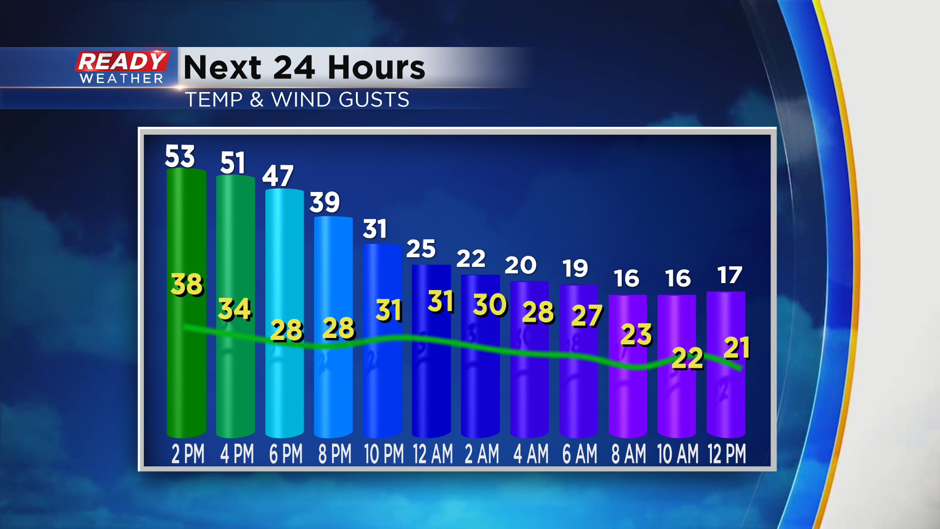
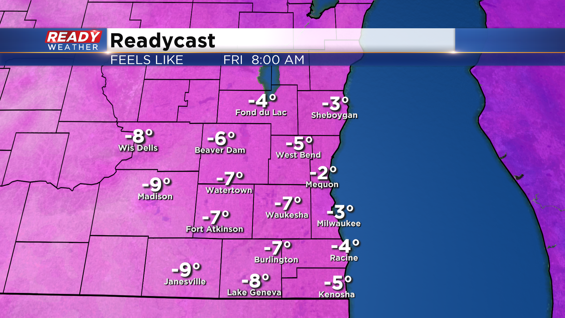
Temperatures won't get out of the teens on Christmas Eve, and with winds continuing to gust between 20-25 mph it'll feel like it's below zero all day. We can't rule out some flurries falling from the lingering clouds on Christmas Eve, but it won't be enough snow to give us a white Christmas.
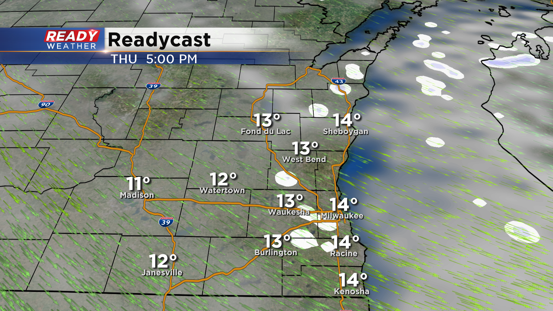
We'll still have a bit of a breeze on Christmas morning, so wind chills will be below zero once again during the morning hours, but should climb into the single digits above zero during the afternoon with more clouds than sun.
Temperatures will warm back to normal in the low 30s during the weekend with another chance for some light snow by the end of the weekend. Download the CBS 58 Ready Weather App to track the light afternoon showers.