Big blast of cold air on the way to end October with potentially the first snowflakes

-
5:30

A college degree in death investigation? Inside the final exam...
-
0:38

CBS 58’s Jessie Garcia launches debut novel at Boswell Books...
-
2:13

ICE detention facility coming to Milwaukee, immigrant groups...
-
1:58

Jeffrey Grob becomes 12th Archbishop of Milwaukee
-
0:51

Wisconsin’s photo ID requirement will be on the April ballot
-
3:29

What’s going to happen to TikTok if it’s banned? New apps...
-
2:04

Waukesha shelter set to reopen after broken sprinkler caused...
-
1:25

Milwaukee Bucks make wishes come true for 4 children undergoing...
-
1:40

Ski and tube into winter at Crystal Ridge Resort in Franklin
-
1:16

41-year-old man killed during argument in targeted hit-and-run...
-
2:30

Gov. Evers creates statewide office of violence prevention
-
4:27

Milwaukee Chamber Theatre previews adaptation of ’A Doll’s...

Highs soared close to 60° on Wednesday thanks to a little extra sunshine. Hopefully you enjoyed it because that will likely be our lat time above average over the next two weeks as our first blast of real chilly air arrives.
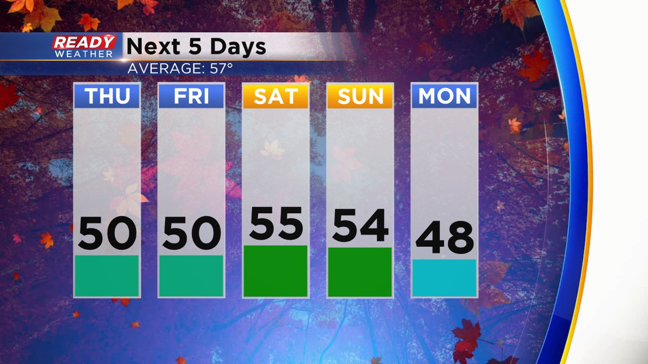
High temps the next five days aren't super cold but definitely below-average in the low to middle 50s.
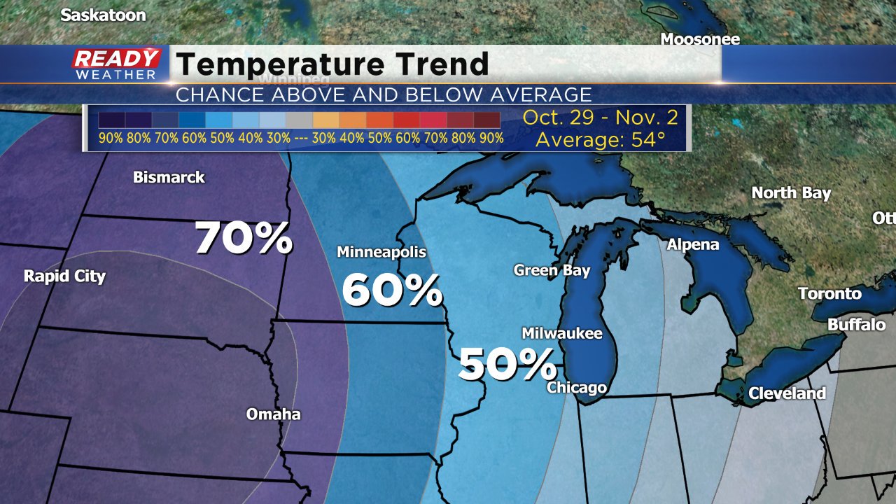
The end of October is really when the blast of cold air arrives. Highs are looking closer to 40° rather than the mid-50s average is. Most of Wisconsin has a 50-60% chance of below-average temps for the last couple days of October and first days of November. Halloween looks to be the coldest. The Ready Weather 10-day currently has a Halloween high of 42° with lows around 30°.
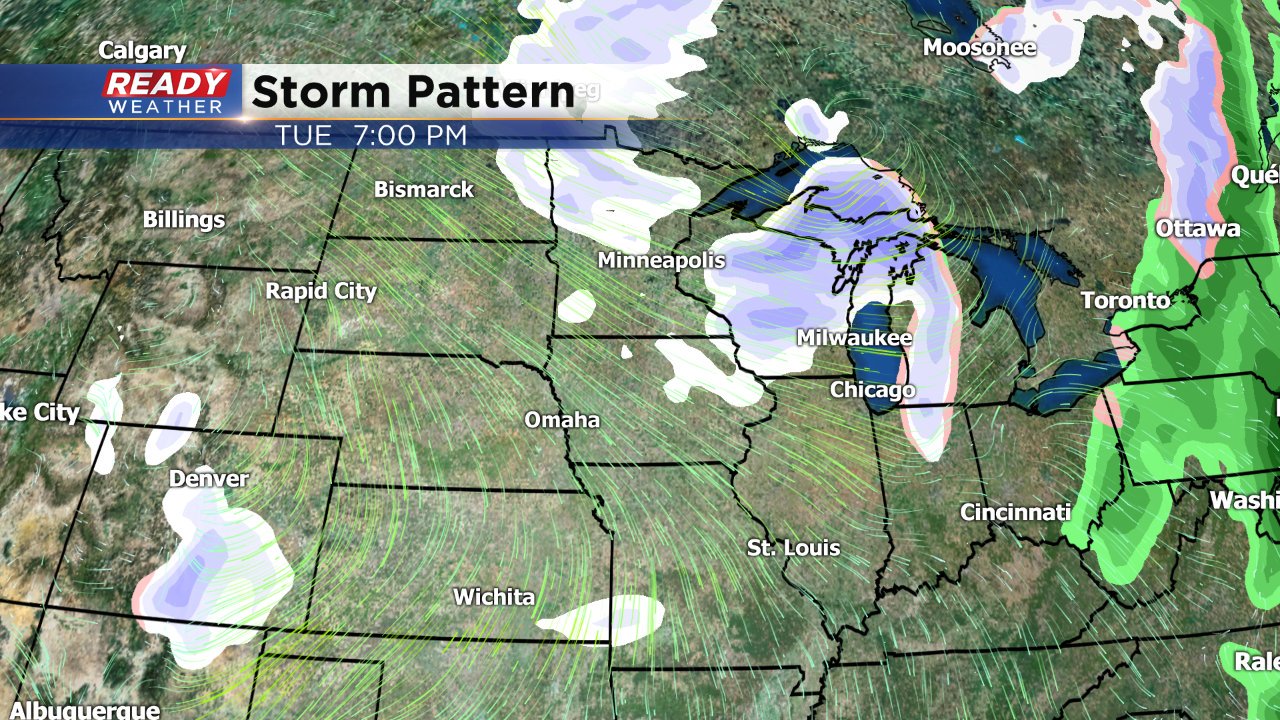
With all the cold air comes our first real shot at some wintry weather. Rain changing to snow is in the forecast for Tuesday. It's actually right on track with average for our first snowflakes which are typically seen on October 28. Our average measureable snow is the middle of November.
Download the CBS 58 Ready Weather app to see the full 10-day forecast.