


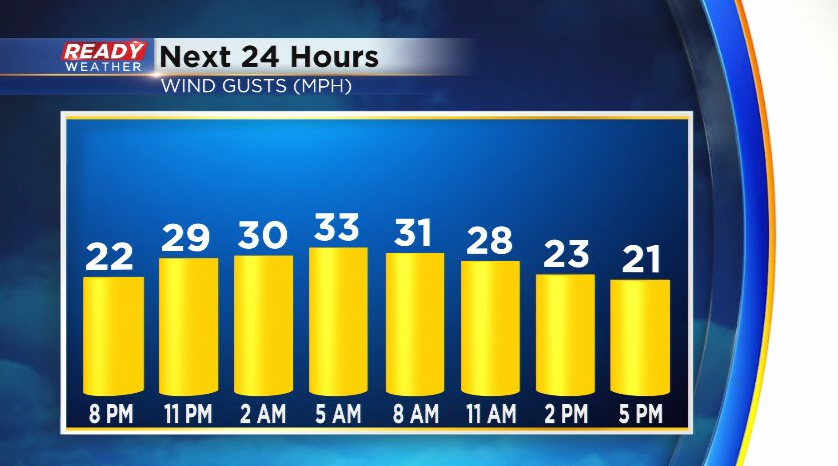
The rain and snow showers have moved out of the state, but a batch of clouds will linger into tonight as the upper level low slowly pulls away. A gusty northwest wind will return tonight and continue throughout Sunday. The strongest gusts of 30-35 mph are expected in the morning, gradually tapering off by sunset.
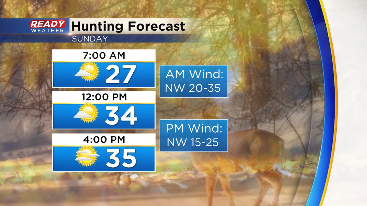
The gusty winds and clouds will keep temps in the mid to upper 20s tonight, but once you factor in the wind it'll feel like the teens in the morning and low to mid 20s in the afternoon. Dress warm if you're heading out for the last day of the gun deer season!
Some sunshine will mix with the clouds on Sunday, but mostly cloudy skies return Sunday night into Monday ahead of another quick moving system. This looks to bring a band of wet snow across the area mid to late morning, quickly moving east by early afternoon.
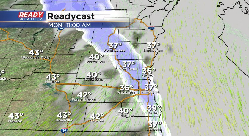
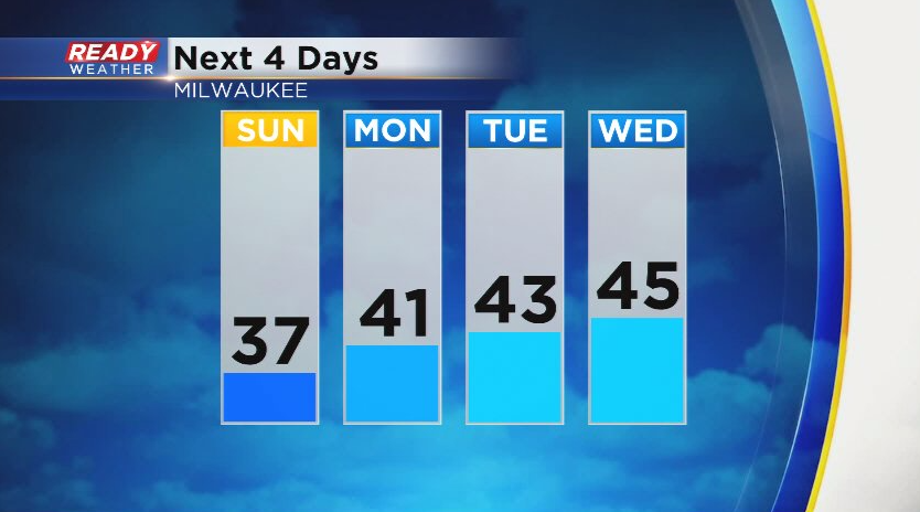
Primary impact with this band of snow will be reduced visibility and wet/slushy roads, but any slush that accumulates on the grass will likely melt in the afternoon as temps rise into the upper 30s to low 40s. Temps warm back into the low to mid 40s for a good chunk of the upcoming work week with another small chance of showers on Wednesday.
Download the CBS 58 Ready Weather App to track the snow chances.