9 am Update: Wet snow starting to mix with rain this morning


Updated: Sunday October 18th 9:05 am:
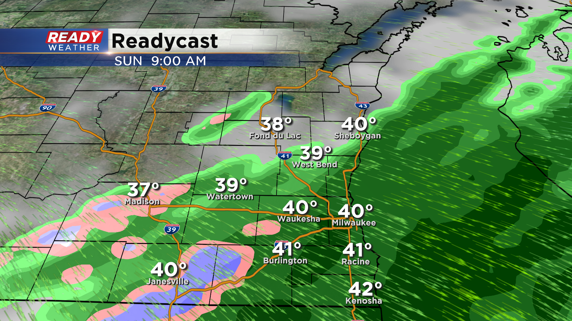
Cold air filtering into southern Wisconsin is causing some rain to mix with/change over to wet snow on the back edge of this system. Visibility may be reduced if any spots completely change over to snow for a brief period of time, but no accumulation is expected.
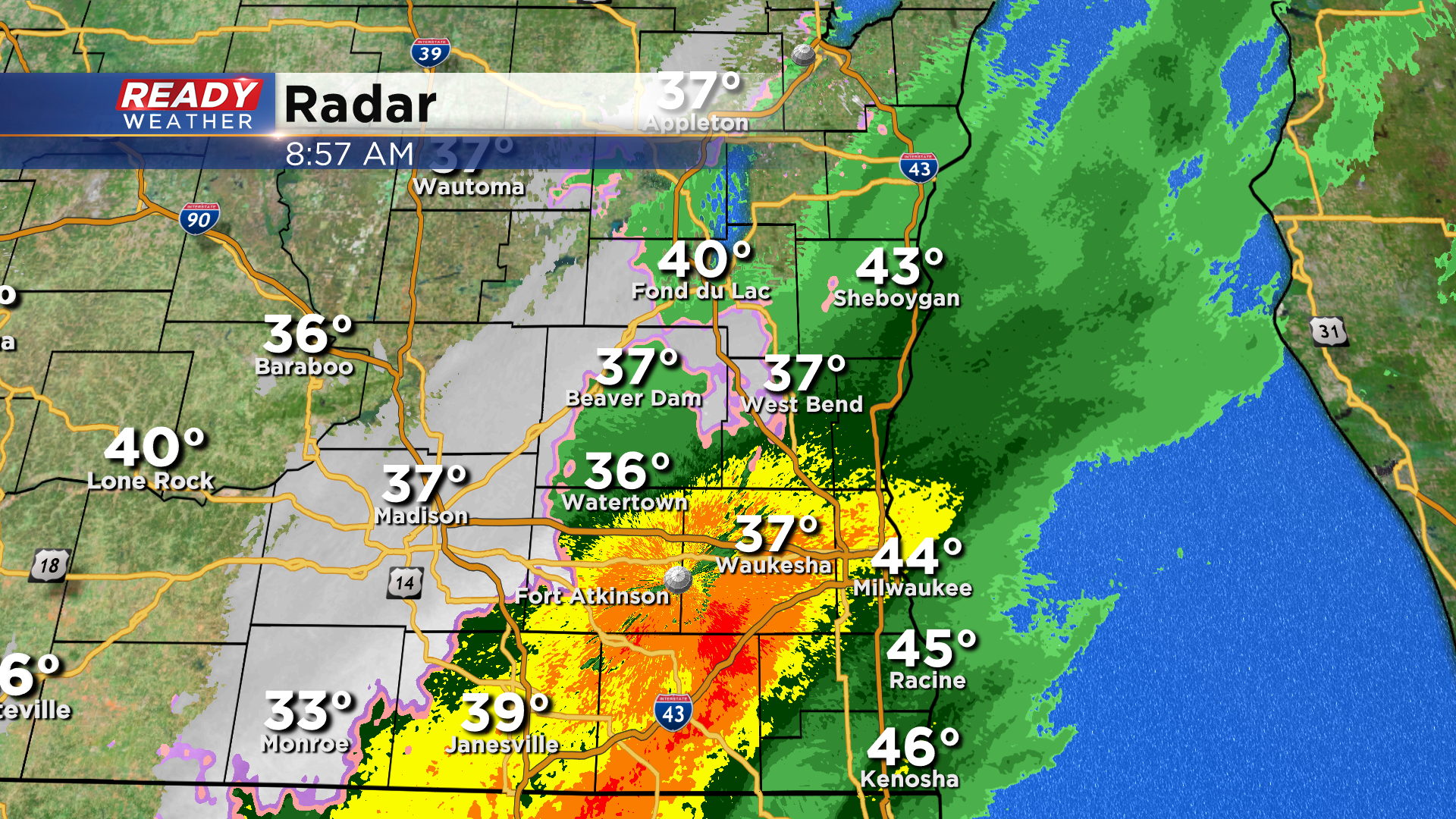
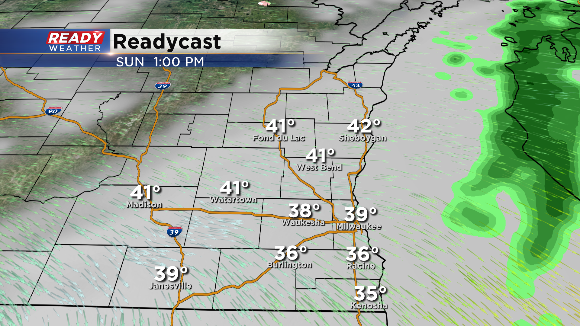
Most of the area will dry out by midday, but a few showers may linger into the early afternoon in the Kenosha/Racine area. It'll remain chilly this afternoon with temps only rebounding into the low to mid 40s after falling into the 30s late this morning.
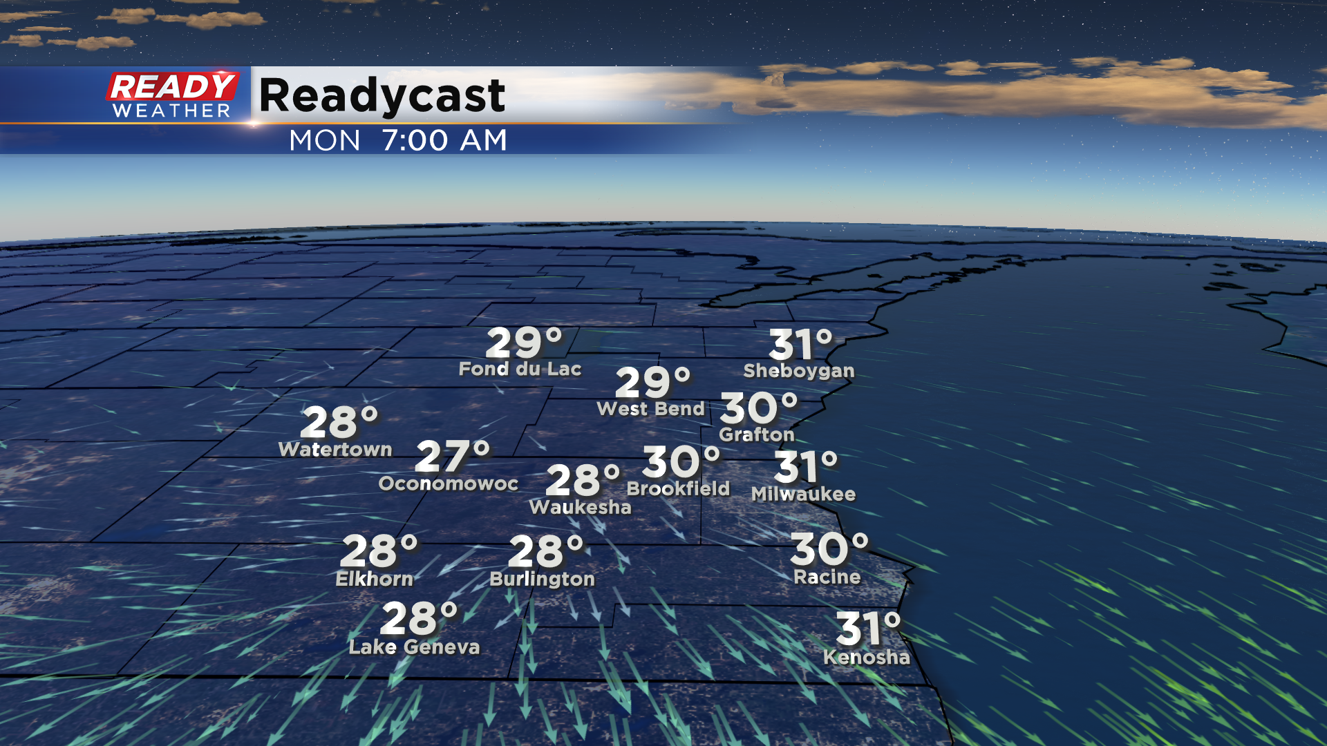
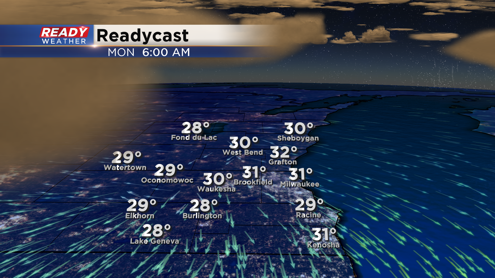
Clouds will gradually decrease this afternoon behind the wintry mix and will be mostly clear during the night tonight. This, combined with calm winds, will allow temps to drop into the mid 20s to low 30s with a widespread freeze expected.
Download the CBS 58 Ready Weather App to track the wintry mix.
------------------------------------------------------------------------------------
It's been a windy fall day across southeast Wisconsin with most of the area experiencing wind gusts between 35-45 mph this afternoon. The strongest gust of the day occurred in Kenosha at 48 mph!
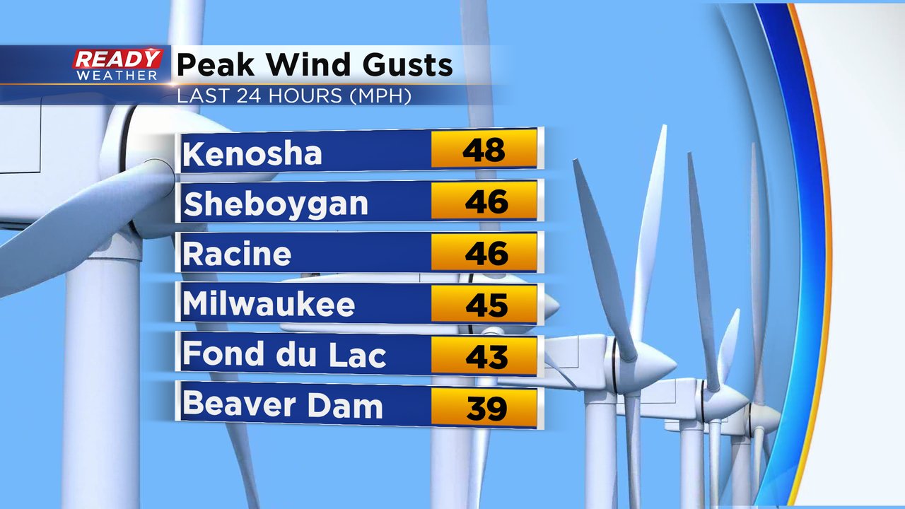
The strong gusts over 40 mph will subside this evening, but the gusty winds won't completely lighten up until a cold front starts to move through overnight. That front is currently generating a band of light rain from northern Wisconsin into southern Minnesota.
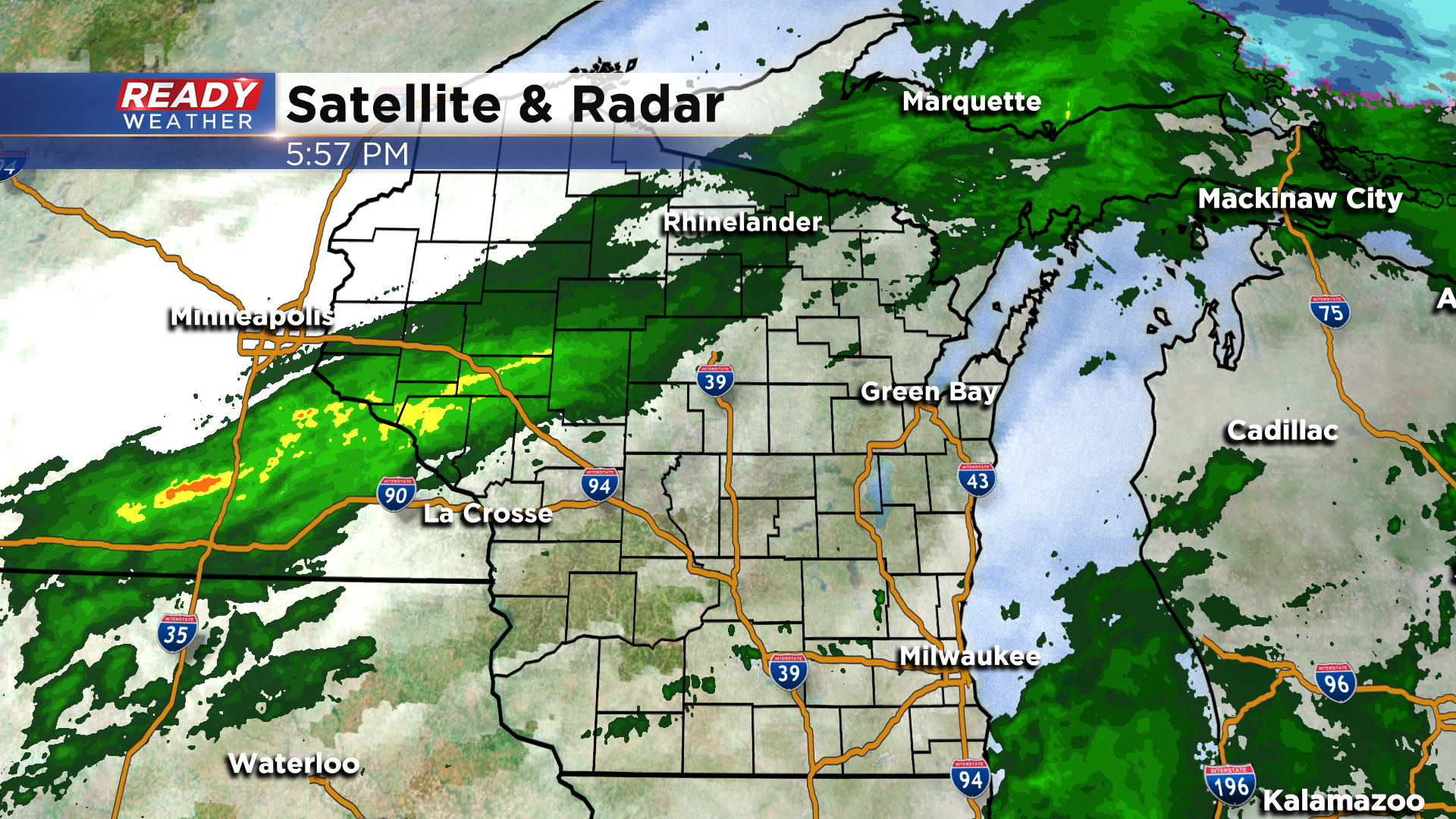
This band of rain will slowly move across the state tonight into Sunday morning. Light showers will start to move into our northwest counties after midnight.
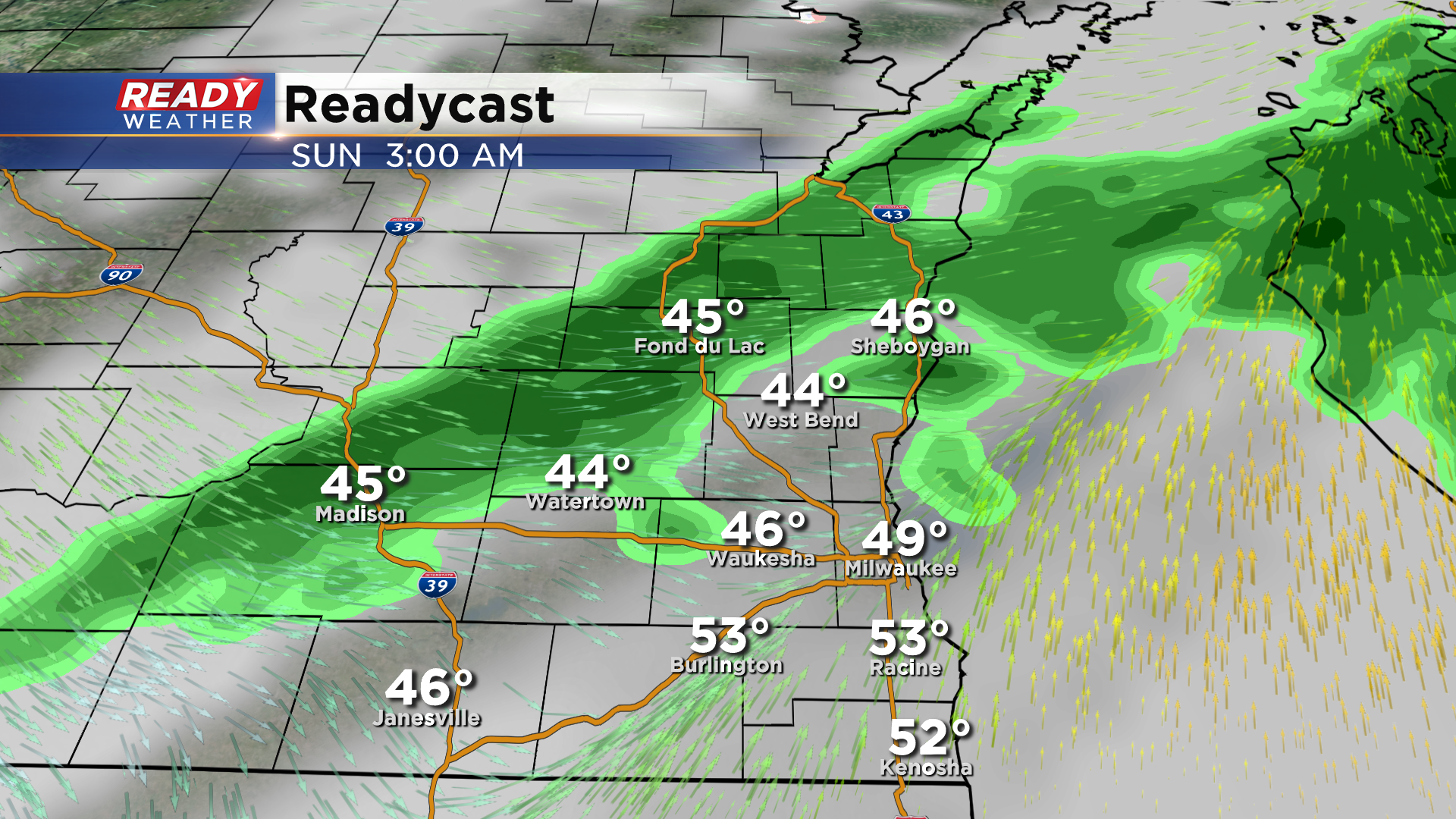
This light rain looks to continue through daybreak, tapering off between mid to late morning. The showers will linger the longest in far SE Wisconsin. Cold, dry air will be rushing in behind these showers, so we can't rule out some wet snow mixing in with the rain between 8-11 am as it exits the area.
Clouds decrease Sunday afternoon and will remain clear to partly cloudy Sunday night. Winds will turn calm and allow temps to plummet into the mid 20s to low 30s. A widespread freeze is expected for all of southeast Wisconsin.
Cooler temps will linger to start the week, but will start to rebound back into the mid 50s by Wednesday and low 60s on Thursday.
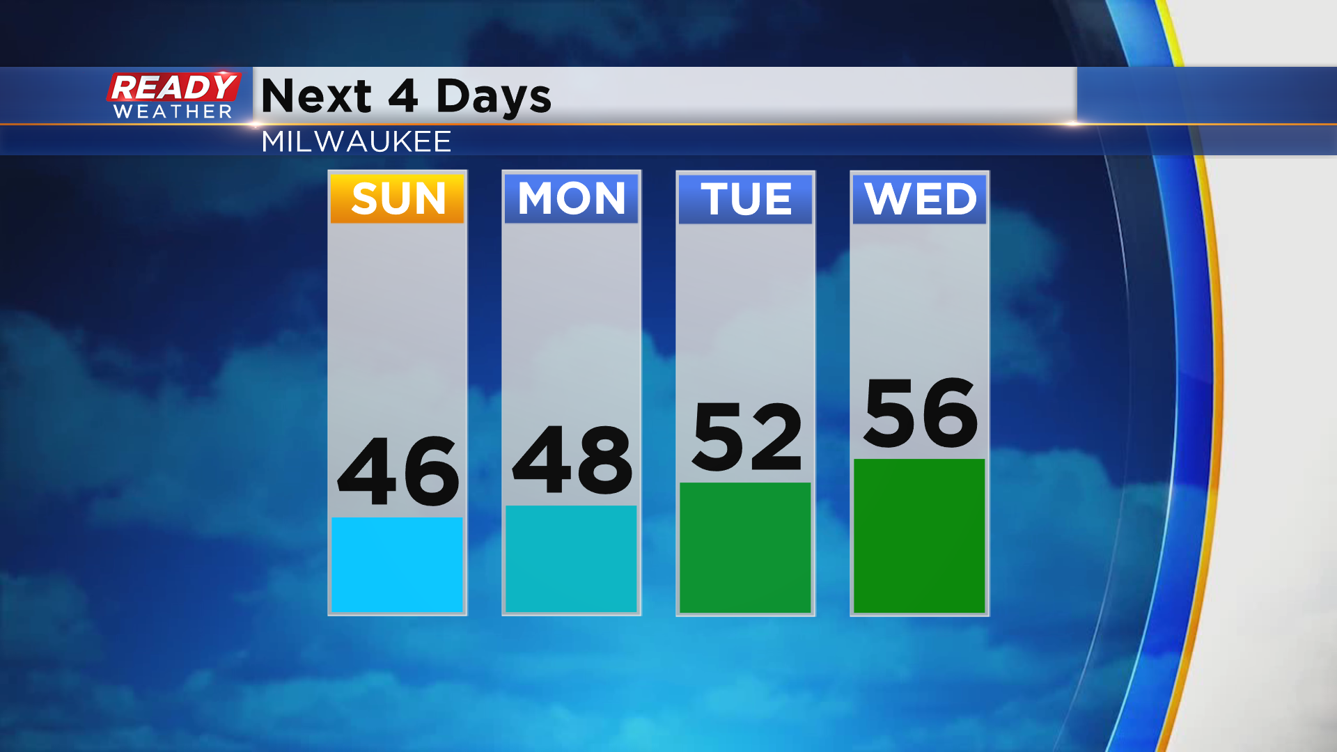
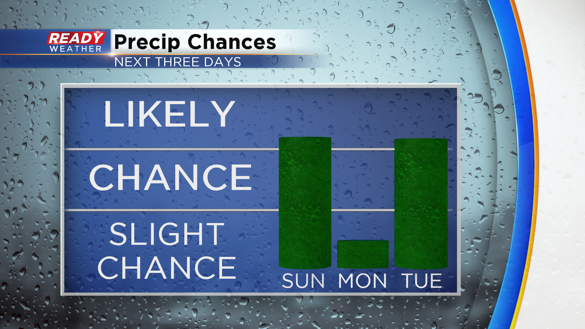
We'll remain in an active weather pattern throughout this week with multiple chances for showers, but no day looks to be a washout. There's a slight chance for showers later Monday evening in the southern half of the area, and temps may be cool enough for some wet snow to mix in, but the better chance for rain will be to the south in Illinois. Another round of rain is possible later Tuesday afternoon and evening.
We'll dry out on Wednesday, but a strong system will drag rain back into the area Wednesday night and possible generate some storms later Thursday. Cooler air moves in behind that system. Download the CBS 58 Ready Weather app to see the temperature trend heading into next weekend.