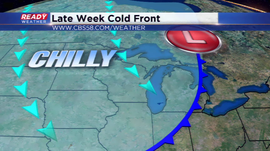
Cold front could bring the first frost of the season
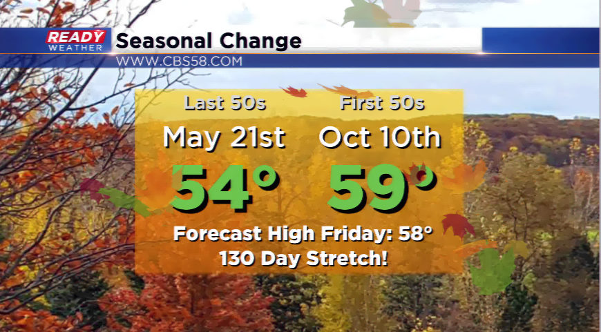
We have been spoiled this month with 17 of the 26 days registering an above average temperature in September. This will come to an end after today’s temps and milder air. We could reach a high of around 70 on your Thursday, and then the cool air begins to move in.
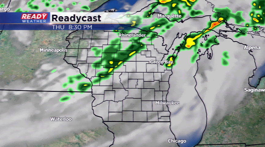
A cold front is expected to kick up spotty showers today, especially this evening around the region. Some of these could linger into early tomorrow morning. The front will power out of the area by daybreak and lagging clouds will be possible. You will notice the different with much cooler air rolling in.
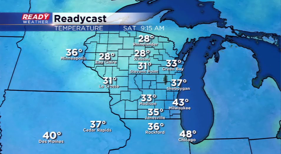
All attention sits with the possibility of frost for the first time this season for parts of the viewing area. The best chances of frost will be outside the city and in the rural locations. Overnight lows in northern Wisconsin could fall into the 20s. It’s looking like the best setup for frost statewide of the early fall season.
The chilly air will be short-lived. Highs will remain cooler than average on Saturday with 50s likely; daytime temps drive back into the 70s for next week.