Continued heat gives way to severe storms this weekend


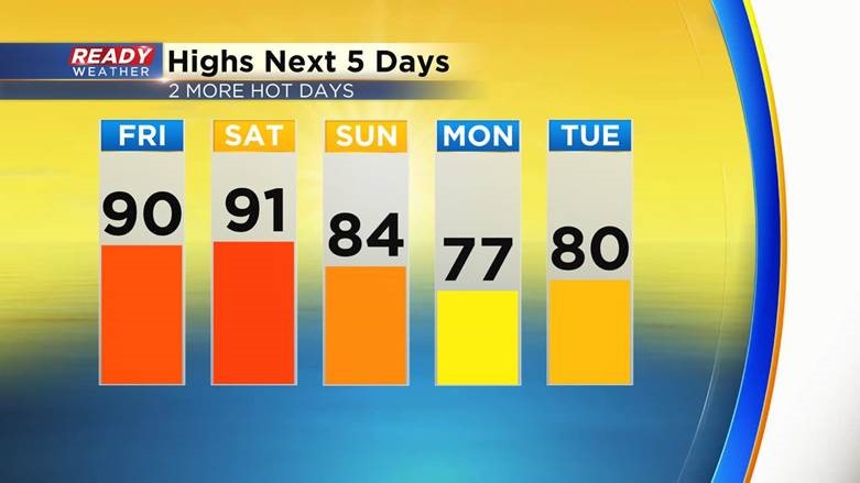
WISCONSIN (CBS 58) -- The heat from this week is not going anywhere as we kick off the weekend. High temperatures both Friday and Saturday will reach 90* once again. Sunday is still pretty warm in the 80s, then we drop slightly below-average for the new work week. The humidity will be a little lower Friday with peak dew points in the low 60s, but that humidity returns in force for Saturday and stays high through the first half of Sunday.
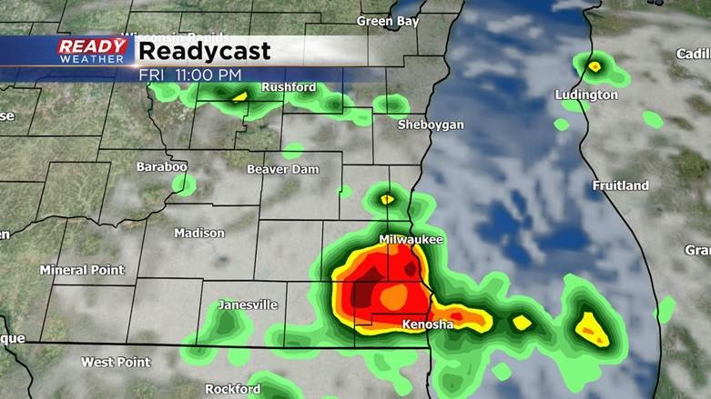
All of the heat and humidity will give way to a few chances for storms the next 48 hours. The first round will be possible after sunset Friday evening with a few stronger thunderstorms possible along and south of I-94. It is a possibility these storms stay just south of the border. All of southeast Wisconsin is in the Level 1 Marginal Risk Friday night for any storms that do form, bringing with it a chance for gusty wind and small hail.
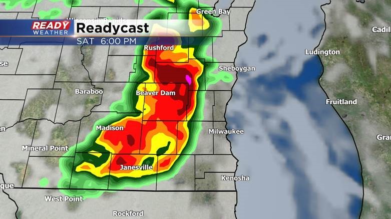
Most of Saturday morning and afternoon will be dry, but Saturday evening will bring in the best chance for storms and severe weather. There's a bullseye in central and western Wisconsin where a Level 3 Enhanced Risk has been put in place. A cluster or line of storms will likely form here and move east.
As that line of storms moves across the state it will likely weaken a bit, but there's still a good chance for strong to severe storms locally, especially in our western and northern counties that are under the Level 2 Slight Risk for severe weather. Damaging wind is the main threat along with some hail and heavy downpours that could bring in some quick flooding. The tornado threat is low but not zero.
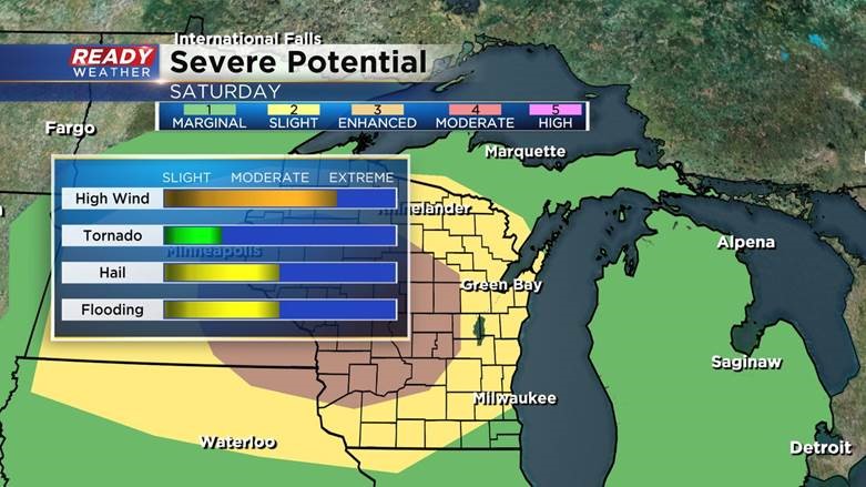
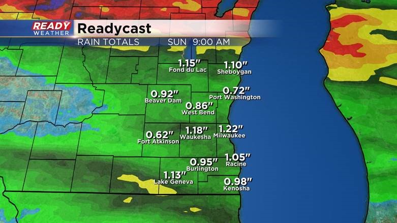
A good chunk of heavy rain will be possible, with many areas 0.50-1.00" of good rainfall. Those that see some decent thunderstorms could even get 1-2" of new rain.
Download the CBS 58 Ready Weather app to track the storms and get alerts if watches or warnings are issued.