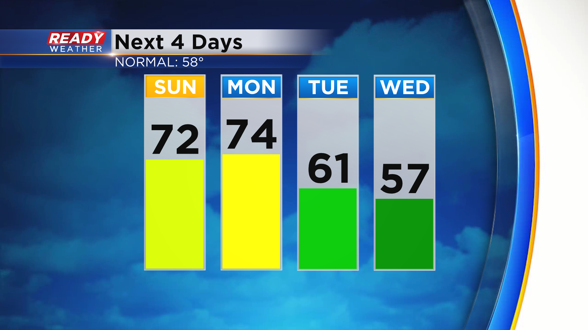
Couple more days in the 70s before a cold front arrives


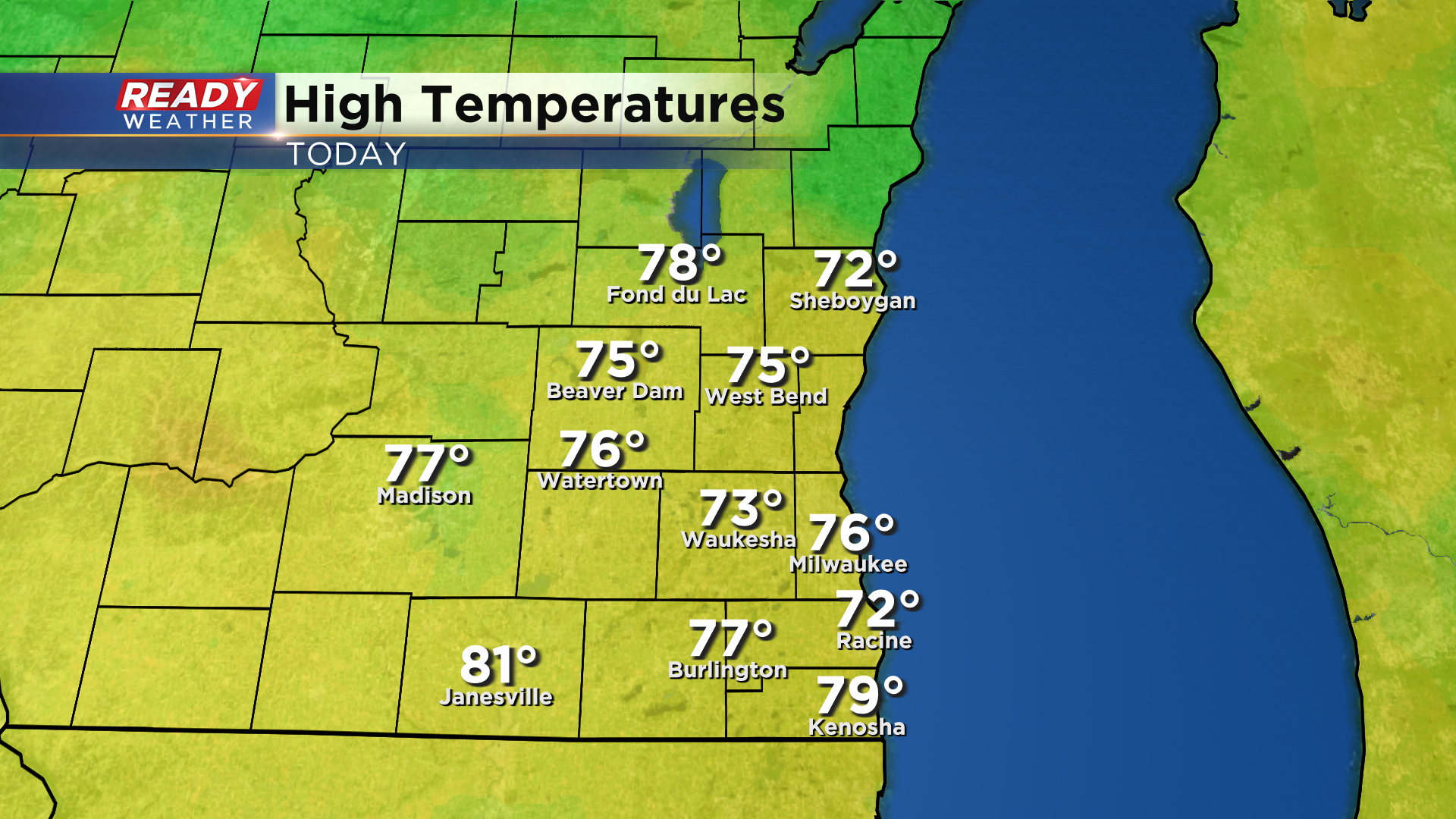
It's been another spectacular day across southeast Wisconsin with abundant sunshine and temps climbing well into the 70s once again!
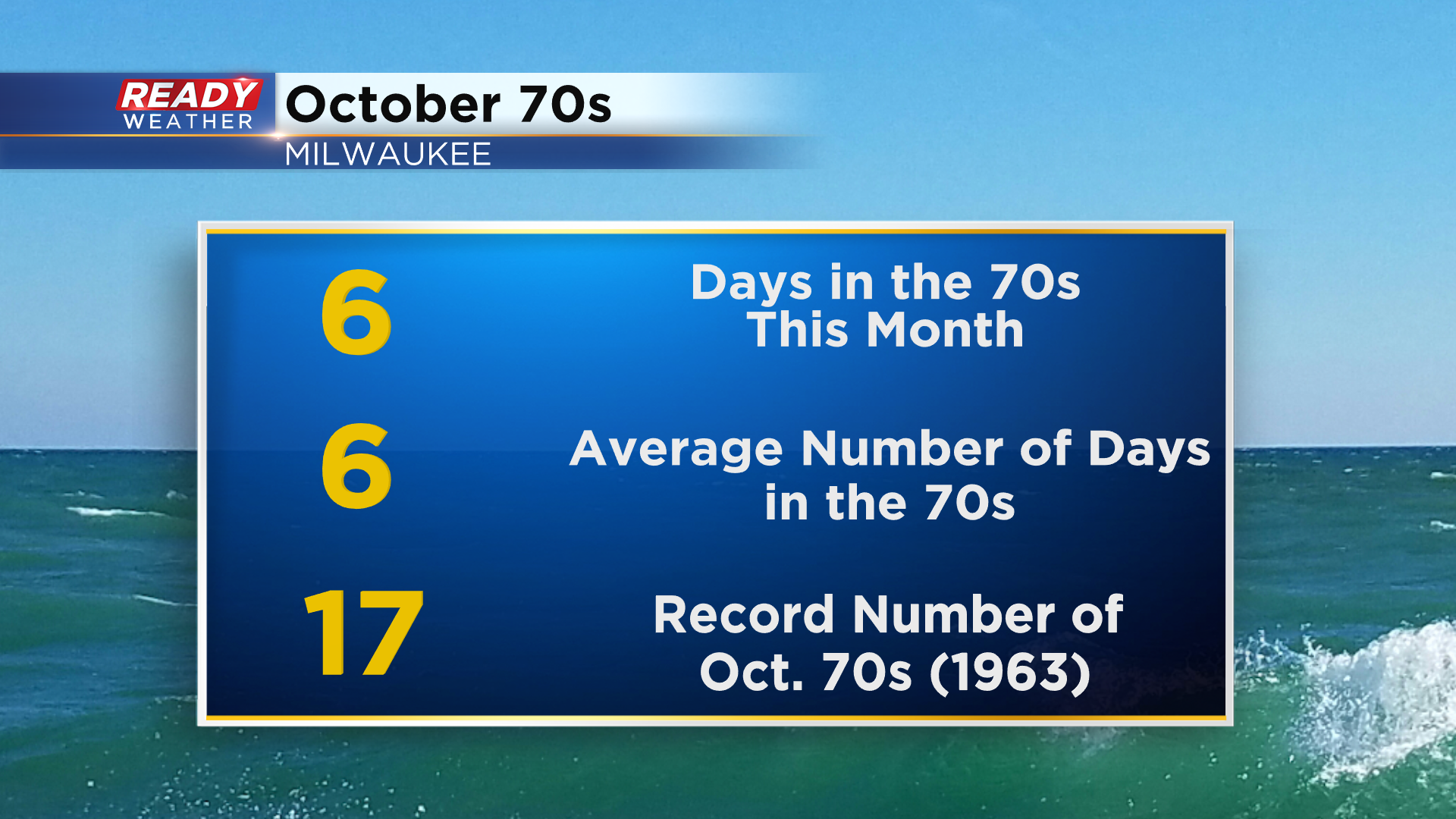
Today was Milwaukee's 6th day in the 70s this month, which is normal for October.
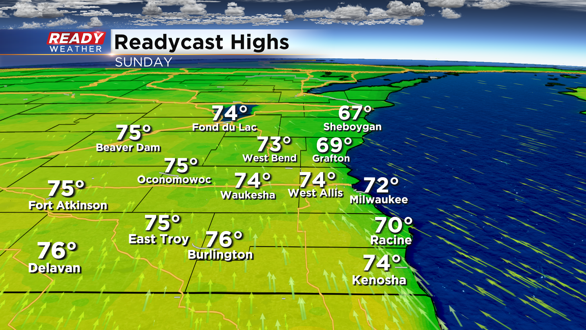
We'll warm into the 70s again on Sunday, but with a blustery SE wind at 15-30 mph highs will only top out near 70° lakeside with mid 70s expected inland.
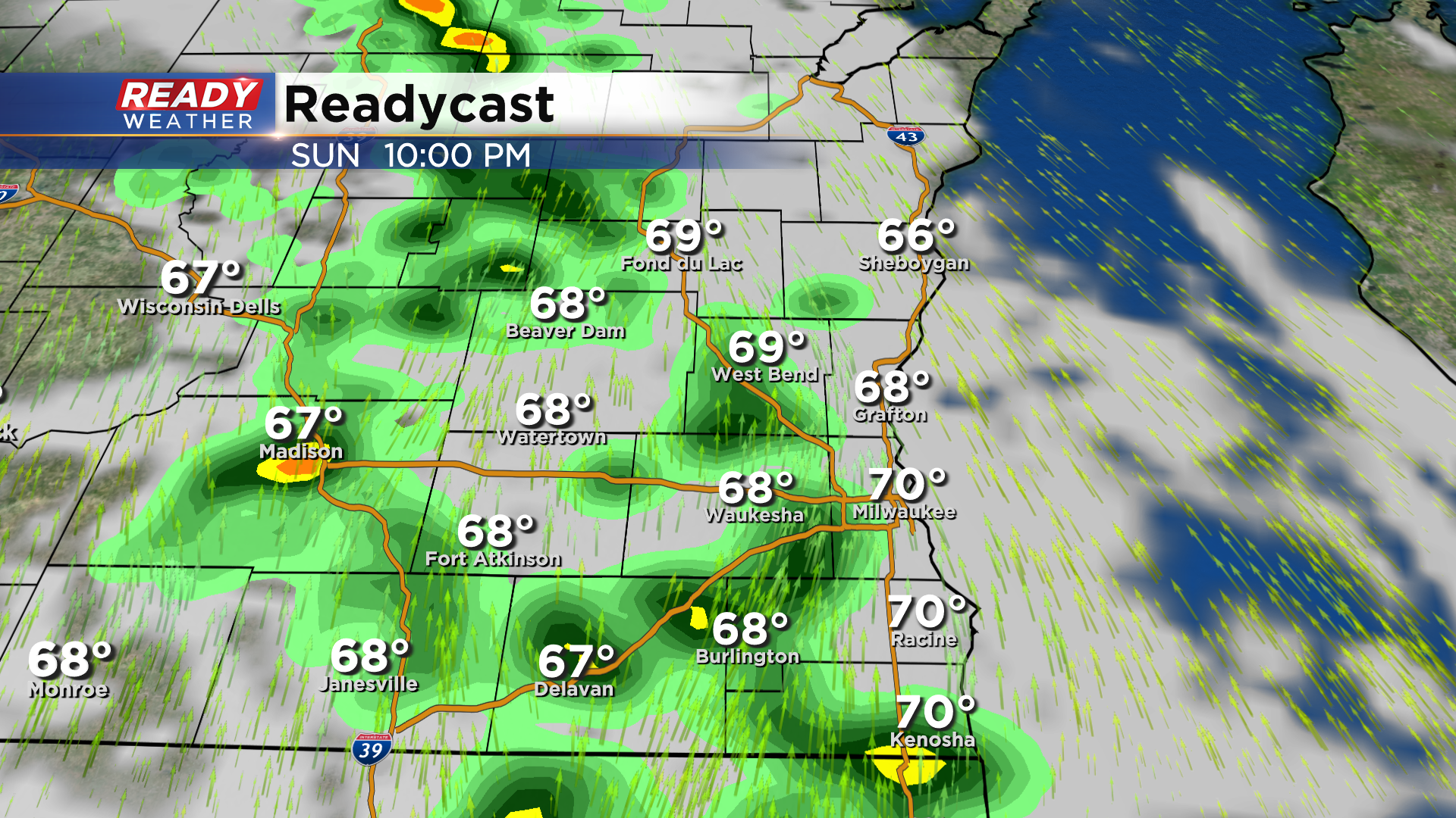
Mostly sunny skies are expected most of Sunday, but more clouds start to roll in late afternoon. Dry weather will continue through the daylight hours, but a round of scattered showers and isolated storms will develop mid to late evening Sunday.
The showers largely exit by sunrise Monday morning, but an isolated shower or two may linger through the morning commute. A few peeks of sunshine look to develop on Monday, which combined with a strong southerly wind, should help temps warm into at least the low 70s. Clouds thicken back up later in the day as a slow moving cold front approaches, bringing another round of rain into the area Monday night into early Tuesday.
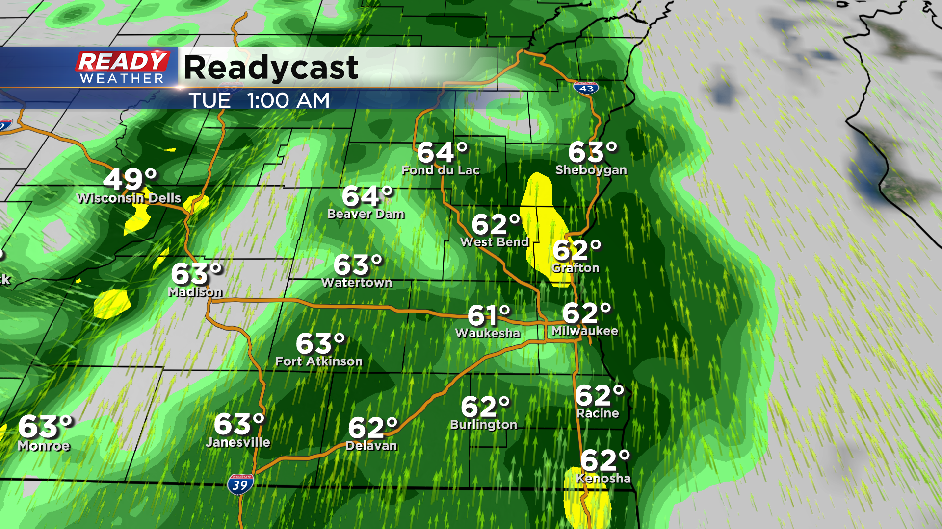
There's some uncertainty where the cold front will stall out, so there is a chance for another round of showers later Tuesday afternoon into Tuesday night as a low pressure system tracks to our south. The farther SE you are in the state, the better chance you have at seeing this last round of showers.
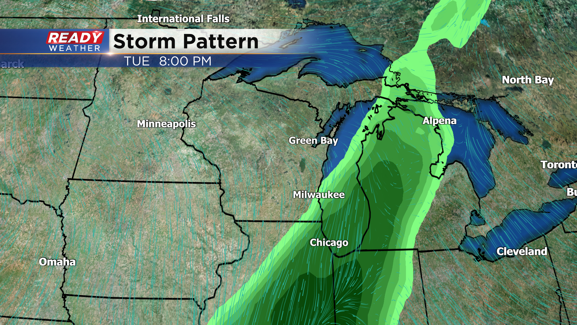
Temperatures cool down closer to normal for this time of year behind the cold front with highs generally in the 50s for the rest of the week.
Download the CBS 58 Ready Weather App to track the rounds of rain.