Couple of light precip. chances to end the year while temps remain above normal


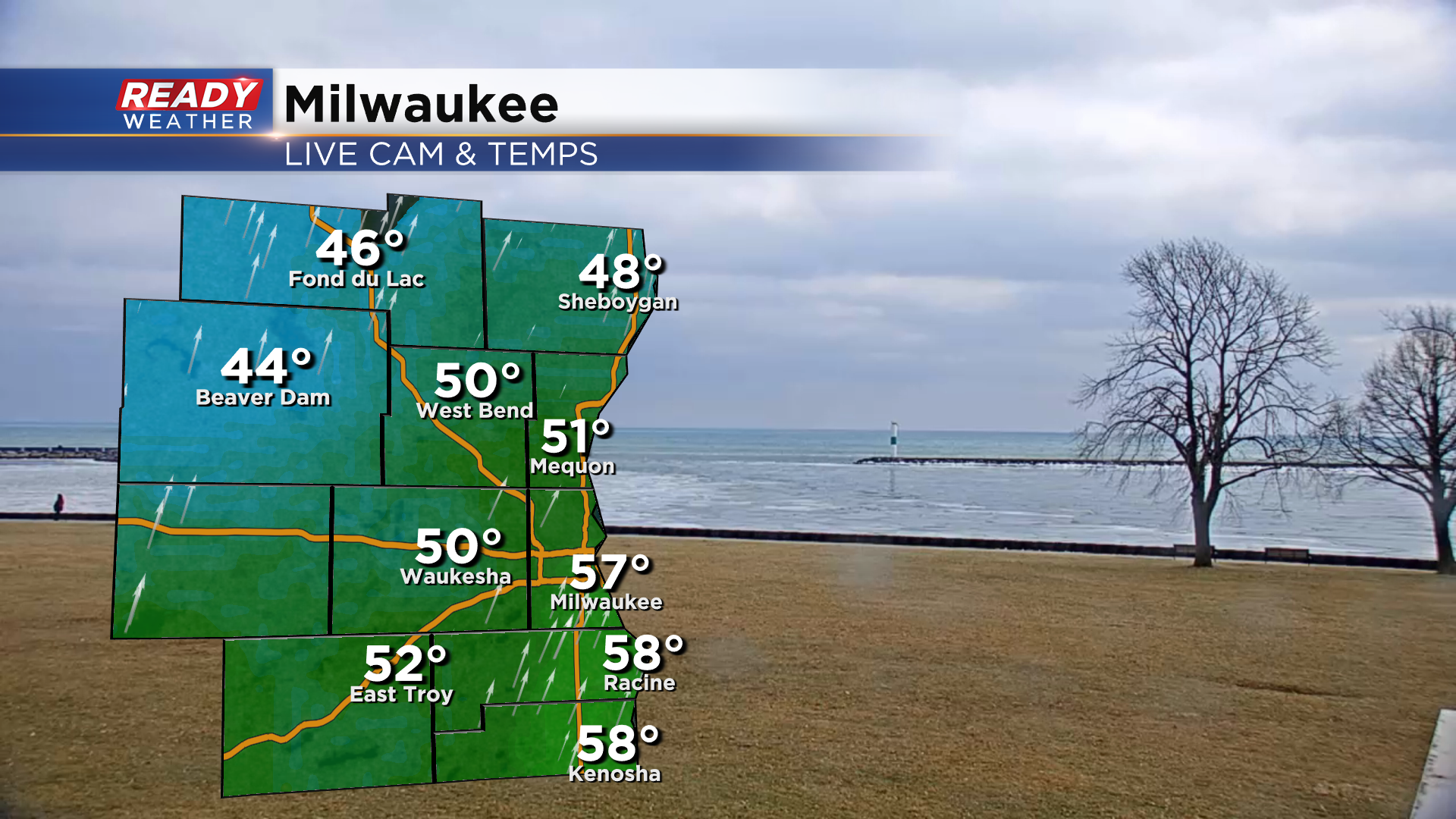
What a difference a week makes! Temps have warmed well into the 50s for many folks as of 11 am and will rise another couple degrees as we head through the day.
Drizzle has been slow to form so far today, but patchy drizzle is expected to develop by mid to late afternoon with spotty, very light showers this evening before a cold front moves through tonight.
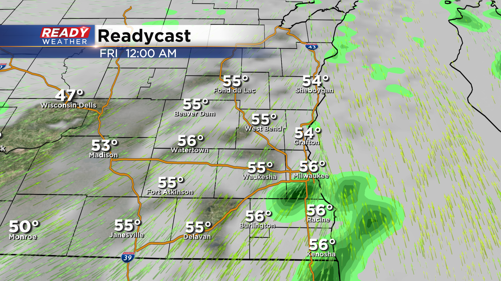
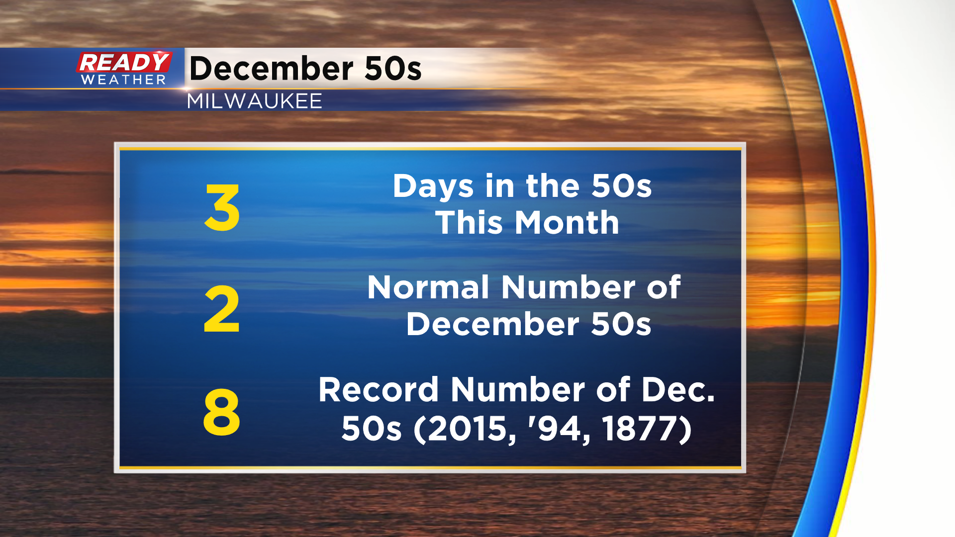
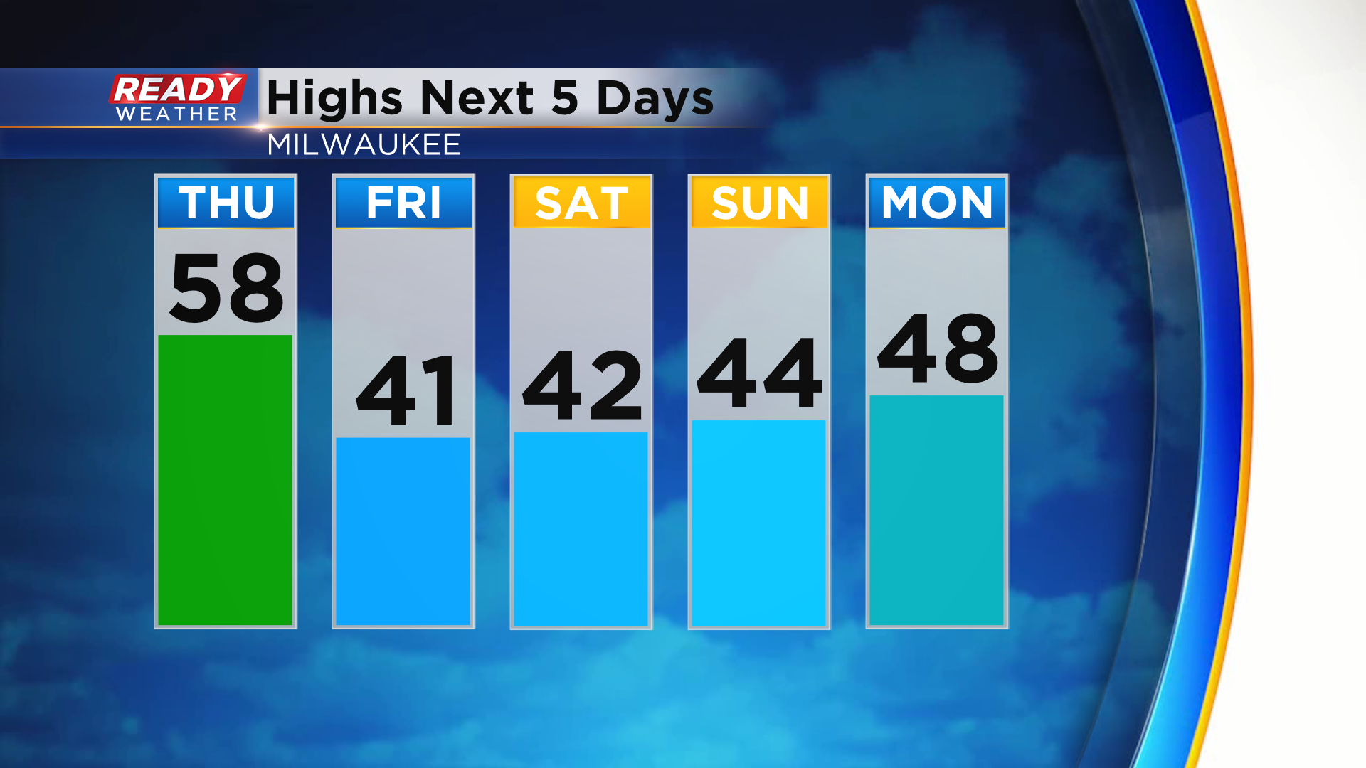
Temps will remain in the 50s until the cold front moves through overnight, so our high temperature for Friday will likely occur shortly after midnight with temps sitting in the 30s to low 40s the rest of the day. With that scenario expected, we could notch our 4th day in the 50s this December early Friday morning, which would be double what's average for December.
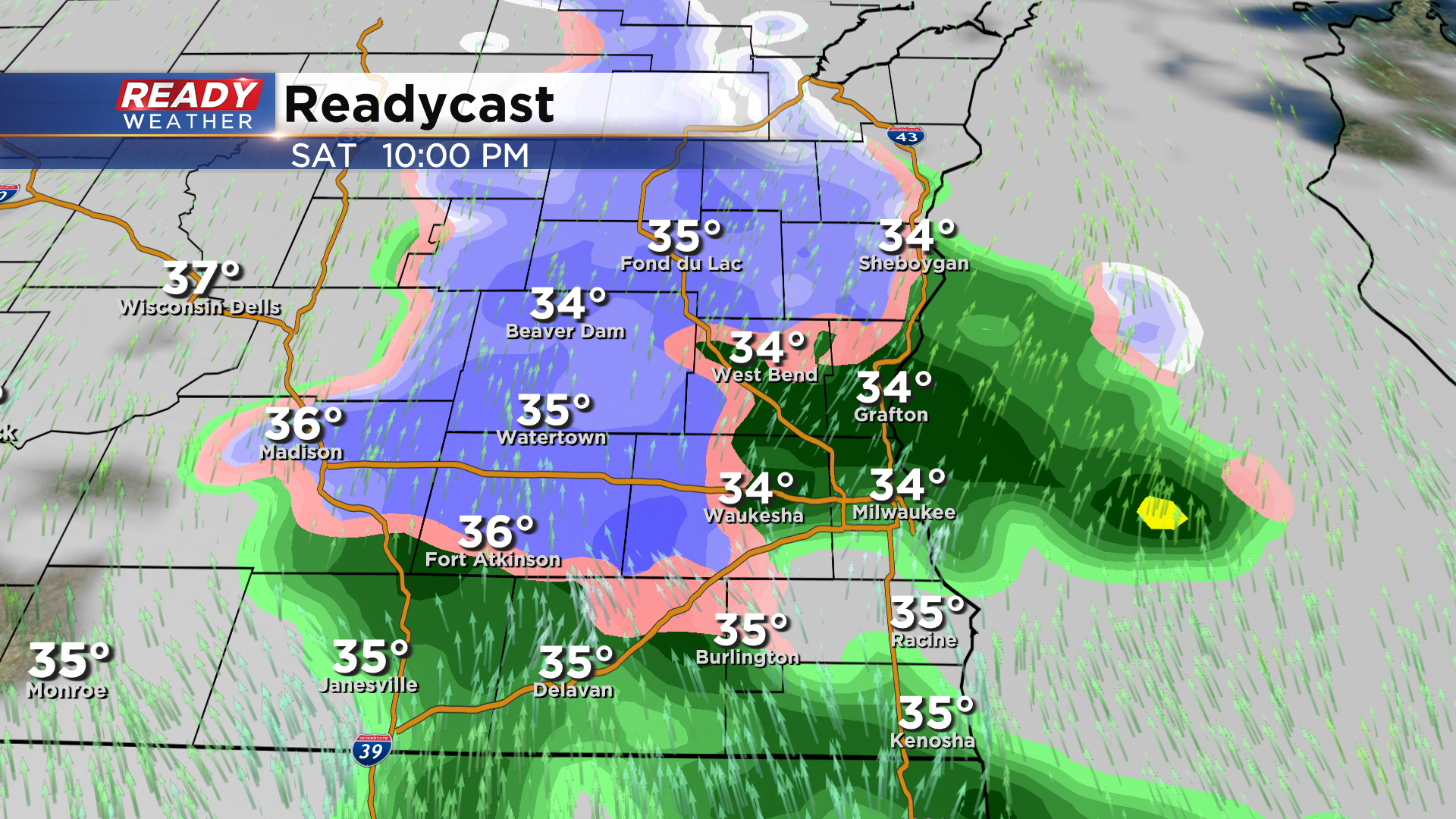
Dry weather returns most of Friday and Saturday, but a light wintry mix of rain and snow is possible Saturday evening into Saturday night. This could make roads slippery in spots, especially inland, so drive with caution New Year's Eve night!
New Year's weekend features temps in the low to mid 40s, but mid to upper 40s return on Monday as a stronger low pressure system closes in on Wisconsin. The strong southerly wind is expected to warm temps back into the low 50s on Tuesday before the cold front moves through.
Steady rain is expected late Monday into early Tuesday, and we could even hear some thunder! Download the CBS 58 Ready Weather App for the full forecast.