Afternoon Update: Storms have exited the area for now but more are brewing to our west and headed this way


Updated: 1:45 p.m. Aug. 27, 2024
We are getting a temporary break from the heat as a line of severe storms blew across the area. It remains humid and while we have clouds overhead, the clearing line in already pushing back into western locations. Just west of that, additional storms are firing, and all this activity is heading this way.

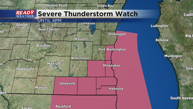
Updated: 12:30 p.m. Aug. 27, 2024
A severe line of storms continues to sweep west to east across the viewing area. In addition to the warnings, The National Weather Service has issued a Severe Thunderstorm Watch until 4pm to cover this line moving through. They will also trigger downstream warnings as necessary.
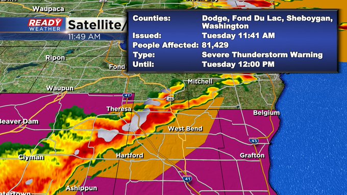
Updated: 11:45 a.m. Aug. 27, 2024
Several counties are under Severe Thunderstorm Warnings as of now. Take a look:

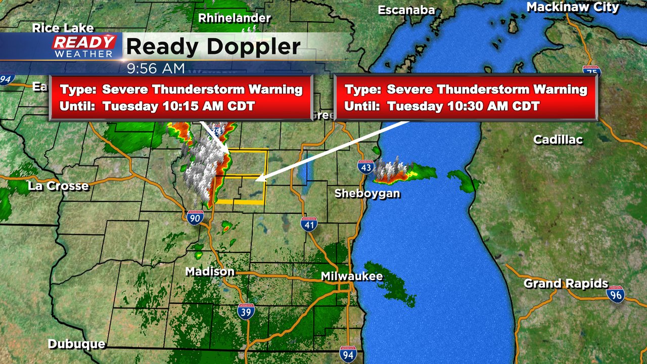
Updated: 10:09 a.m. Aug. 27, 2024
The heat is back for another day. As of 10 a.m. temperatures have already warmed into the upper 80s in some locations and dew points never really dropped Monday night so they are still in the middle and even upper 70s making for heat index values already nearing 100.
Here's current feels like temps that will updated with time:

Some storms are already tapping into all of the atmospheric energy that comes with heat and humidity and have become severe across central Wisconsin. We will watch these storms closely as they approach Fond du Lac and Sheboygan Counties. Most of southeast Wisconsin should stay dry with these morning storms except those northern areas. More strong to severe storms will be possible late Tuesday afternoon into Tuesday evening.
The rest of the heat, humidity and storm forecast highlighted below is on track.
------
Posted: 5:34 a.m. Aug. 27, 2024
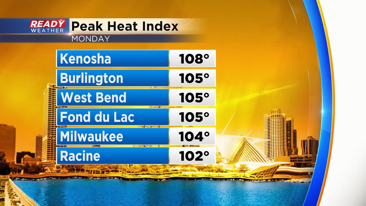
Monday was a very hot and humid day across southeast Wisconsin. High temperatures Monday reached the lower 90s for most of the area with dew points in the low to middle 70s pushing heat index values into the 100s across much of the area.
Tuesday will be another hot day with high temperatures reaching the low to middle 90s for most of the area. A few northern and western communities may stay just barely in the upper 80s.

Dew points are expected to be even higher Tuesday into the upper 70s or even around 80 degrees in spots making it the most humid day of the year. Even though the temperatures get closer to average by Wednesday, the humidity levels stay pretty tropical with dew points around 70.

The combination of highs in the mid 90s and dew points in the upper 70s will push heat index values close to 110 degrees or even hotter in some areas.

Because of the extreme heat, a heat advisory and excessive heat warning have been issued for Tuesday from 11 AM to 7 PM. The heat advisory is in effect for our northern counties of Fond du Lac and Sheboygan Counties who did see some storms from 1 to 2:30 AM early Tuesday morning. The rest of southeast Wisconsin is under an Excessive Heat Warning.

All of the heat and humidity will give lots of fuel for thunderstorms that form along a weak cold front late Tuesday afternoon into the evening. The best timing for storms looks to be after 4 PM through just after midnight. A few showers or an isolated rumble of thunder could linger into Wednesday as well.

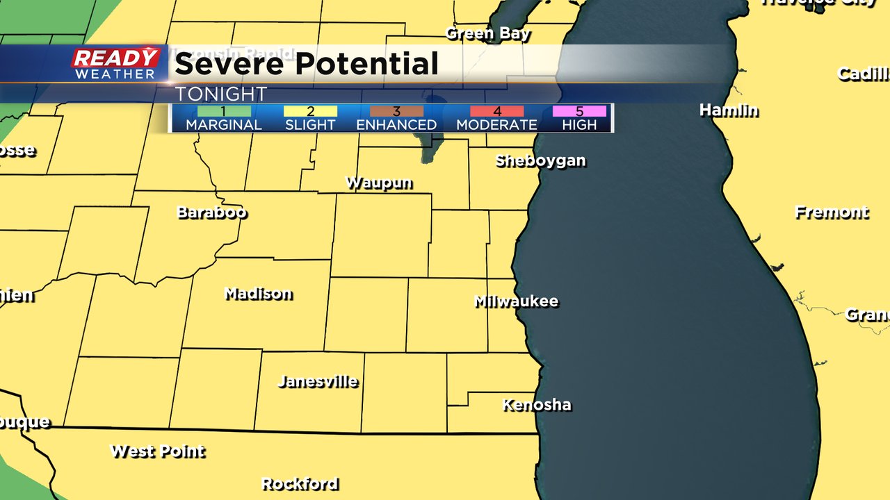
Any storms that form would likely be at least strong to even severe thanks to all the fuel the heat and humidity will give storms. All of southeast Wisconsin is under a Level 2 Slight Risk for severe weather.
For any strong to severe storms that do form, hail and gusty wind will be the main threats but an isolated tornado cannot be ruled out as well.

Download the CBS 58 Ready Weather app to track another day of heat and humidity and the chance for strong to severe storms.