Delayed cold finally arrives with coldest temps since February


Cold! It's the first time this season we can really use that word. Low temperatures Tuesday morning dropped into the teens near Lake Michigan and into the single digits for the first time this season inland. The spots that saw the most snow last weekend were the ones that got the coldest.
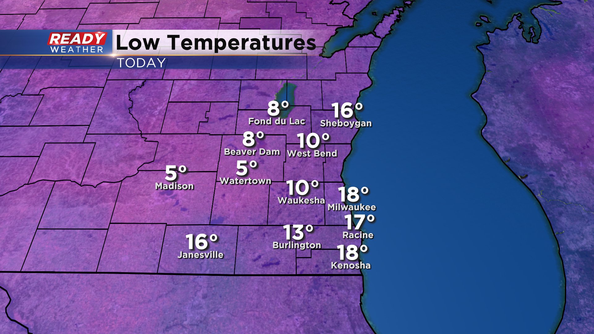
Tuesday's lows were the coldest since the end of February - Leap Day in fact. Exactly 290 days ago!

The cold Tuesday morning temperatures come after the coldest highs of the season on Monday when Milwaukee only hit 30* which is the coldest high temperature since March.

If this "cold" seems delayed to you, than you're absolutely right. We would typically see these "first" teens for lows and 20s to around 30 for highs in November or even at the end of October. Seeing our first 30* high on Monday (December 14th) is the 8th latest on record. Seeing our first teens for low on December 15th is the 6th latest on record. We're still waiting on our first day of highs in the 20s in Milwaukee. Right now the record for the latest first occurrence of that is January 3rd back in 1932.

Temperatures the next few days will hang out around average (33*) and then warm going into the weekend to around 40*.

There's still no sign of really cold temperatures heading our way. The latest temperature trend gives most of Wisconsin a 70% chance for above-average temperatures heading into Christmas Eve. There may be some cooler days here or there but most of them look close to average, not below it.

Download the CBS 58 Ready Weather app to see when cold air will start to arrive and track the holiday forecast.