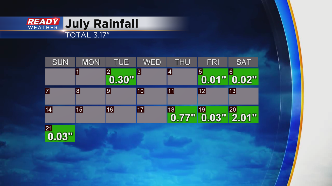
It's been almost two week since we've had measurable rain in the city of Milwaukee. Twelve days to be exact. And even when we did have rain in July, it was hit or miss. Check it out:
The last time we had rain was the 21st of July from a soaking system that the day prior dropped over two inches of rainfall. Now as we have entered August, it's our rainiest summer month, per the averages. August sees almost four inches of rain in Milwaukee. Last month we fell exactly a half inch short of the average rainfall of 3.67". The good news is that we not be waiting much longer for a drink of water on lawns and gardens.
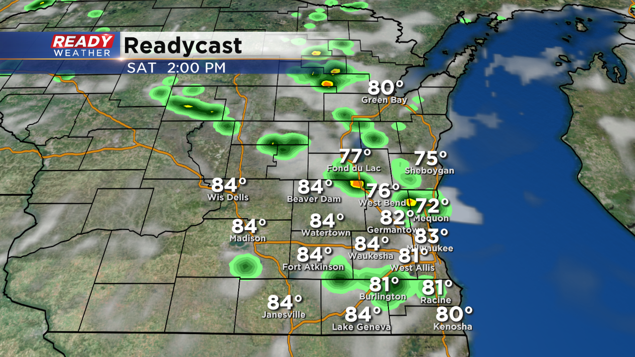
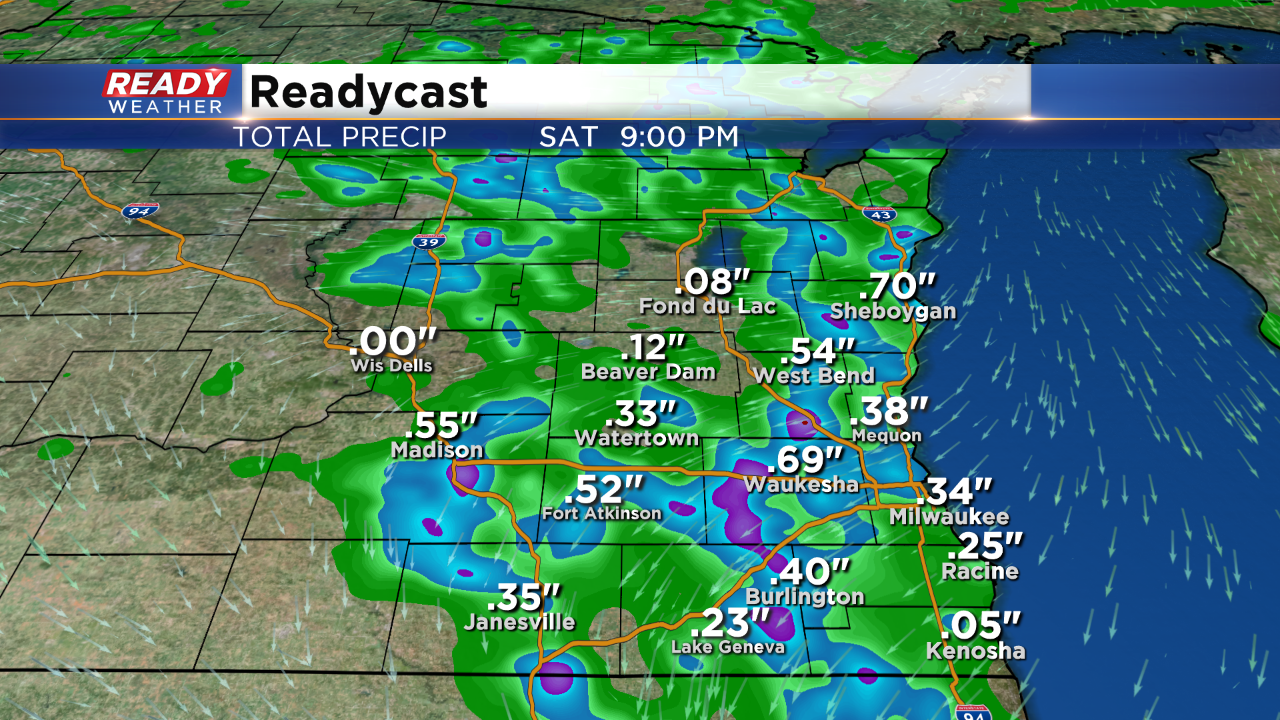
The set up for your Saturday includes a touch more humidity in the air along with warming temps into the middle 80s. So we've got the heat and humidity. Wind starts west and then abruptly turn northeast around noon which helps to trigger some showers and storms through the afternoon. Let's go through the timing
By 2pm, Showers and a few non severe storms are in progress.
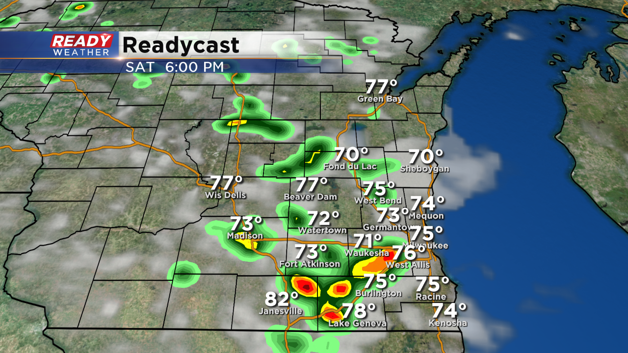
By dinner time these isolated storms pool into a few heftier downpours and start to drift southwest across the area.
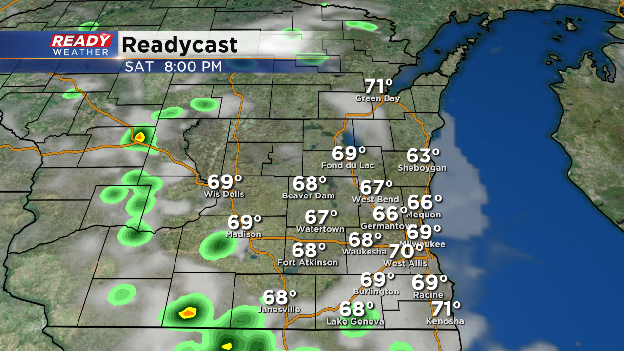
As we near sunset the storms start to push out of the area and fade away. Here's how much rain is possible:
Now is the perfect time to download our CBS58 Ready Weather App to stay ahead of the weekend storms. You can find it at Google play for Android or the App store on your iPhone. The best part, it's free!
I'm meteorologist Rebecca Schuld