


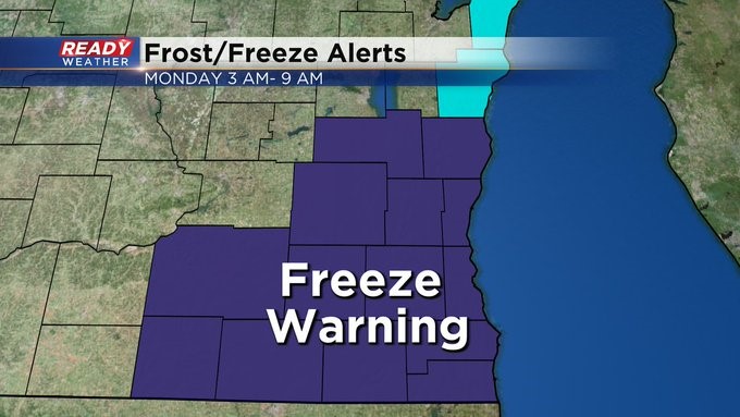
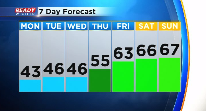
It's unfortunately time to break out the winter jackets as an early taste of winter arrives on Monday. Temperatures will drop into the low 30s by early Monday morning with another Freeze Warning in effect for the entire area.
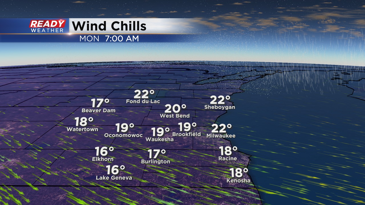
It'll feel way colder than the low 30s as you head out the door Monday morning thanks to a NW wind gusting between 30-35 mph. The wind will make it feel like the upper teens to low 20s area-wide.
Not only will it feel like winter, it'll also look like winter for some of us as a batch of wet snow showers track across the eastern part of the state during the morning hours.
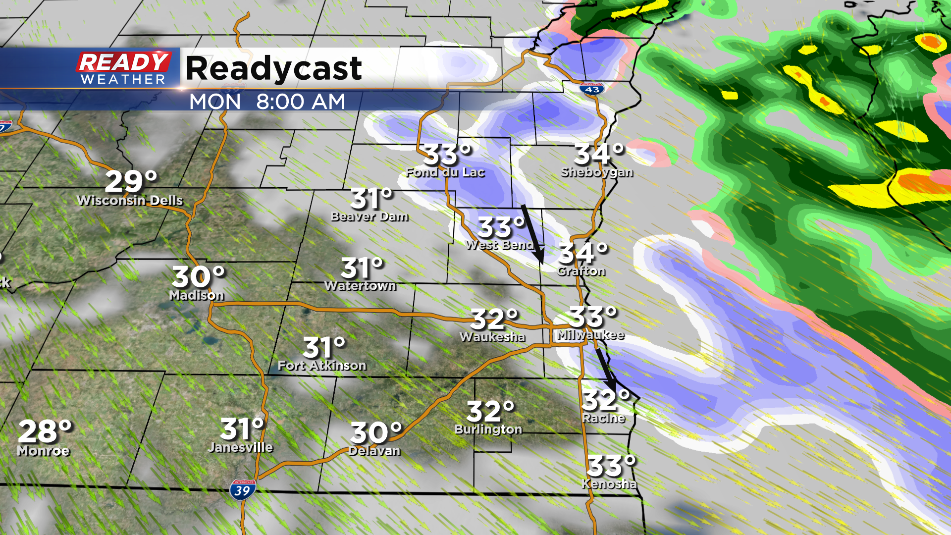
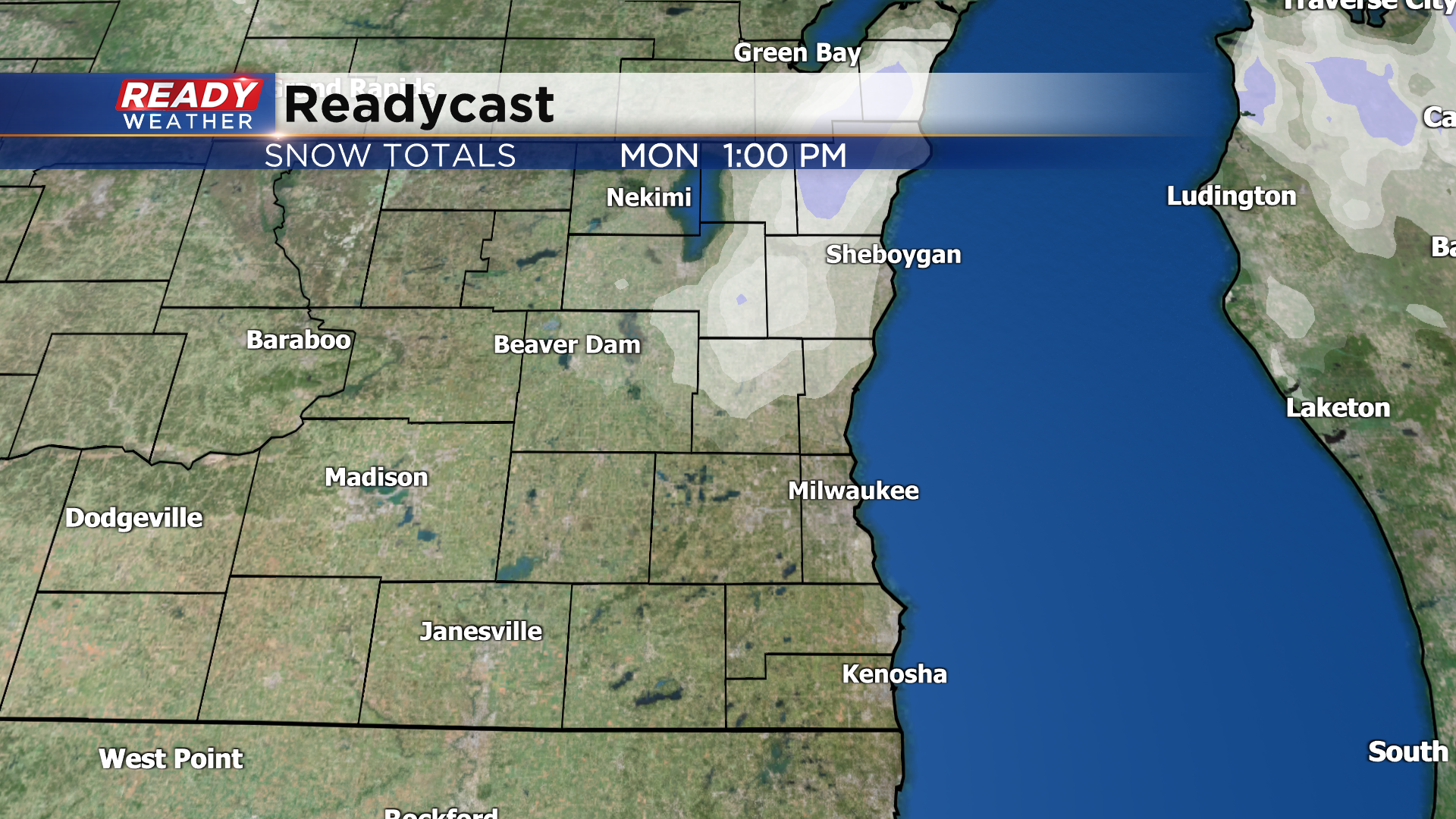
Thankfully the pavement is way too warm for any accumulation on roads, but parts of Sheboygan, Fond du Lac, Washington, and Ozaukee counties may see a dusting on the grass.
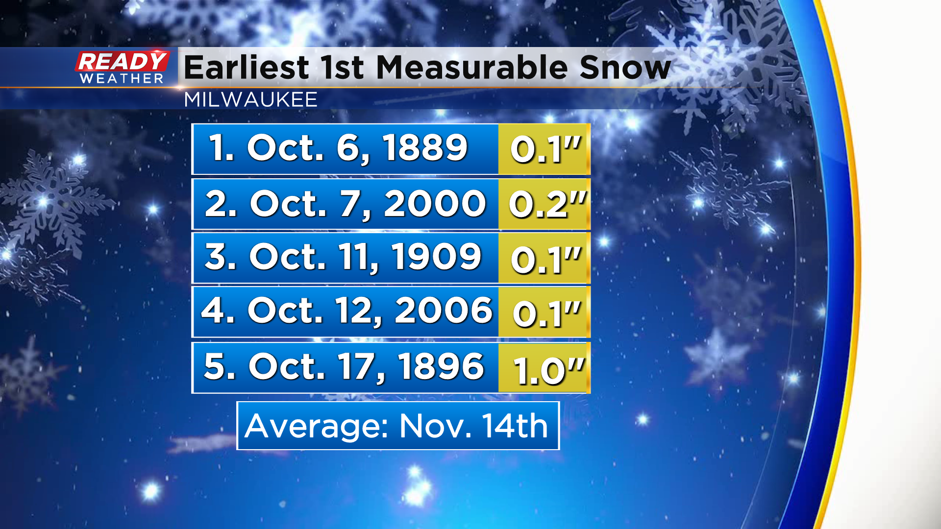
If Milwaukee is able to pick up 0.1" of snow tomorrow, it would tie the 5th earliest measurable snow on record. Normal our first measurable snowfall doesn't occur until November 14th.
Any precipitation that lingers into the midday - afternoon hours will mix with or change over to rain as temps warm into the low 40s. Thankfully this winter-like weather will only be here for a day. It'll still be chilly and breezy early in the week, but temps will rebound back into the low to mid 60s by the end of the week.
Download the CBS 58 Ready Weather App to track Monday's wet snow.