Excessive heat warning issued, feels like temps above 110°


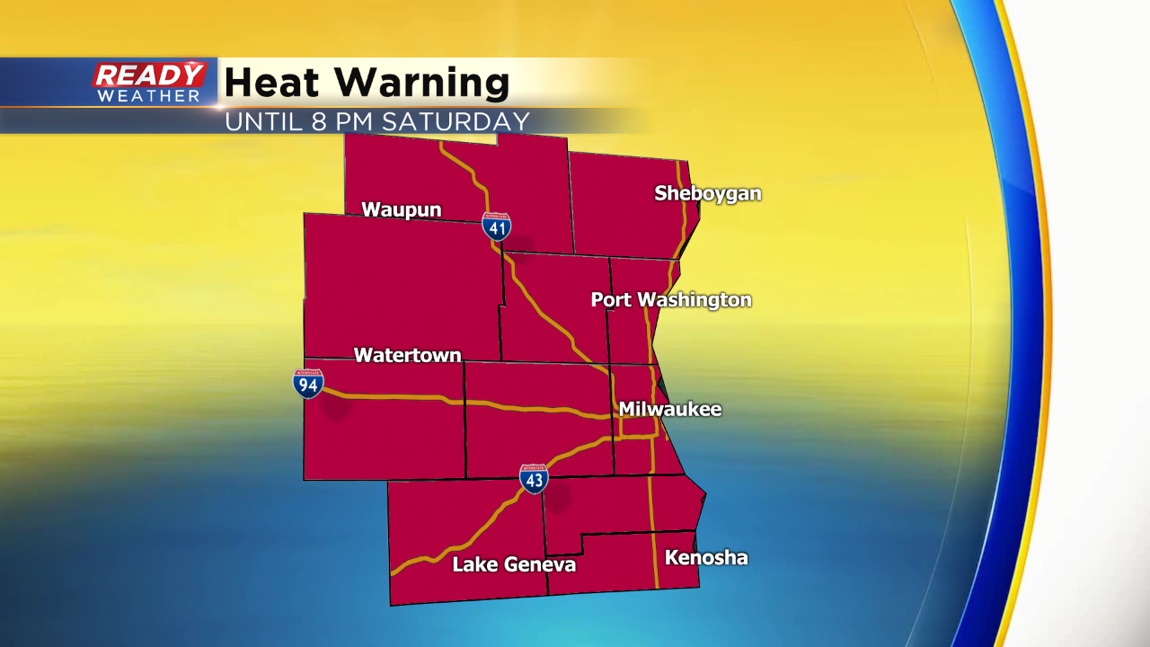
For the first time in over a year an excessive heat warning has been issued for all of southeast Wisconsin. The warning starts at 10 a.m. Friday and lasts through Saturday morning at 8 p.m. This heat warning replaces the heat advisory that had previously been issued.
Morning storms on Thursday kept our temperatures down a bit with highs in the upper 80s feeling like the upper 90s. A few storms are once again rolling through Friday morning but are not expected to linger as long as they did on Thursday so temperatures will be able to warm quicker and faster. Friday will be very close to the record of 98° set back in 1932. Saturday is also trending warmer with a later arrival of a cold front. Highs on Saturday are now looking more like the low 90s which is still a ways away from the record of 100° in 1930.

Humidity is expected to be oppressive both Friday and Saturday with dew points getting as high as they really can in Wisconsin towards 80°. The humidity slowly decreases throughout Sunday with pleasant humidity finally returning on Monday.

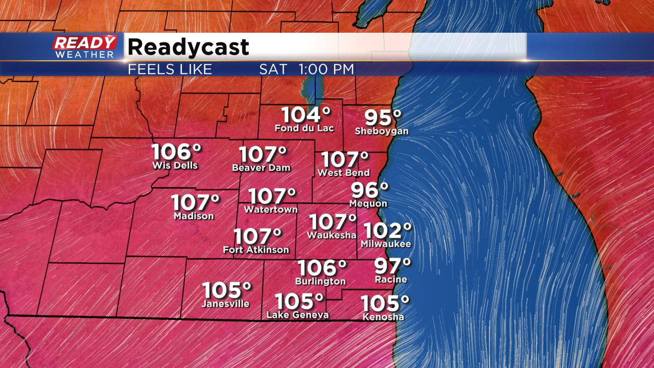
The reason an excessive heat warning has been issued is because the feels like temperatures will reach the widespread 100s. A few spots could see a heat index over 110° Friday.

The heat will likely remain on Saturday with heat indices getting close to 100°. Whenever the front pushes through will have a big impact on temps. If the front arrives later the heat indices might get as warm as 105°, but if it arrives earlier it will be a little cooler.
Download the CBS 58 Ready Weather App to track any storms that pop with the heat and see how hot the temp is where you live. The app just went through an update so make sure to download the newest version.