Excessive heat warning issued for Wednesday with highs reaching 100° 🥵


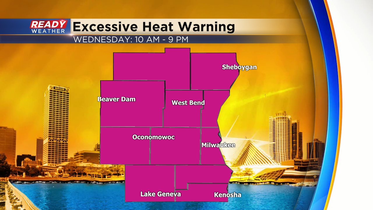
The heat for the middle of the week just got hotter. An excessive heat warning has been issued for all of southeast Wisconsin from 10 AM Wednesday to 9 PM. This is our first excessive heat warning in 4 years since July, 2019. An excessive heat watch remains in effect for Thursday.
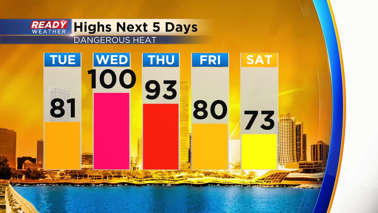
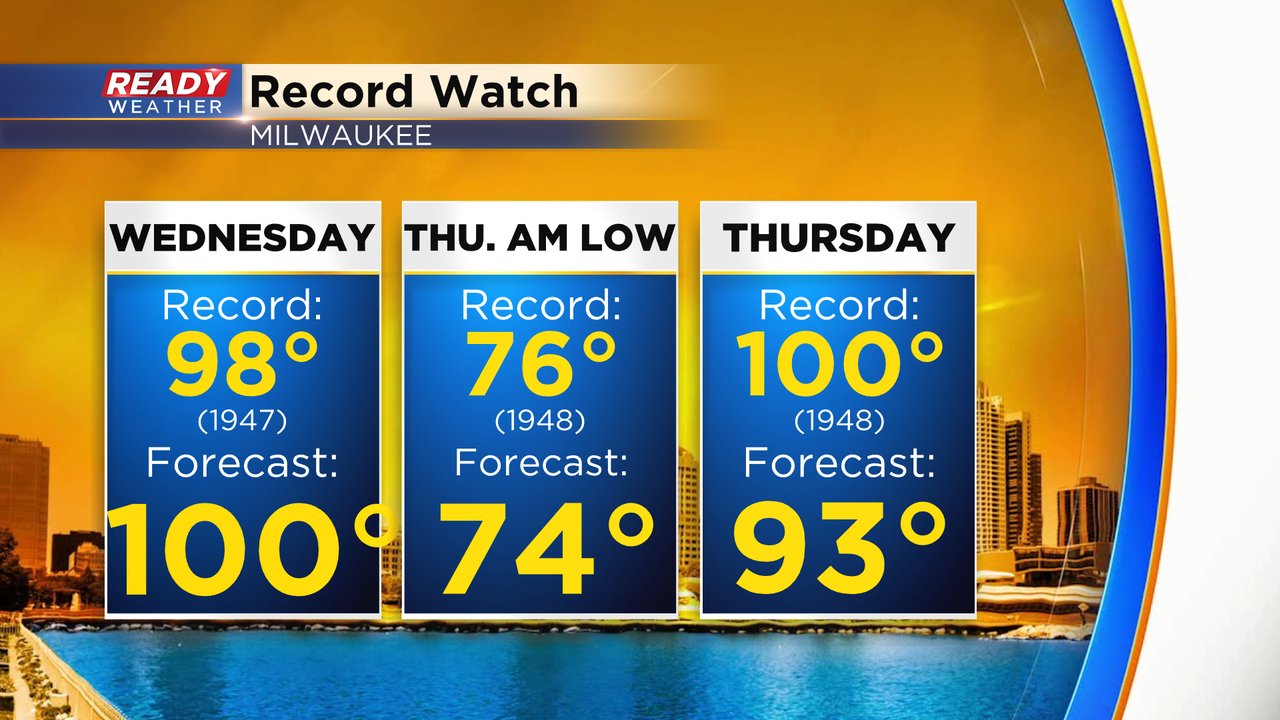
The high temperatures for Wednesday are now forecast to be even warmer. A few weather models indicate that 100* is a real possibility and it has been added to the forecast. Thursday has also trended warmer in the low 90s. Comfy air will return for the weekend with highs in the lower 70s.
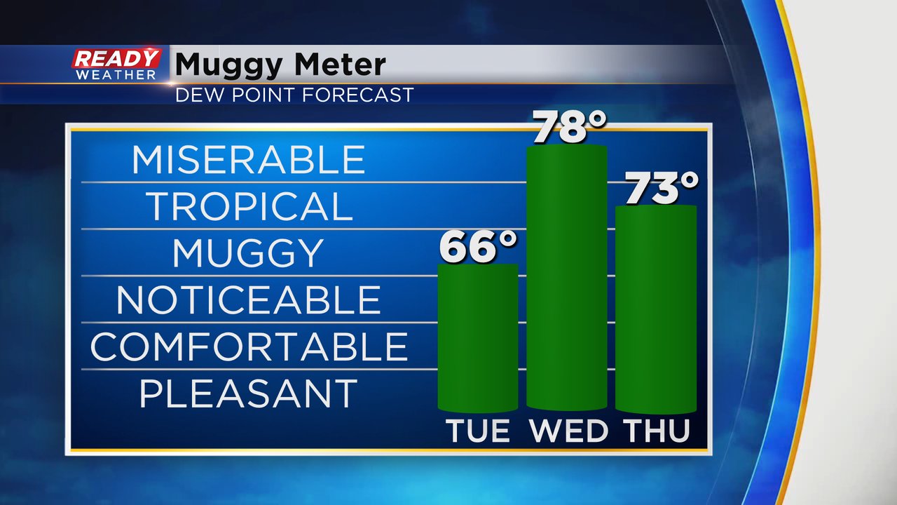
Dew points for Wednesday are also looking higher. Humidity and stickiness start to return Tuesday in the mid 60s but Wednesday's peak dew point could reach the upper 70s which is very rare for southeast Wisconsin. Tropical level humidity will stick around for Thursday as well.
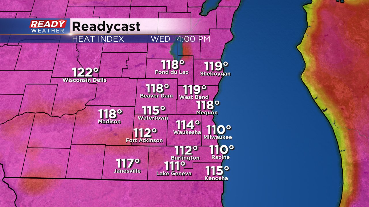
The combination of the heat and humidity for Wednesday will push feel like temps well into the 100s. Most of southeast Wisconsin will feel heat indices between 110-120. Thursday will have feels like temps in the 100-110 range.
With the warmer forecast on the way for Wednesday and Thursday we are getting closer to breaking records. A high temperature of 100* would break the record high for Wednesday. The current forecast would fall short of records for the warmest low temperature Thursday morning and high temperature Thursday afternoon.
Last year we hit 100* in June and getting back-to-back years with 100* temps is rare. The last time it happened was in 1994-1995.
Download the CBS 58 to track the heat where you live.