🥵 Excessive Heat Watch issued for the middle of the week


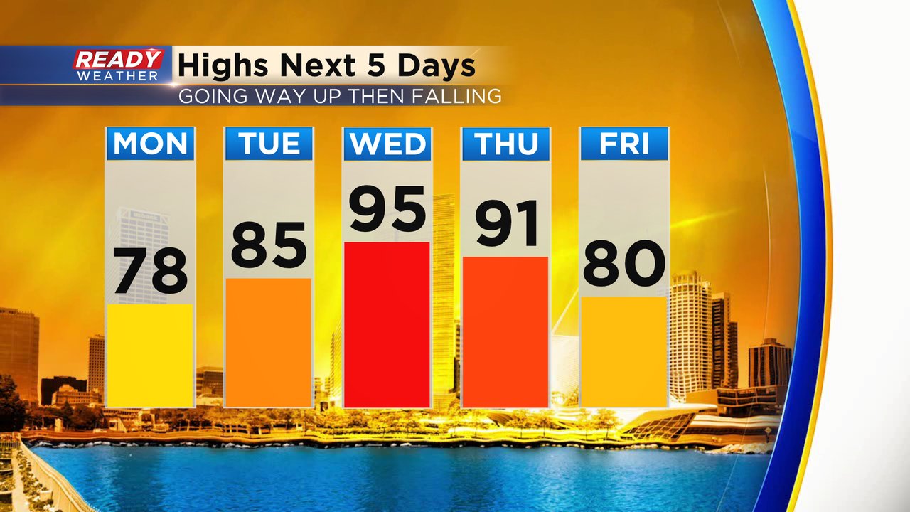
The heat is back! Temperatures Sunday reached the upper 80s with lots of humidity and heat index values peaking in the 100s for many communities. That heat backs off a little with highs in the 70s Monday then warming Tuesday in the 80s but 90s look likely both Wednesday and Thursday.
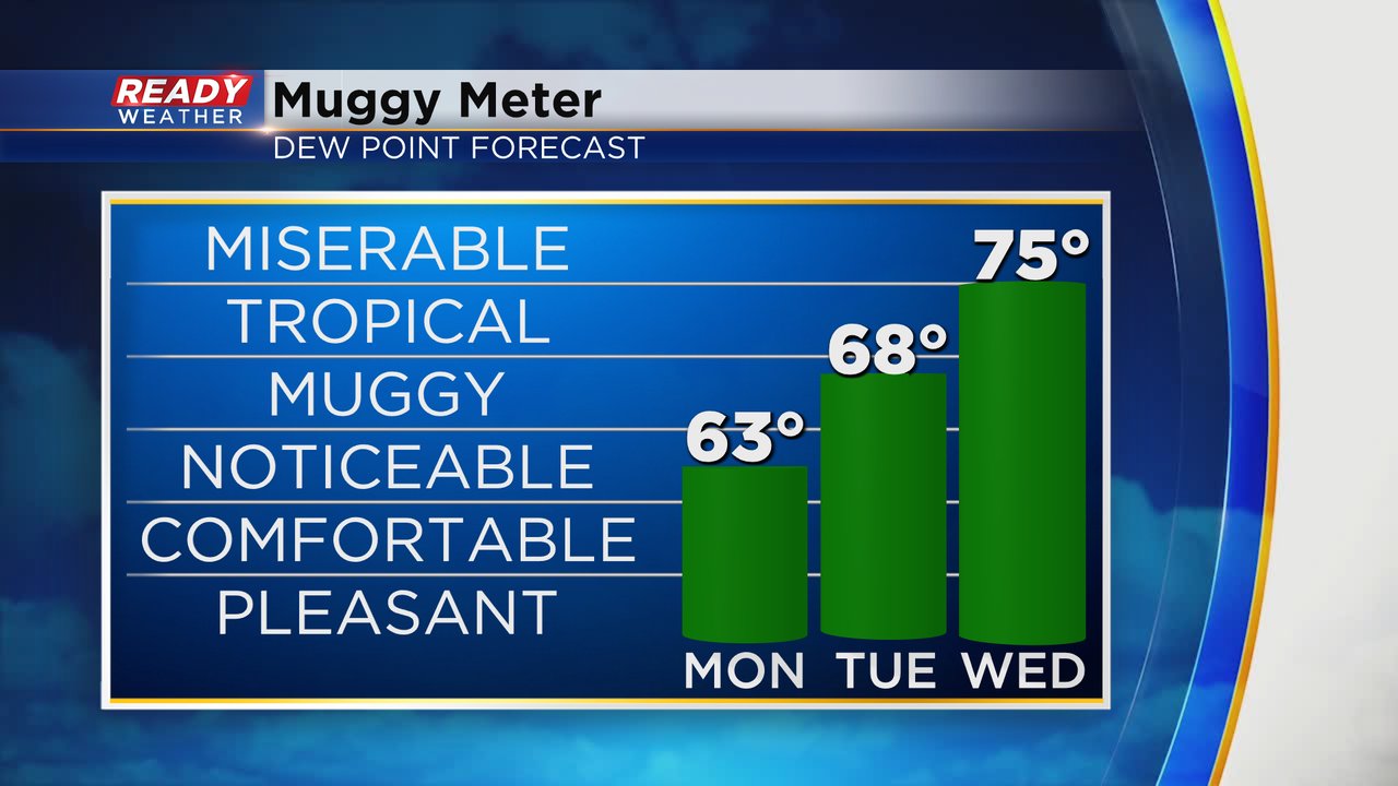
As the temperatures increase, the humidity will also increase. Dew points Monday stay in the low 60s with a touch of humidity. Tuesday gets real sticky with dews reaching the upper 60s but Wednesday is that real humid day with dew points hitting the middle 70s.
When you combine the heat and humidity for Wednesday it's going to feel like the 100s. Heat index values could get as high as 110* or even a bit warmer in some hometowns.

Because of the prolonged heat on the way, an excessive heat watch has been issued for all of southeast Wisconsin. This is the first time since 2016 that an excessive heat watch has been issued for our local area although an excessive heat warning was issued in 2019. The heat watch goes from Wednesday morning through Thursday evening.

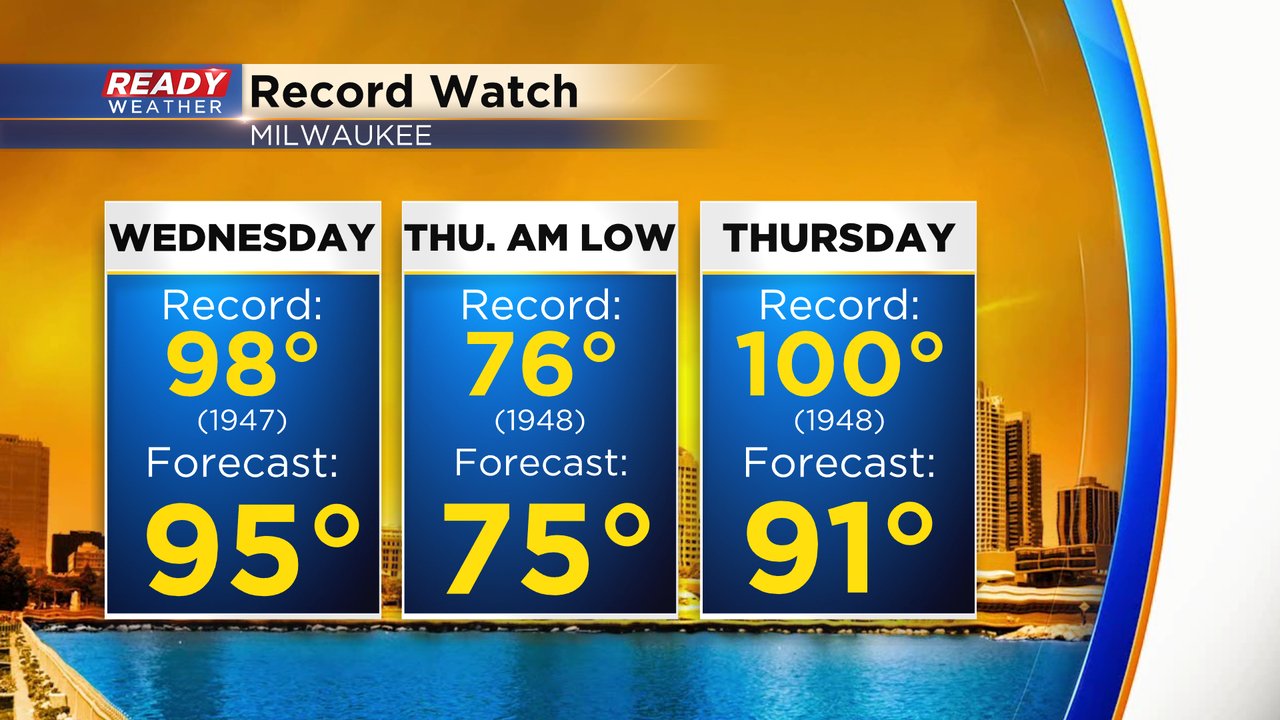
Even though it's going to be hot Wednesday and Thursday, it probably doesn't break any records. Wednesday comes close to the record of 98* but the record Thursday is very safe at 100*. The record that is in the most jeopardy is the Thursday morning low. The current record warmest low is 76 and we may stay in the mid 70s for the lows.
Download the CBS 58 Ready Weather app to track the heat and get alerts when excessive heat warnings are issued.