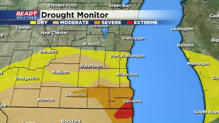
Extreme drought returns with rather dry weather pattern ahead
Last week's drought monitor update provided good news for those along I-94 with the elimination of the moderate drought. However, we really needed that rain south of I-94. Extreme drought conditions have returned to far SE Kenosha county, while severe drought conditions have expanded across northern Walworth and Rock counties over the last week.
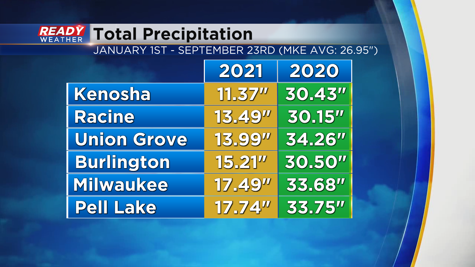
This time last year most of far southeast Wisconsin was running around 6" above normal on precipitation. This year we're running 9-12" below normal on rainfall.
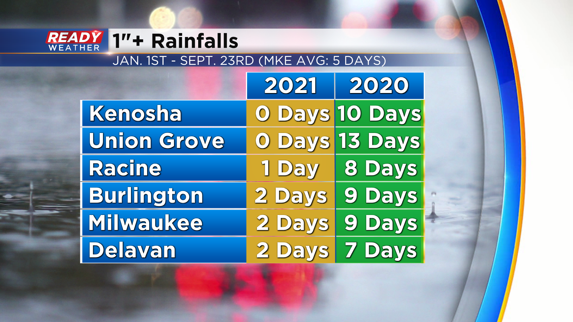
One reason for the severe/extreme drought in far SE WI? There haven't been many 1"+ rainfalls this year. In fact, Kenosha and Union Grove haven't had any, which is night and day compared to last year.
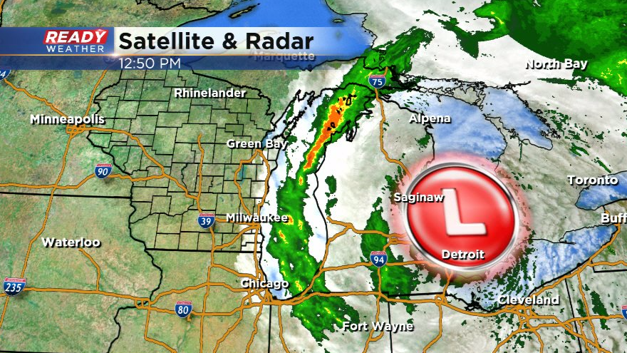
There aren't many chances for rain over the next week besides a small chance today and tomorrow. A low pressure system wobbling over the Detroit area could cause a few showers to brush the lakeshore through early evening, but most of the area will stay dry today.
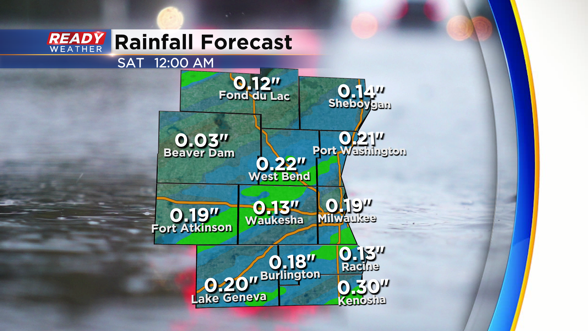
A little better chance for rain arrives Friday evening with a cold front. These showers will exit by sunrise Saturday morning.
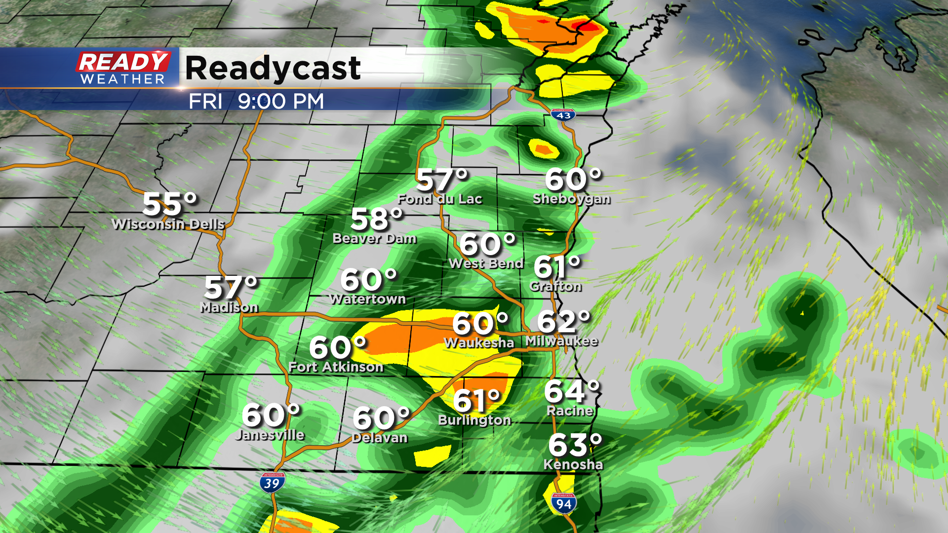
Rain totals from this front look rather light between .15-.25".
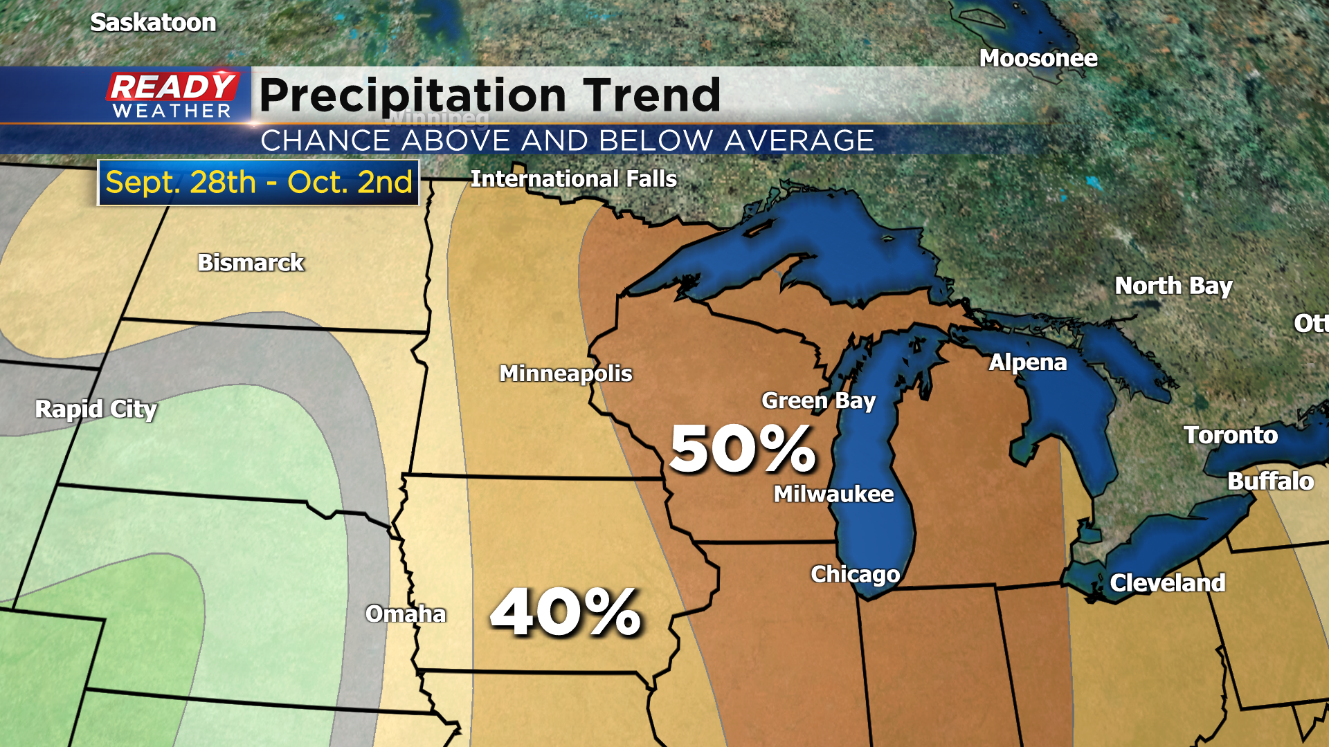
After Friday night a rather dry weather pattern will set up for the next week or so. The 6 to 10 day precipitation outlook that takes us through the end of September and start of October favors below normal rainfall across the state.
Download the CBS 58 Ready Weather App to see if temps will warm up with the drier weather.
