6 PM Update: Much needed rain and storms moving through the area
Updated: 6:00 pm Monday, May 3rd:
Line of moderate to heavy rain with embedded thunderstorms is continuing to push eastward this evening. We are keeping an eye on the portion of the line tracking through Janesville as it's moving into an area of instability in Walworth county. A few stronger wind gusts may be possible with this portion of the line over the next hour.
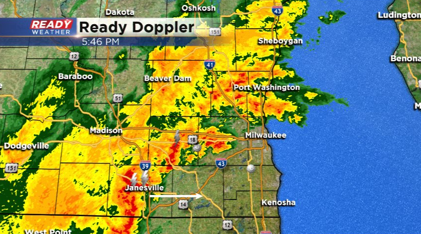
The back edge of the rain will exit eastern Wisconsin around 10 pm.
---------------------------------------------------------------------------------------------------
Updated: 4:00 pm Monday, May 3rd:
Isolated showers and storms have been popping up in the Milwaukee metro over the last hour, with a few lightning strikes noted in the storms near Pewaukee and Brookfield. These showers and storms haven't been able to sustain themselves for long before falling apart.

The main line of steady rain and storms has pushed into Dodge and Fond du Lac counties. We're keeping an eye on the section of the line west of Janesville as it moves east into a favorable environment for strengthening.
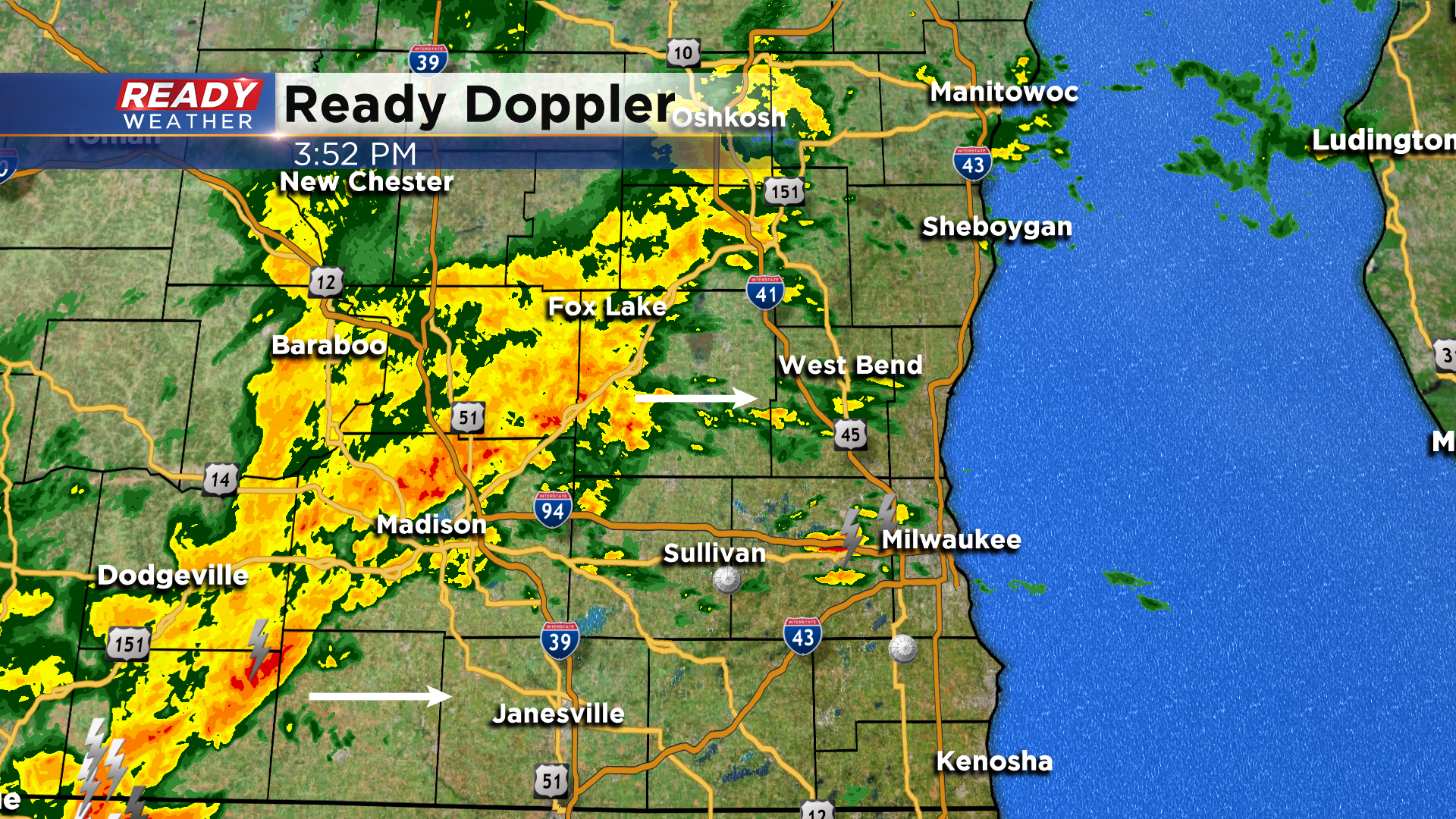
The best chance for strong storms with gusty winds will come with that portion of the line as it tracks east over the next 1-3 hours.
-----------------------------------------------------------------------------
Besides a few showers north of Milwaukee late this morning, today has been rather quiet. However, scattered showers and isolated storms are developing back to the west as a low pressure system and cold front approach the area.

These showers and storms will continue to develop into a line and track across southeast Wisconsin between 5-8 pm.
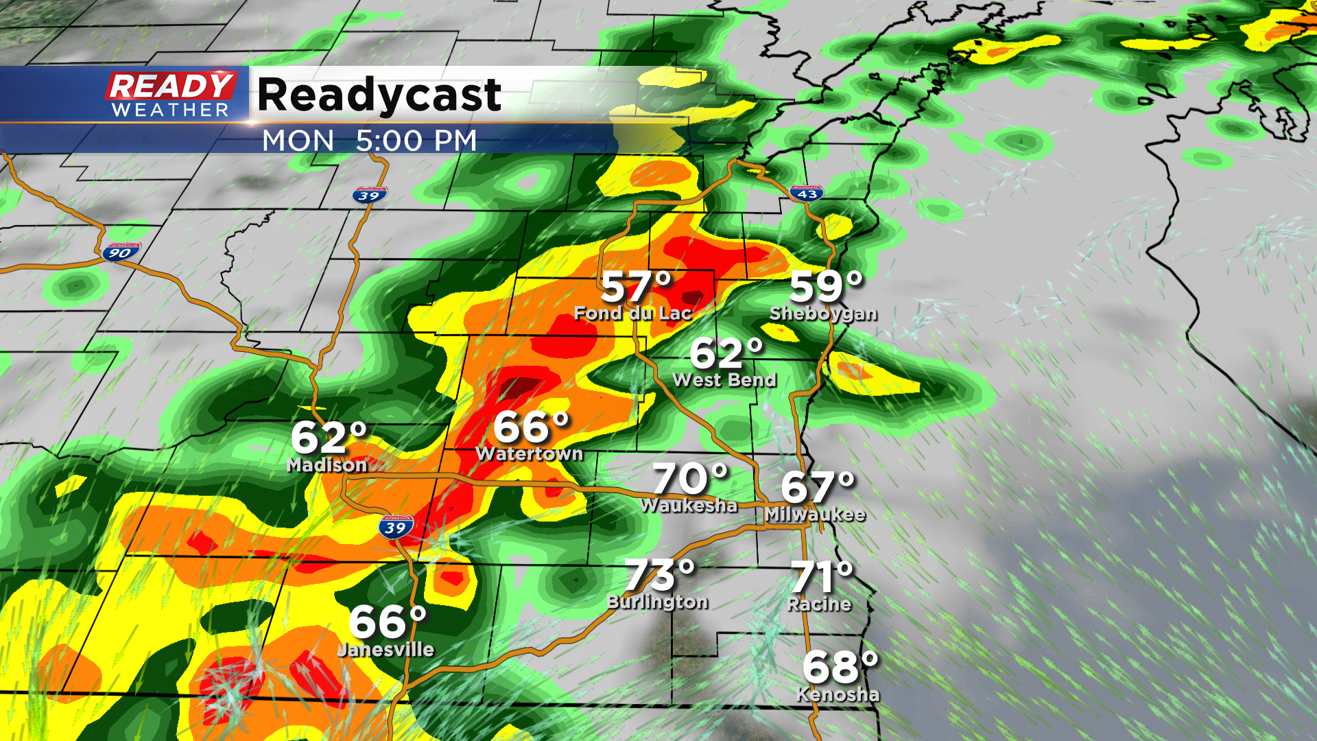
Areas that saw the shower activity earlier today are too stable for any strong to severe storms, but there has been some sunshine in far southeast Wisconsin at times today which has allowed for temperatures to warm into the upper 60s to low 70s. This has allowed for some instability to grow along and south of I-94, where a Marginal Risk (level 1 of 5) for severe storms is in place.

Gusty winds and torrential downpours will be the main threats, along with small hail. With a lake breeze in place near the lakeshore, it currently looks like the best chance for any strong to severe storms would be south of I-94 and west of HWY 45, with that threat lowering closer to the lakeshore. Download the CBS 58 Ready Weather App to get any warnings sent to your phone.
