


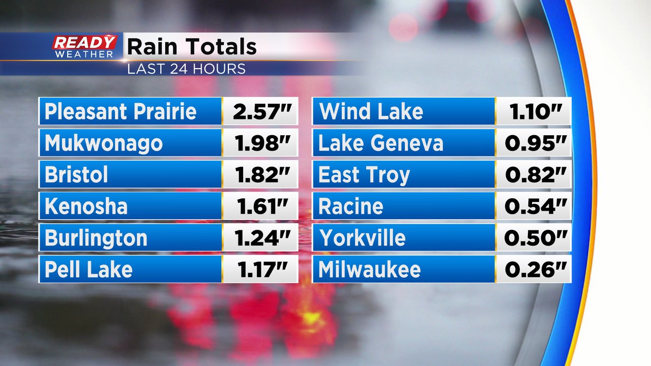
Parts of southeast Wisconsin saw heavy rain and storms Monday evening as the northern edge of a line of storms across the Midwest pushed east. Those storms dropped a lot of rain in Kenosha County and the surrounding area with over 3" of rain in the city of Kenosha leading to brief flooding. other areas, especially north of I-94 got around a quarter inch of rain or less.
While we missed out on storm damage in southeast Wisconsin, the same cannot be said for most of the Midwest. A derecho stretched over 400 miles from central Iowa into northwest Ohio with plenty of wind damage reports. At one point the National Weather Service in Chicago was tracking over 10 possible tornadoes at the same time. One wind report near Dubuque, Iowa measured 97 mph!

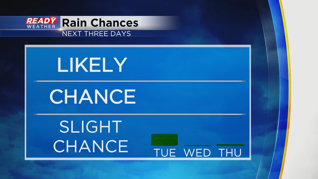
Besides a stray shower or storm on Tuesday, the vast majority of southeast Wisconsin finally gets a break from the rain and storms and Wednesday and Thursday look even drier with no chance for any rain.
The temperatures will start to drop as well with highs around 80 degrees Tuesday, just a little below average. Thursday is the coolest day this week with highs in the low 70s then we warm back up around 80 for the weekend.

Even though temperatures drop a bit, we see dew points stay very humid Tuesday in the upper 60s to around 70. Those dew points drop on Wednesday to barely noticeable levels then it gets comfy for Thursday.

Download the CBS 58 Ready Weather app to track the extended temperature and humidity forecast on the 10-day.