First spring snow possible Wednesday night with some rain


So far rain chances have stayed away from southeast Wisconsin this week but a few isolated showers will be possible the next 36 hours. The first chance is Wednesday morning with precipitation mostly staying to our north but a trailing line of isolated and light showers could role through until the mid-morning hours. A better chance for showers will arrive Wednesday evening, mostly in southern counties. Rain totals by late morning on Thursday will range from barely a tenth in northern counties to up to a half inch in southern counties.

Then overnight Wednesday into Thursday morning some of the rain showers could mix and even switch to a little bit of snow. Most of that light mix won't impact roads and wrap up by the mid-morning hours with dry conditions returning the rest of Thursday and most of Friday.
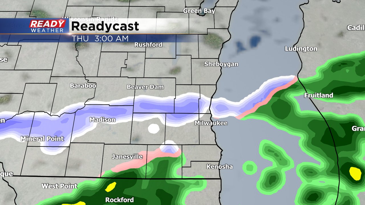
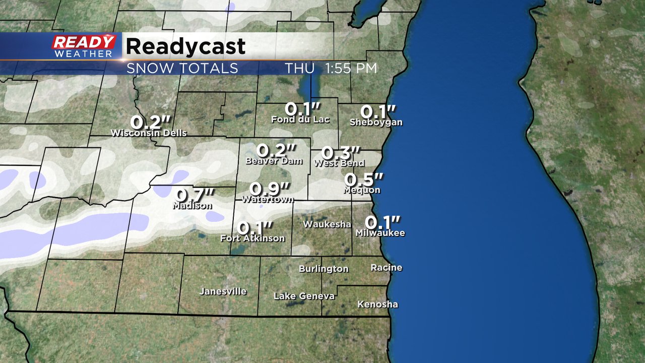
A touch of accumulating snow, mostly on untreated roads and grass, is not out of the question for Thursday morning. Northern counties have the best chance for this snow but a dusting can't be ruled out in southern counties either. Some isolated communities could see a few tenths or even up to a full inch of snowfall.
Download the CBS 58 Ready Weather app to track this first round of potential snow in spring.