


It has been a very gloomy and dreary week in southeast Wisconsin. Since Tuesday we've been dealing with at least scattered rain showers and very little, if any, sunshine. That trend will continue through the rest of the work week with more light mix showers. Don't expect any sun until Saturday afternoon.
Rain totals since Tuesday show some areas getting close to 2" with most of southeast Wisconsin picking up around an inch of rain so far.

The light scattered rain showers will start to mix and switch with some snow during the day Thursday. We could even see some sleet and graupel mixing in at times.

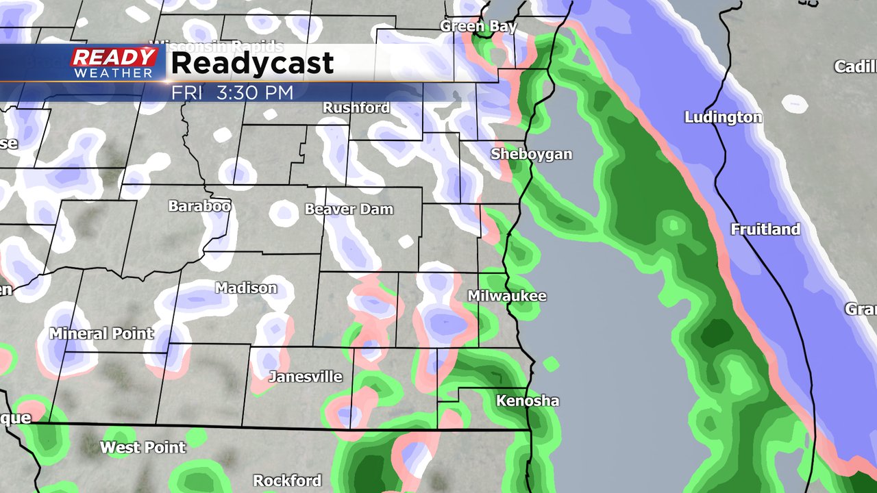
Thursday evening through early Friday morning looks pretty dry. By Friday mid-morning our next storm system arrives with another chance for light rain/snow/mix for Friday late morning through the afternoon and evening and possibly lingering through the pre-sunrise hours of Saturday.
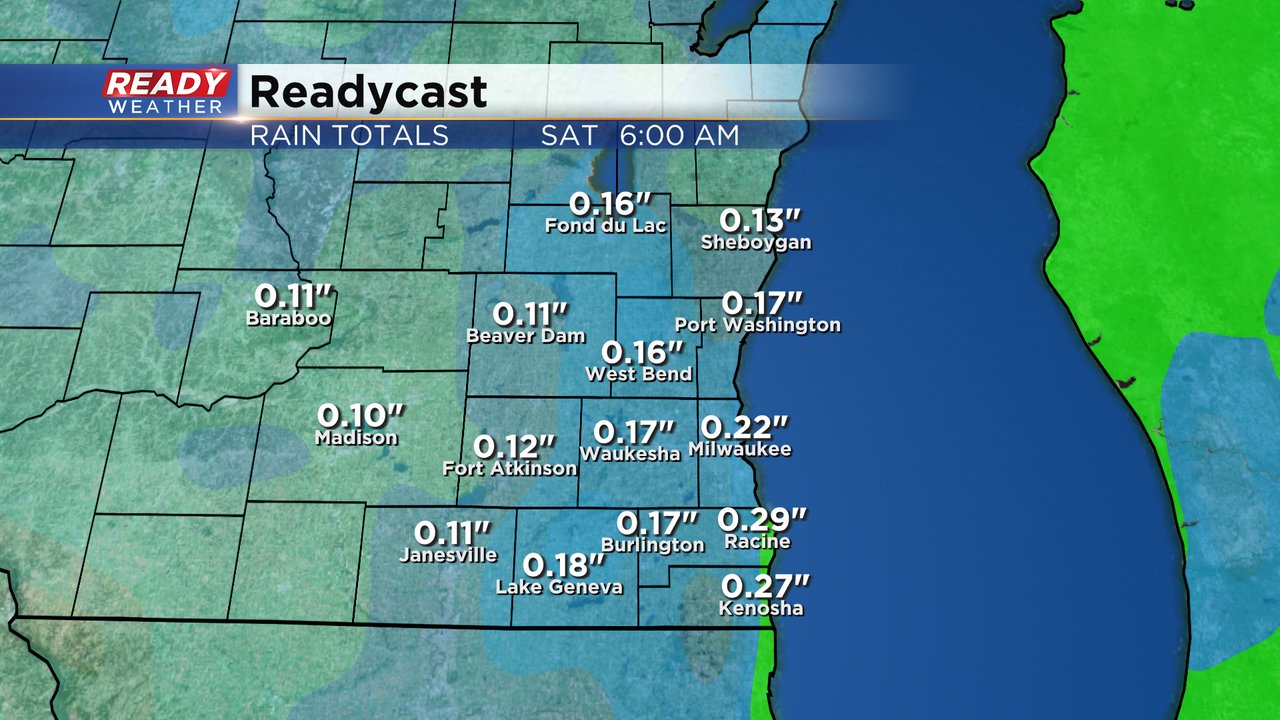
Any additional rain we see Thursday and Friday won't amount to much with a tenth to 0.25" of additional rain possible. The ground is pretty saturated right now but these light showers are great to make a dent in our current drought status.
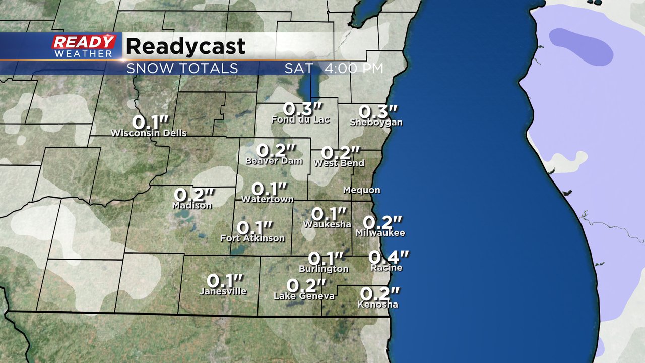
There is the possibility to see some slushy accumulating snow, especially if we switch over to all snow and get a burst here or there on Thursday or Friday. Any slushy snow would likely only accumulate on grassy surfaces leaving sidewalks and roads just wet.
Download the CBS 58 Ready Weather app to track the light mix to end the week.