Heat and humidity build back in to start the work week


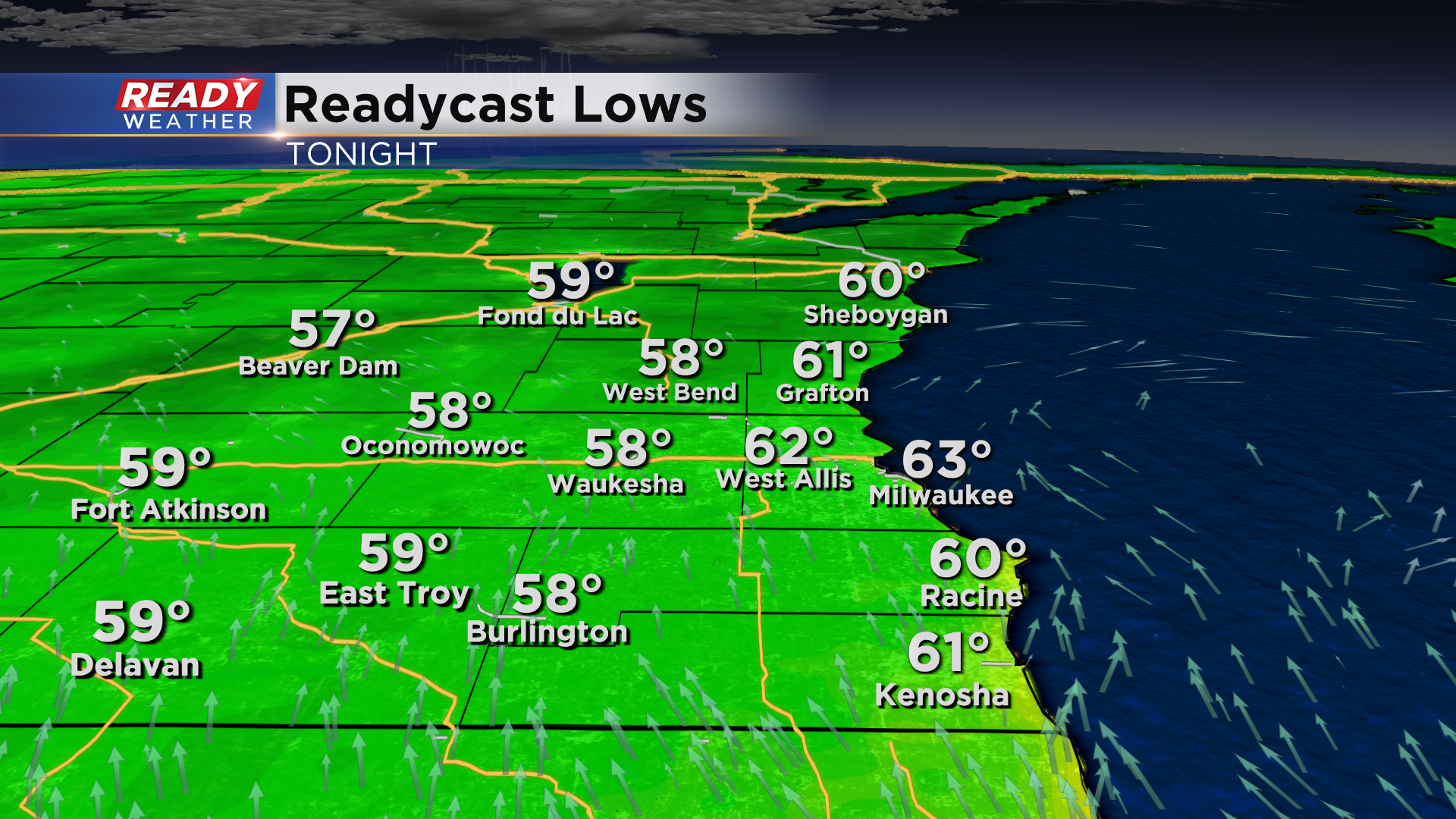
It's been an absolutely fantastic day across southeast Wisconsin with temperatures in the 70s and comfortable levels of humidity. It'll remain comfortable tonight as well with temperatures dropping into the low 60s lakeside and upper 50s inland.
Skies will be mostly clear throughout the night, but some cloud cover will move in closer to sunrise ahead of a weak area of showers and isolated storms. These are expected to fizzle out before reaching southeast Wisconsin.
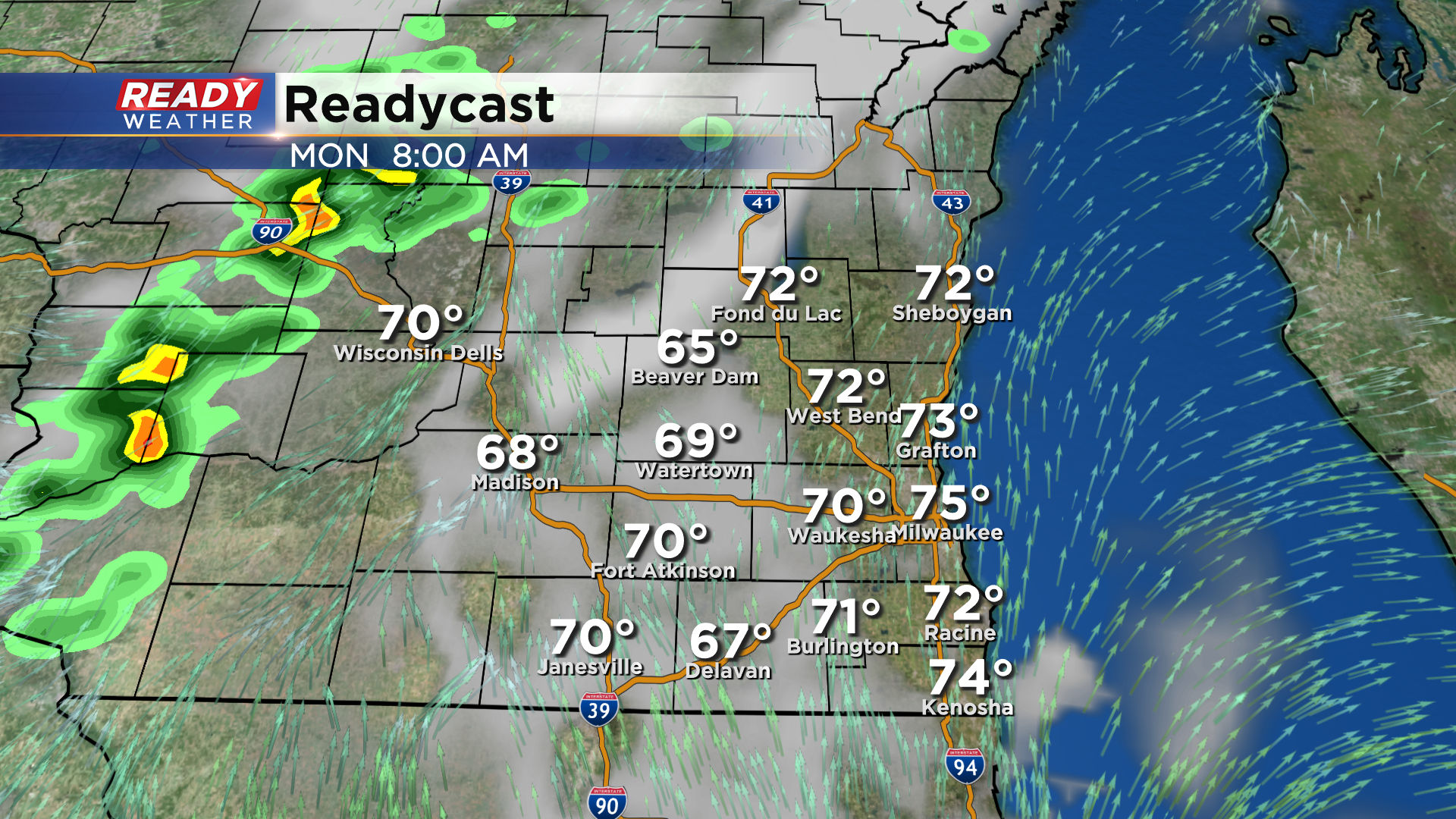
The morning cloud cover will give way to afternoon sunshine, which will allow temperatures to climb through the mid to upper 80s. Temps will then remain in the mid 80s to around 90 degrees through Wednesday.
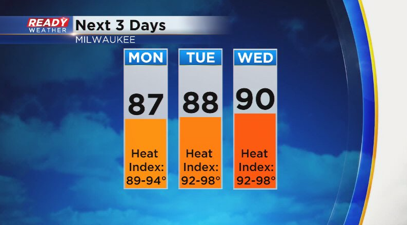
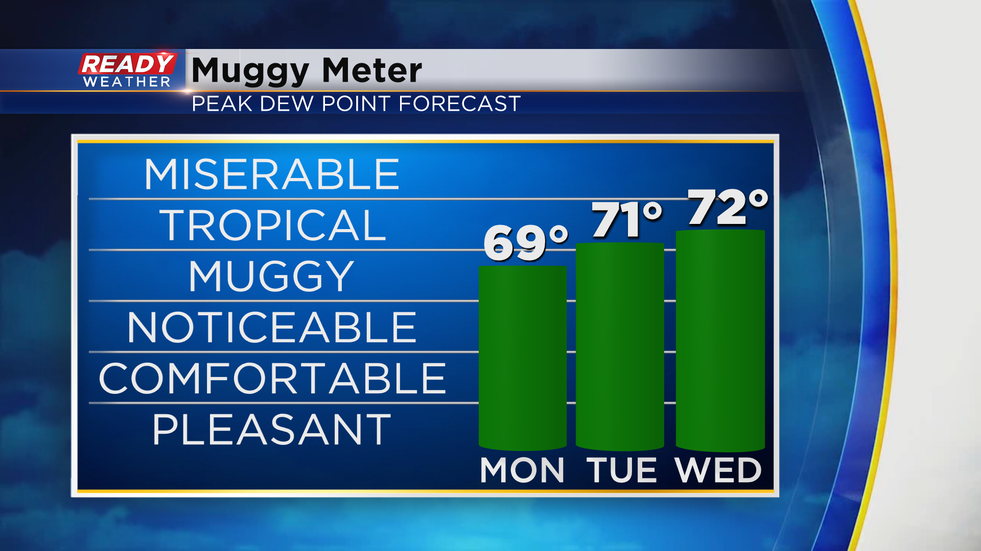
Not only will temperatures climb Monday afternoon, so will the humidity. Dew points will be back in the upper 60s to around 70 degrees by late afternoon - early evening on Monday and remain in the low 70s Tuesday and Wednesday.
This will lead to more chances for showers and storms. A few isolated storms will be possible well after midnight Monday night into Tuesday morning, with another round possible late in the day into early Wednesday morning.
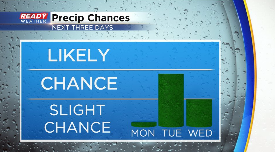
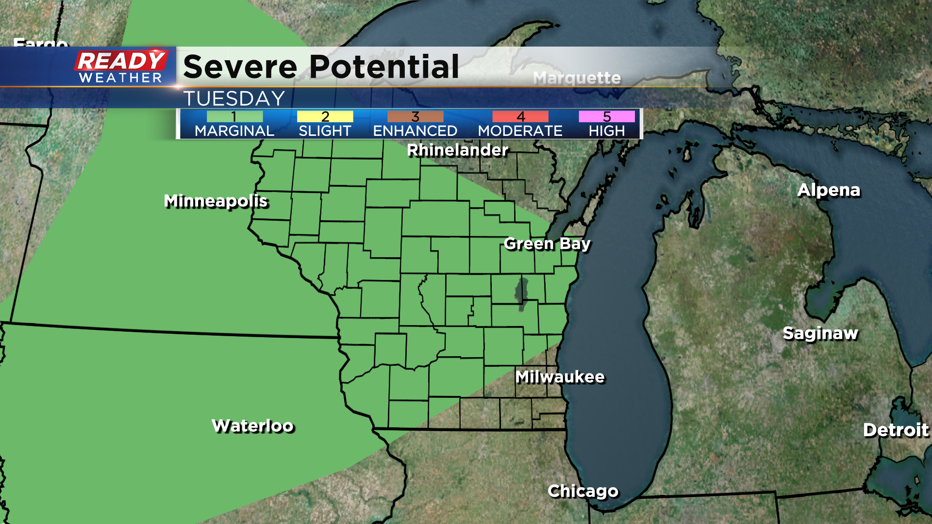
With the heat and humidity in place, a few of the storms on Tuesday could be strong to severe. There's currently a level 1, Marginal Risk, in place for a good chunk of the state.
We'll have a small break from the real hot and humid weather for the second half of the work week as a front slips through, but that front lifts back northward as a warm front heading into next weekend, which could allow for the hot weather to return. Download the CBS 58 Ready Weather App to see the full 7 day forecast.