


After a couple of cooler days with highs in the 70s over the weekend and going just slightly above-average on Tuesday, highs return to the 90s for most of southeast Wisconsin Wednesday. A breeze out of the southwest gusting to 25 mph will push the warm air in as a storm system approaches from the west. Typically with a southwest wind our lakeside communities become the warmest so highs there will reach the lower 90s with upper 80s for most inland spots.

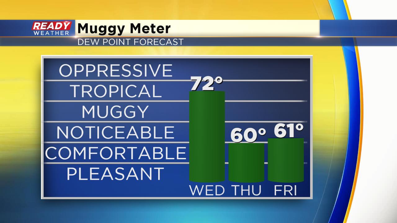
Humidity will also increase on Wednesday with dew points reaching the low 70s considered tropical. Luckily both the heat and humidity take a break Thursday with highs in the 70s and dew points hovering around 60°.
The combination of Wednesday's heat and humidity will be enough to push the heat index (feels like temperature) near the triple digits in some spots. Humidity may be higher in some inland spots so 100° heat indices are not out the question. Drink plenty of water if you are spending time outside.

Most of southeast Wisconsin saw a few areas of rain early Wednesday with some downpours but the rain was out by 3 a.m. The rain chance for Wednesday afternoon has gone down and most will stay dry, but an isolated storm may be possible. With all of the heat and humidity, any storm that does develop during the afternoon and evening could quickly become strong with damaging wind the main threat. Southeast Wisconsin has been removed from the "Slight" risk for severe weather, with everyone under a "marginal" risk.

Download the CBS 58 Ready Weather app to see how hot the temperature is where you live and see where storms pop up this afternoon.